MyTopo
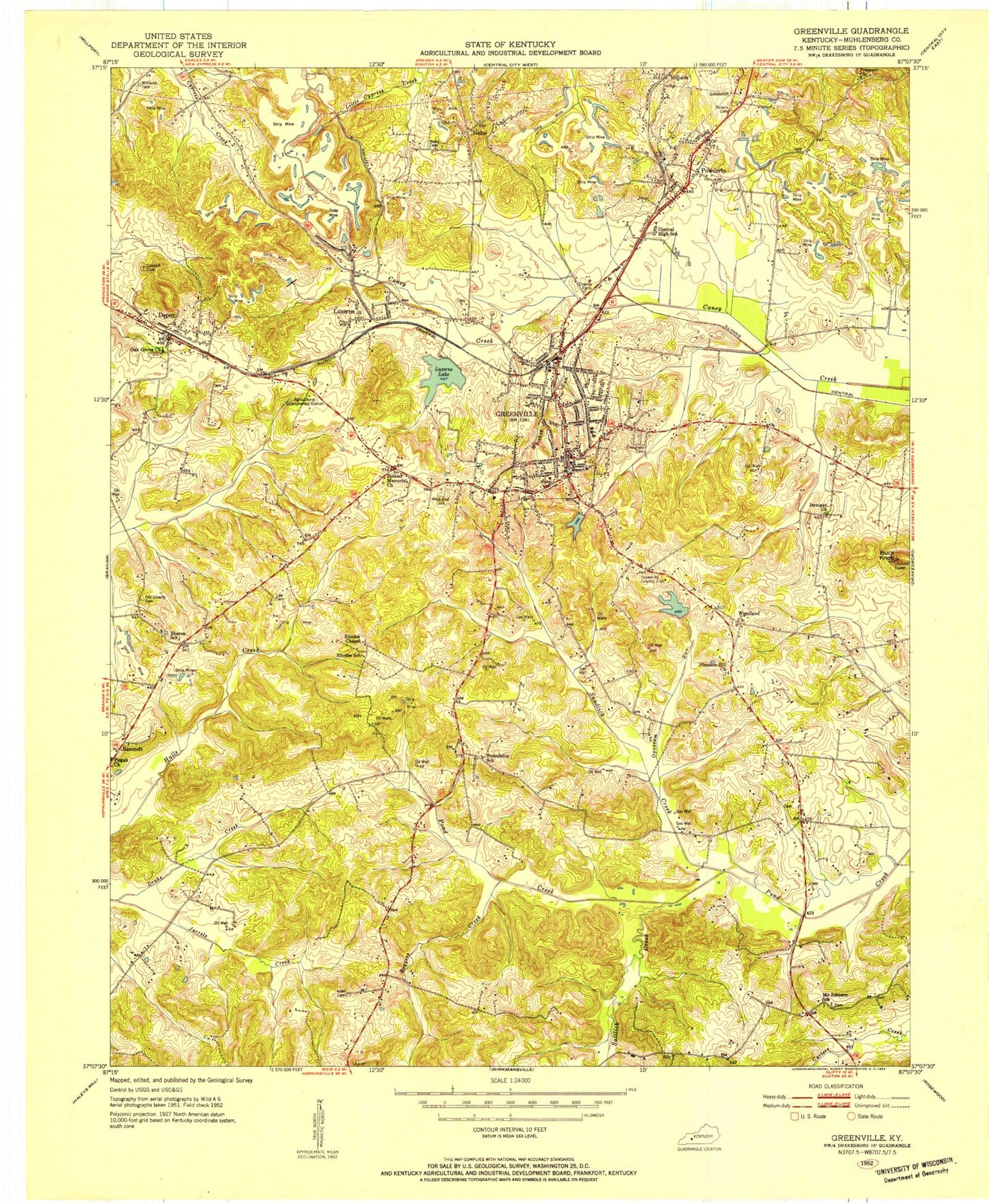
Classic USGS Greenville Kentucky 7.5'x7.5' Topo Map
Couldn't load pickup availability
Historical USGS topographic quad map of Greenville in the state of Kentucky. Map scale may vary for some years, but is generally around 1:24,000. Print size is approximately 24" x 27"
This quadrangle is in the following counties: Muhlenberg.
The map contains contour lines, roads, rivers, towns, and lakes. Printed on high-quality waterproof paper with UV fade-resistant inks, and shipped rolled.
Contains the following named places: Allen Cemetery, Bancroft, Boggess Creek, Buck Knob, Central High School, Cessna Cemetery, City of Greenville, City of Powderly, Depoy, Drake Creek, Evergreen Cemetery, Greenville, Greenville Country Club, Greenville Division, Greenville Fire Department, Greenville Police Department, Greenville Post Office, Hillside, Jernigan Chapel, Jernigan Church, Lee Cemetery, Luckett Cemetery, Luzerne, Luzerne Lake, Muhlenberg County, Muhlenberg County Airport, Muhlenberg County Sheriff's Office, Nebo, Nebo Cemetery, Oak Grove Church, Old Liberty Cemetery, Opossum Run, Owensboro Health Muhlenberg Community Hospital, Peabody State Wildlife Area, Pleasant Hill, Pleasant Hill Church, Powderly, Powderly Post Office, Prospect, Prospect Church, Roland Memorial Church, Saltlick Creek, Sandlick Creek, Sharon, Sharon Church, West End Cemetery, Whiskey Run, Williams Cemetery, Woodland Church, WWHK-FM (Greenville), ZIP Codes: 42345, 42367