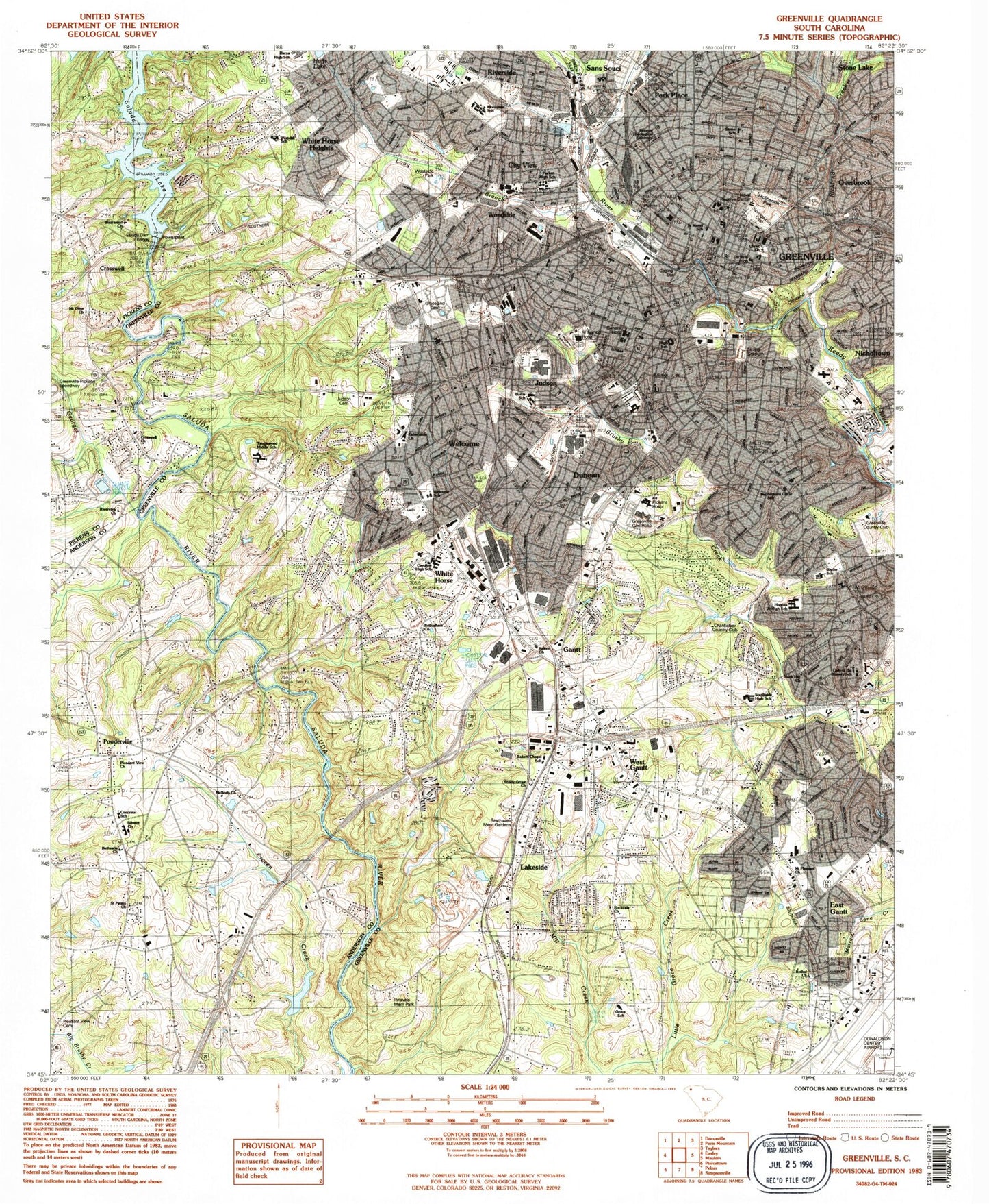
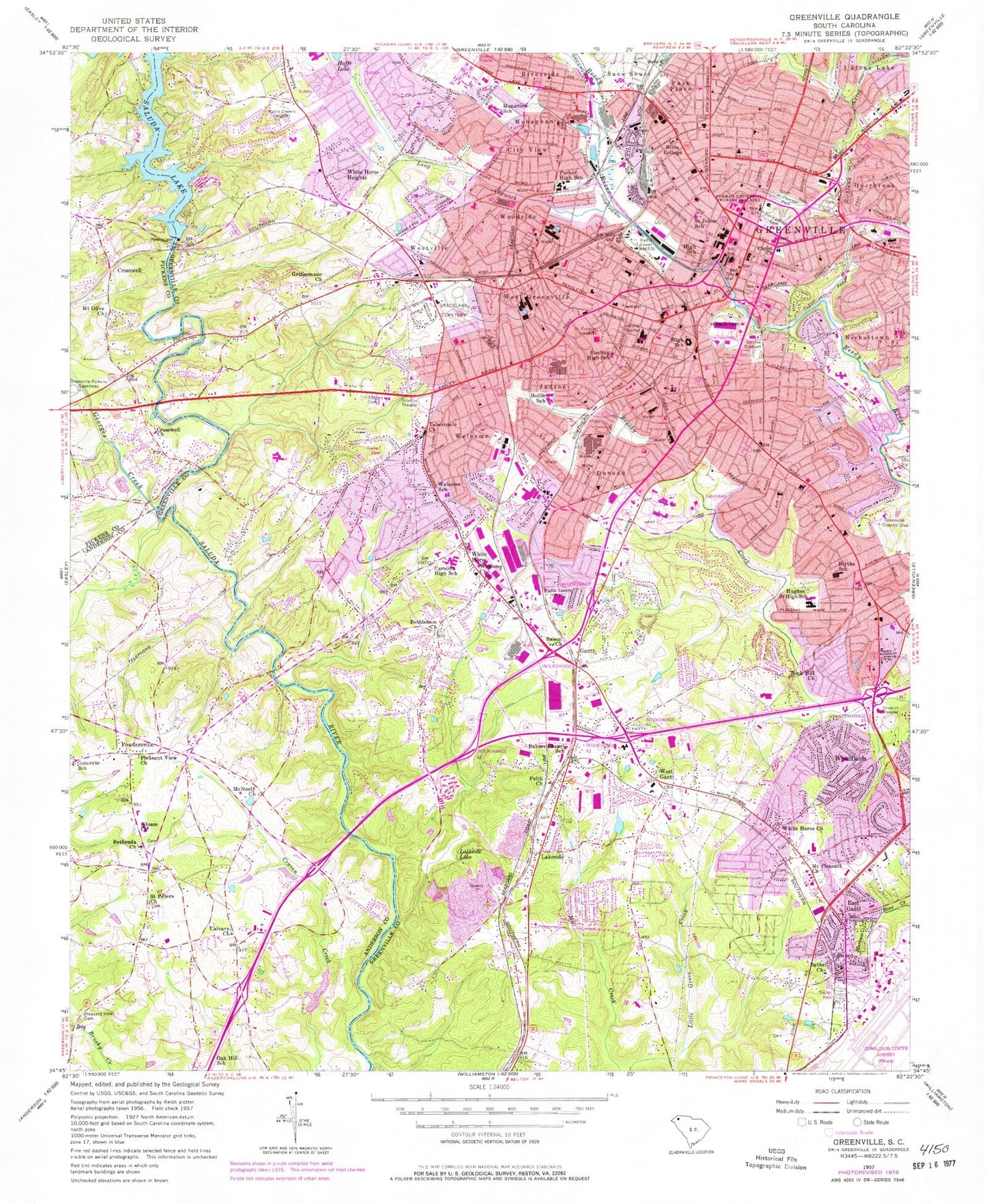
MyTopo
Classic USGS Greenville South Carolina 7.5'x7.5' Topo Map
Couldn't load pickup availability
Historical USGS topographic quad map of Greenville in the state of South Carolina. Typical map scale is 1:24,000, but may vary for certain years, if available. Print size: 24" x 27"
This quadrangle is in the following counties: Anderson, Greenville, Pickens.
The map contains contour lines, roads, rivers, towns, and lakes. Printed on high-quality waterproof paper with UV fade-resistant inks, and shipped rolled.
Contains the following named places: Bethel Church, Bethesda Church, Bethlehem Church, Bible College, Calvary Church, Cleveland Park, Concrete Church, Furman University Womens College, Gantt, Georges Creek, Gethsemane Church, Graceland Cemetery West, Judson Cemetery, Lakeside Lake, Long Branch, McPherson Park, Mount Pleasant Church, Pleasant View Baptist Church Cemetery, Pleasant View Church, Richland Creek, Rock Hill Church, Saint Peters Church, Saluda Lake, Springwood Cemetery, Sterling High School (historical), West Gantt, White Horse Church, City View, Crosswell, Dunean, East Gantt, Monaghan, Riverside, Stone Lake, Welcome, West Greenville, Westville, White Horse, White Horse Heights, Woodfields, Woodside, Baker Chapel (historical), Berea High School, Brandon, Chanticleer Country Club, Easley Bridge, Holmes Theological Seminary, Lady of the Rosary School, Pinevale Memorial Park, Resthaven Memorial Gardens, Rockvale Church, Saint Marys School, Saluda Dam Bridge, Sampson, Southside High School, Tanglewood Middle School, West Gantt School (historical), Westcliff School, Westside Park, Pleasantview School (historical), Saint Peters School (historical), Saluda Dam, South Carolina Noname 04003 D-3141 Dam, Woodson Pond, Greenville Country Club, Sirrine Stadium, Crosswell School (historical), Missionary Church, Quail Haven, Riverview Church, Westwood Baptist Church, Bakers Chapel School, Athelone Heights, Belle Meade, Brookforest Estates, Donaldson Vocational Center, Dreher Colony, Fairfield Acres, Holly Springs, Park Lane Terrace, Pecan Terrace, Rockvale, Roseman Heights, Royal Oaks, Sirrine Elementary School, Spring Brook Terrace, South Forest Estates, The Highlands, Woodfield Heights, Alexander Elementary School, Alta Vista, Anderson Road Plaza Shopping Center, Arthur Black Park, Augusta Road Park, Belaire Estates, Bell Plaza Shopping Center, Bell Tower Shopping Center, Bible Presbyterian Church, Biltmore, Buncombe Street United Methodist Church, Carolina Heights, Carver Park, Catlin Park, Central Baptist Church, Chestnut Hills, Chicora College (historical), Christ Church Cemetery, Chanticleer, Cleveland Forest, Club Forest, Colonel Elias Earle Historic District, Cone Elementary School, Cutler Ridge, David Street Baptist Church (historical), Downtown Baptist Church, Dunean Park, Earle Street Baptist Church, Elizabeth Heights, Farmington Acres, Fine Arts Center, First Baptist Church of Greenville, First Presbyterian Church, Glendale, Governors School for the Arts, Grower Child Development Center, Green Forest Park, Greenview Elementary School, Greenville Associate Reformed Presbyterian Church, Greenville City Hall, Greenville County Courthouse, Greenville County Jail, Greenville County Library, Greenville Female College (historical), Greenville High School, Greenville Post Office, Hampton Avenue Baptist Church, Hampton Avenue Church of Christ, Hampton-Pinckney Historic District, Holmes Memorial Church, Holy Trinity Anglican Church, Interstate Industrial Park, John Street Primary School Number 1 (historical), John Wesley United Methodist Church, Knollwood, Lakeside Park, Lewis Plaza Shopping Center, Lockwood Heights, Mansfield Park, Mattoon Presbyterian Church, McBee Mill (historical), Meadowbrook Park, Memorial Auditorium, Mills Mill, New Bethel Church of God, Nicholtown Child Development Center, North Hills, Oak Crest, Oscar Street School (historical), Our Lady of the Rosary Catholic Church, Overbrook Child Development Center, Oxford Acres, Palmetto Terrace, Park Avenue Missionary Alliance Church, Pettigru Street Historic District, Phillis Wheatley Community Center, Piedmont Industrial Park, Pine Hill Village, Plainview Heights, Pleasant Valley, Poe Baptist Church, Poe Methodist Church, Poe Mill Park, Poinsett, Reedy River Falls Park, Reedy River Industrial District, Rockwood Park, Roosevelt Heights, Saint Andrew Church, Saint George Greek Orthodox Church, Saint Marys Roman Catholic Church, Saint Matthew United Methodist Church, Saint Peters Holy Church, Salem United Methodist Church Graveyard, Sirrine Hospital, Smith Heights, Riley Estates, Springfield Baptist Church, Staunton Heights, Sunny Acres, Supreme Forest, Tabernacle Baptist Church, Hughes Heights, Tanglewood, Terrace Shopping Center, Textile Hall, Third Presbyterian Church, Townes Street Church of God, Traxler Park, Trinity Lutheran Church, Triune United Methodist Church, View Point Place, Watts Park, Welcome Acres, Welcome Baptist Church Cemetery, West Greenville Elementary School, Westcliffe, White Horse Industrial District, White Oak Hills, Woodbriar, Woodside Cotton Mill Village Historic District, Greenville, Hollis School, Hughes Middle School, Lakeside, McNeely Church, Monaview School, Blythe School, Carolina High School, Christ Church, Crosswell Baptist Church, Shady Grove Church, Furman University, Bon Secours Saint Francis Downtown Hospital, Greenville Memorial Hospital, Mount Olive Church, Overbrook, Park Place, Parker High School, Powdersville, Saint Johns School, Salem Church, Siloam Baptist Church, Tabernacle Church, Welcome Church, Welcome School, Augusta Circle Elementary School