MyTopo
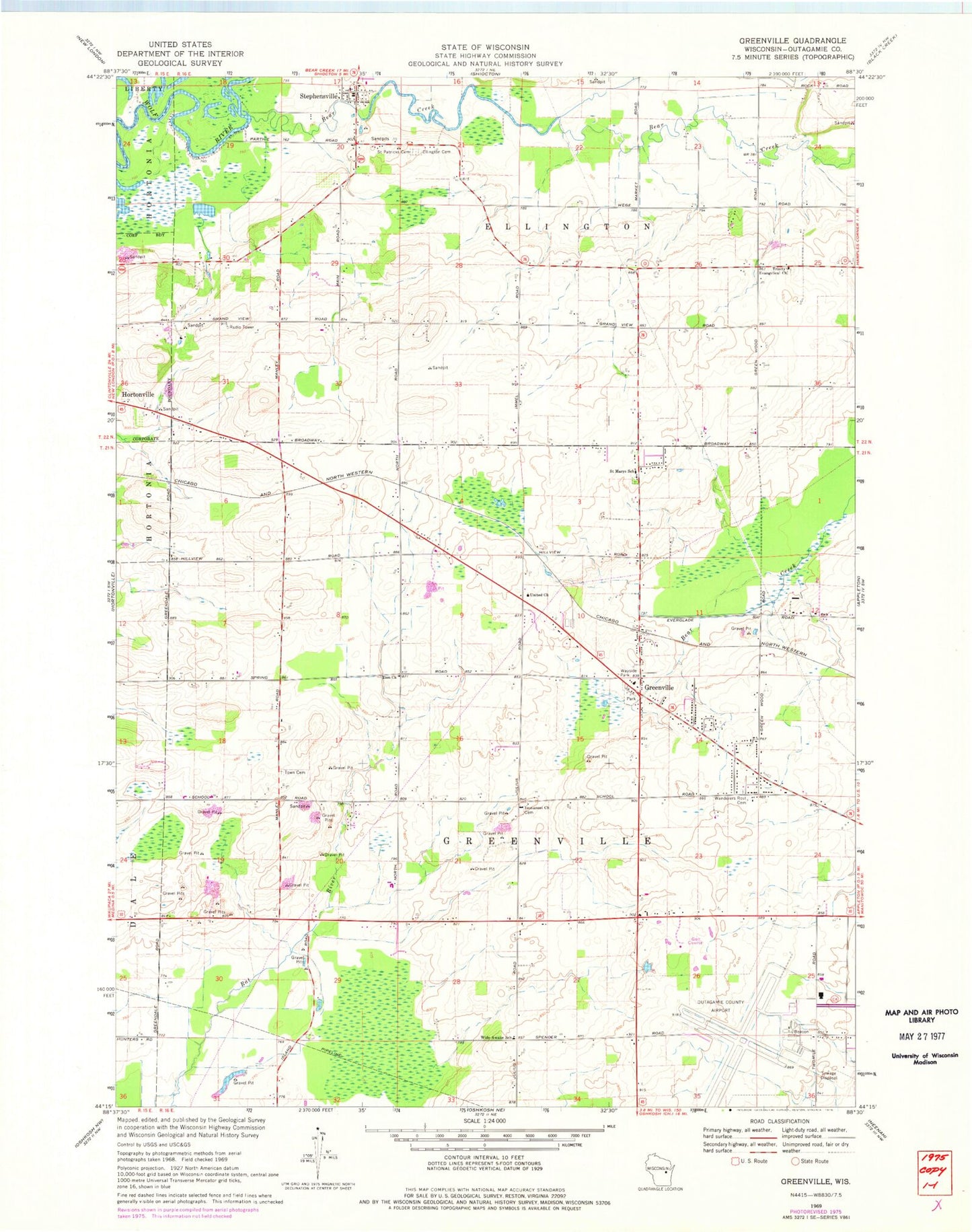
Classic USGS Greenville Wisconsin 7.5'x7.5' Topo Map
Couldn't load pickup availability
Historical USGS topographic quad map of Greenville in the state of Wisconsin. Map scale may vary for some years, but is generally around 1:24,000. Print size is approximately 24" x 27"
This quadrangle is in the following counties: Outagamie.
The map contains contour lines, roads, rivers, towns, and lakes. Printed on high-quality waterproof paper with UV fade-resistant inks, and shipped rolled.
Contains the following named places: Appleton International Airport, Bear Creek, Cedar Grove School, Ellington Union Cemetery, Elm Grove Center School, Elm Tree School, Grandview School, Greenville, Greenville Elementary School, Greenville Middle School, Greenville Post Office, Greenville Volunteer Fire Department, Happy Valley School, Hillside Cooperative Preschool, Immanuel Church, Immanuel Evangelical Lutheran School, Immanuel School, Lutheran School, Medina Pit, Outagamie County Regional Airport Fire Department, Pleasant Corners School, Pleasant Vale School, Rocket City Airport, Saint Mary Convent, Saint Mary of the Immaculate Conception School, Saint Patricks Cemetery, Stephensville, Sunny Slope School, Sunny View School, Town of Ellington, Township of Greenville, Trinity Evangelical Church, United Church, Village of Greenville, Wanderers Rest Cemetery, Wide Awake School, ZIP Code: 54942