MyTopo
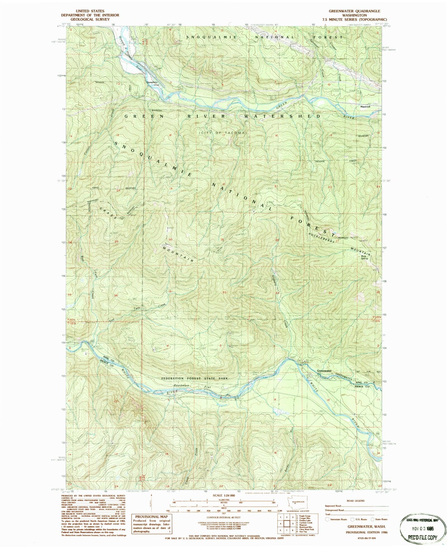
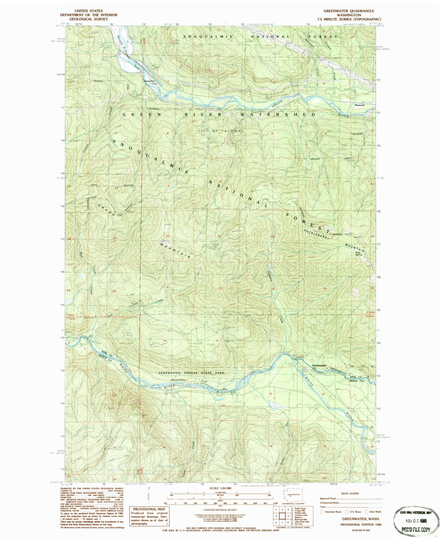
Classic USGS Greenwater Washington 7.5'x7.5' Topo Map
Couldn't load pickup availability
Historical USGS topographic quad map of Greenwater in the state of Washington. Map scale may vary for some years, but is generally around 1:24,000. Print size is approximately 24" x 27"
This quadrangle is in the following counties: King, Pierce.
The map contains contour lines, roads, rivers, towns, and lakes. Printed on high-quality waterproof paper with UV fade-resistant inks, and shipped rolled.
Contains the following named places: Bone Lake Trail, Camp Creek, Canton Creek, Christoff Trail, Cougar Creek, Deadman Flat, East Twin Creek, Federation Forest State Park, Greenwater, Greenwater Census Designated Place, Greenwater River, Humphrey, Humphrey Lookout, Maywood, Mule Spring, Pierce County Fire District 26 Greenwater Station, Rocky Run, Slippery Creek, Sylvester Creek, Twin Creeks Guard Station, West Twin Creek