MyTopo
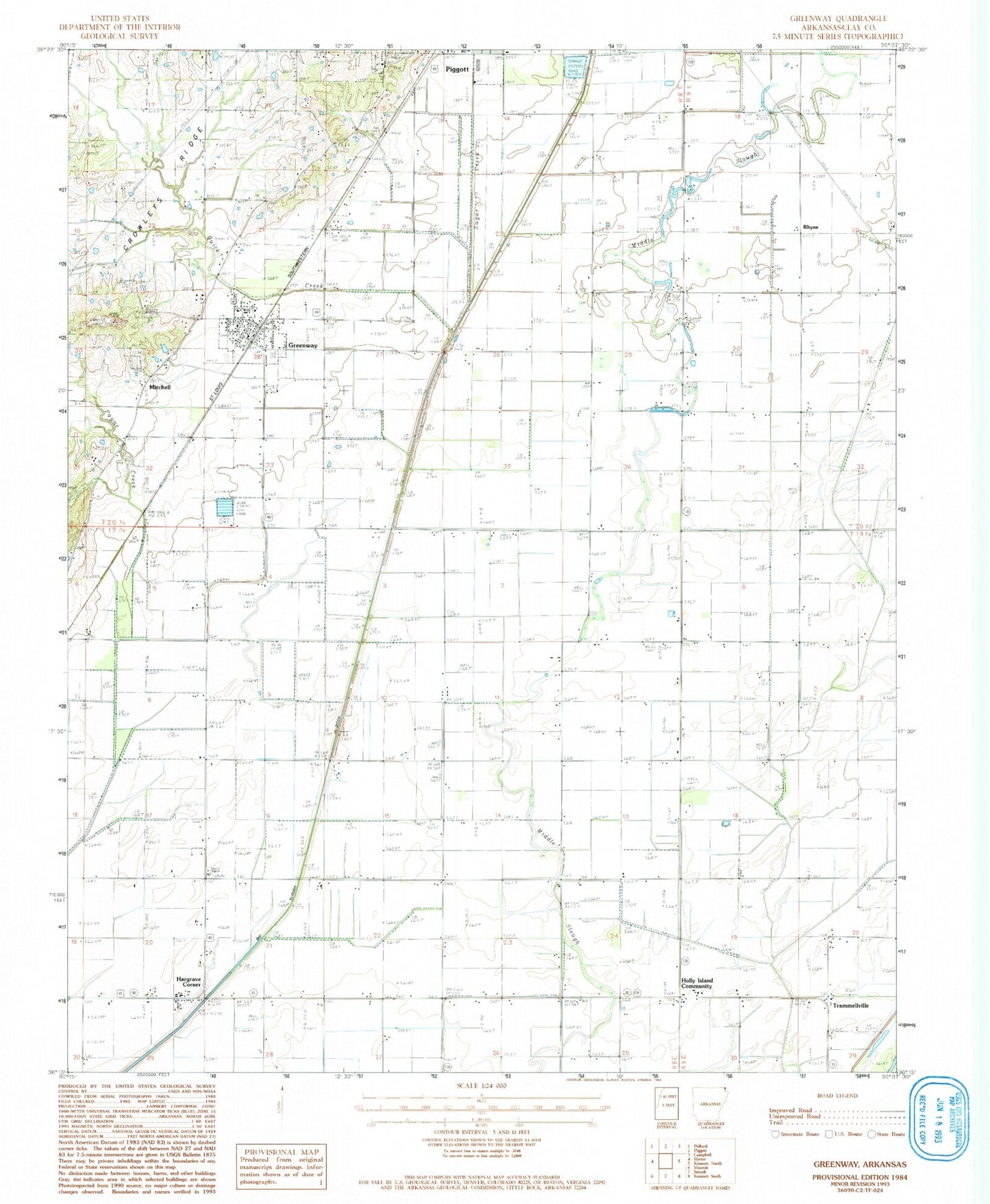
Classic USGS Greenway Arkansas 7.5'x7.5' Topo Map
Couldn't load pickup availability
Historical USGS topographic quad map of Greenway in the state of Arkansas. Map scale may vary for some years, but is generally around 1:24,000. Print size is approximately 24" x 27"
This quadrangle is in the following counties: Clay.
The map contains contour lines, roads, rivers, towns, and lakes. Printed on high-quality waterproof paper with UV fade-resistant inks, and shipped rolled.
Contains the following named places: Calls Church, Calls School, City of Greenway, Greenway, Greenway Fire Station, Greenway Post Office, Hammett, Hampton Slough, Hargrave Corner, Hays School, Holly Island Church, Holly Island Community, Middle Slough, Mitchell, Payne Creek, Phifer School, Piggott Cemetery, Piggott Industrial Park, Pleasant Valley Church, Pleasant Valley School, Quick Creek, Rhyne, Slough Drainage Ditch, Township of East Oak Bluff-Blue Cane, Township of Haywood, Township of South Saint Francis, Union Grove Church, Union Grove School, Union Home Church, Vincent School, Walnut Grove Church, Walnut Grove School, Winston Cemetery, ZIP Code: 72430