MyTopo
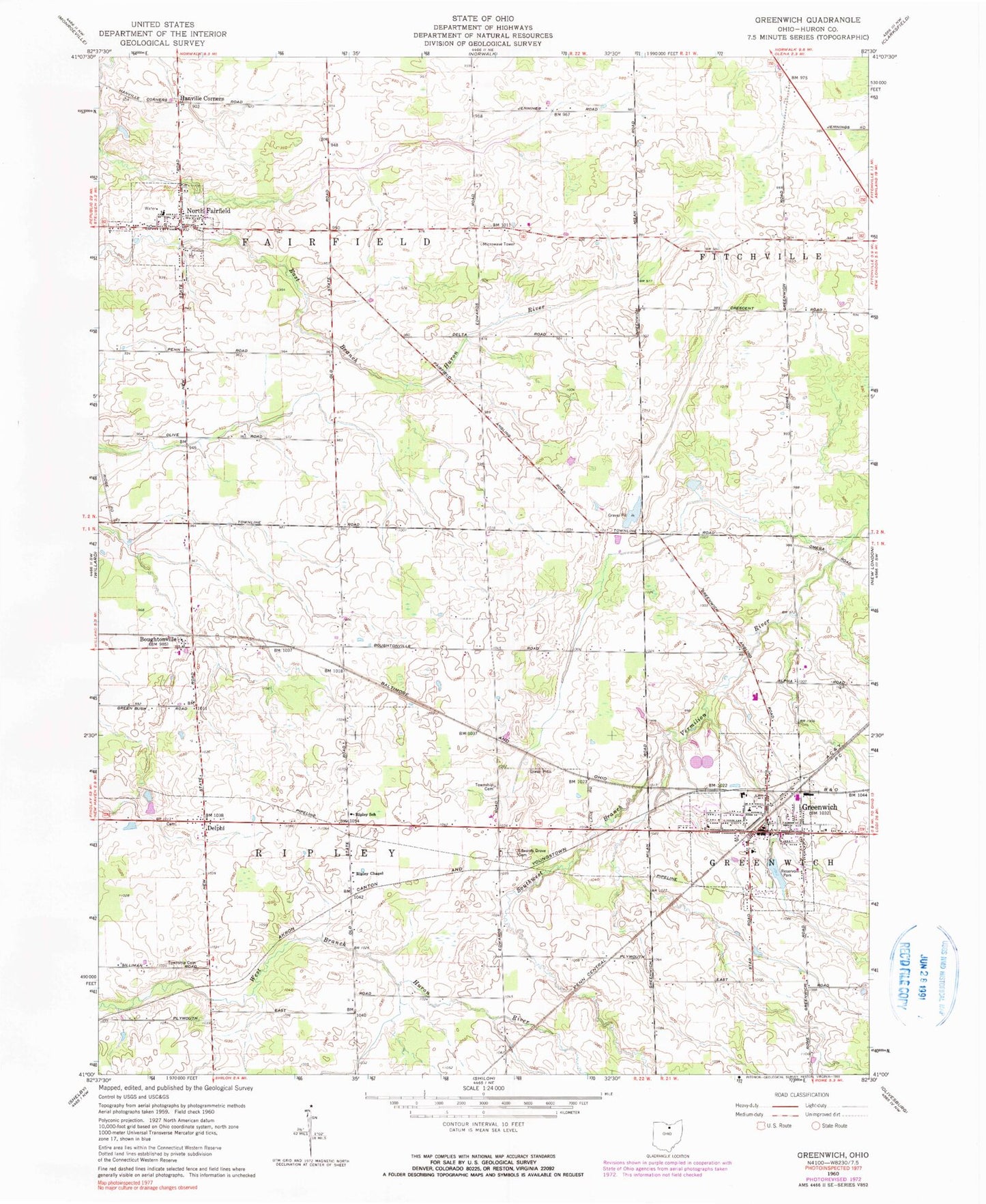
Classic USGS Greenwich Ohio 7.5'x7.5' Topo Map
Couldn't load pickup availability
Historical USGS topographic quad map of Greenwich in the state of Ohio. Map scale may vary for some years, but is generally around 1:24,000. Print size is approximately 24" x 27"
This quadrangle is in the following counties: Huron.
The map contains contour lines, roads, rivers, towns, and lakes. Printed on high-quality waterproof paper with UV fade-resistant inks, and shipped rolled.
Contains the following named places: Barre Farm Cemetery, Boughtonville, Boughtonville Post Office, Branchwood Estates, Delphi, Delphi Cemetery, Edwards Grove Cemetery, Fairfield Emergency Medical Services, Greenlawn Cemetery, Greenwich, Greenwich Police Department, Greenwich Post Office, Greenwich Reservoir, Hanville Corners, North Central Emergency Medical Services, North Fairfield, North Fairfield Cemetery, North Fairfield Post Office, North Fairfield Volunteer Fire Department, Oney's Milkyway Farm, Reservoir Park, Ripley School, School Number 4, School Number 5, School Number 7, School Number 9, South Central Elementary School, South Central High School, South Central Middle School, Township Cemetery, Township of Fairfield, Township of Ripley, Tri - Community Joint Fire Department, Village of Greenwich, Village of North Fairfield, ZIP Code: 44855