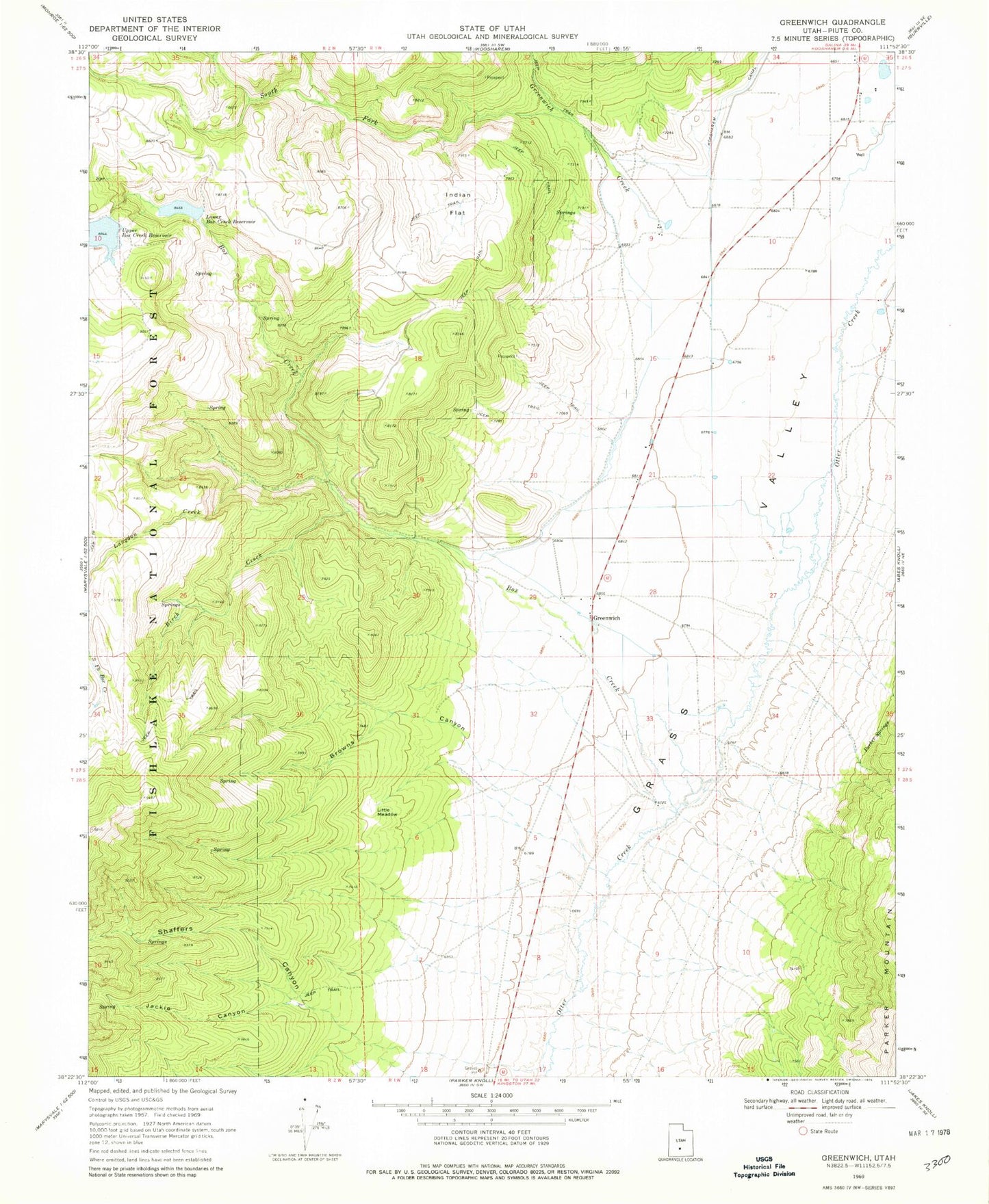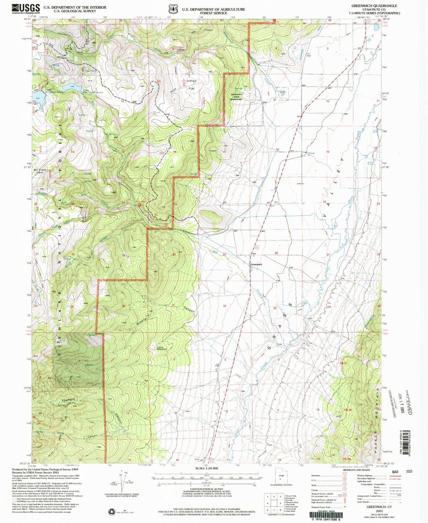
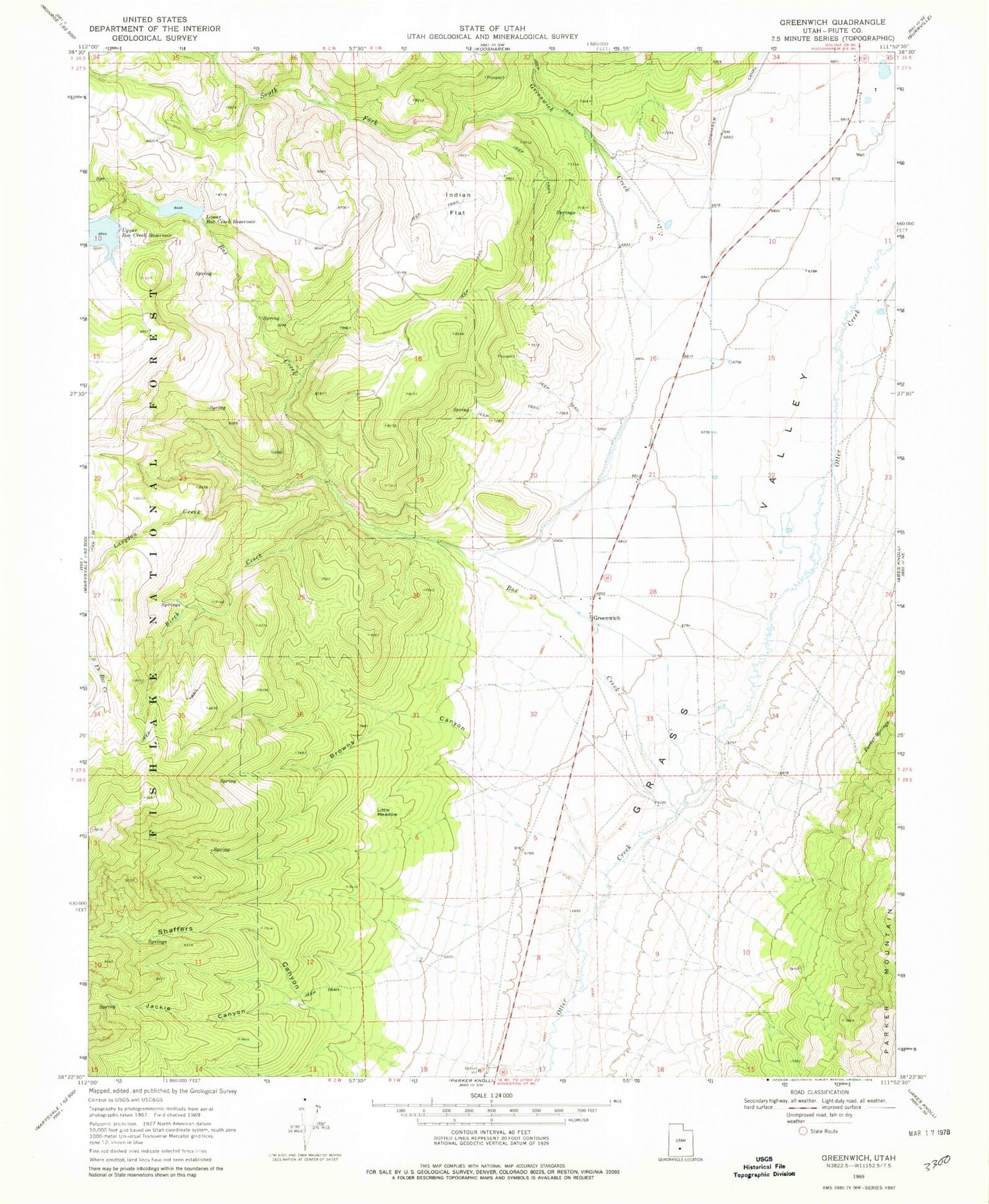
MyTopo
Classic USGS Greenwich Utah 7.5'x7.5' Topo Map
Couldn't load pickup availability
Historical USGS topographic quad map of Greenwich in the state of Utah. Map scale may vary for some years, but is generally around 1:24,000. Print size is approximately 24" x 27"
This quadrangle is in the following counties: Piute.
The map contains contour lines, roads, rivers, towns, and lakes. Printed on high-quality waterproof paper with UV fade-resistant inks, and shipped rolled.
Contains the following named places: Birch Creek, Box Creek, Browns Canyon, Greenwich, Greenwich Creek, Indian Flat, Jackie Canyon, Koosharem Indian Reservation, Little Meadow, Lower Box Creek Dam, Lower Box Creek Reservoir, Middle Fork Box Creek, Parker Springs, Shaffers Canyon, South Fork Box Creek, South Fork Greenwich Creek, ZIP Code: 84732