MyTopo
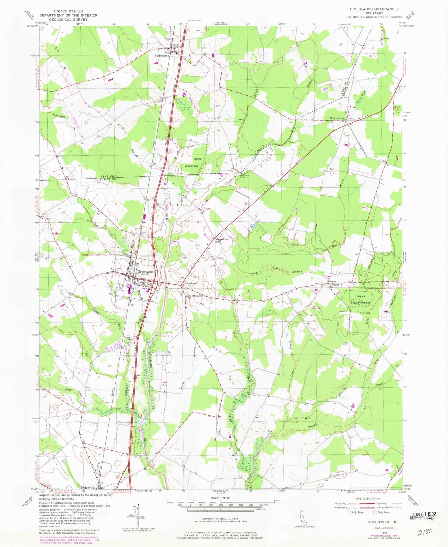
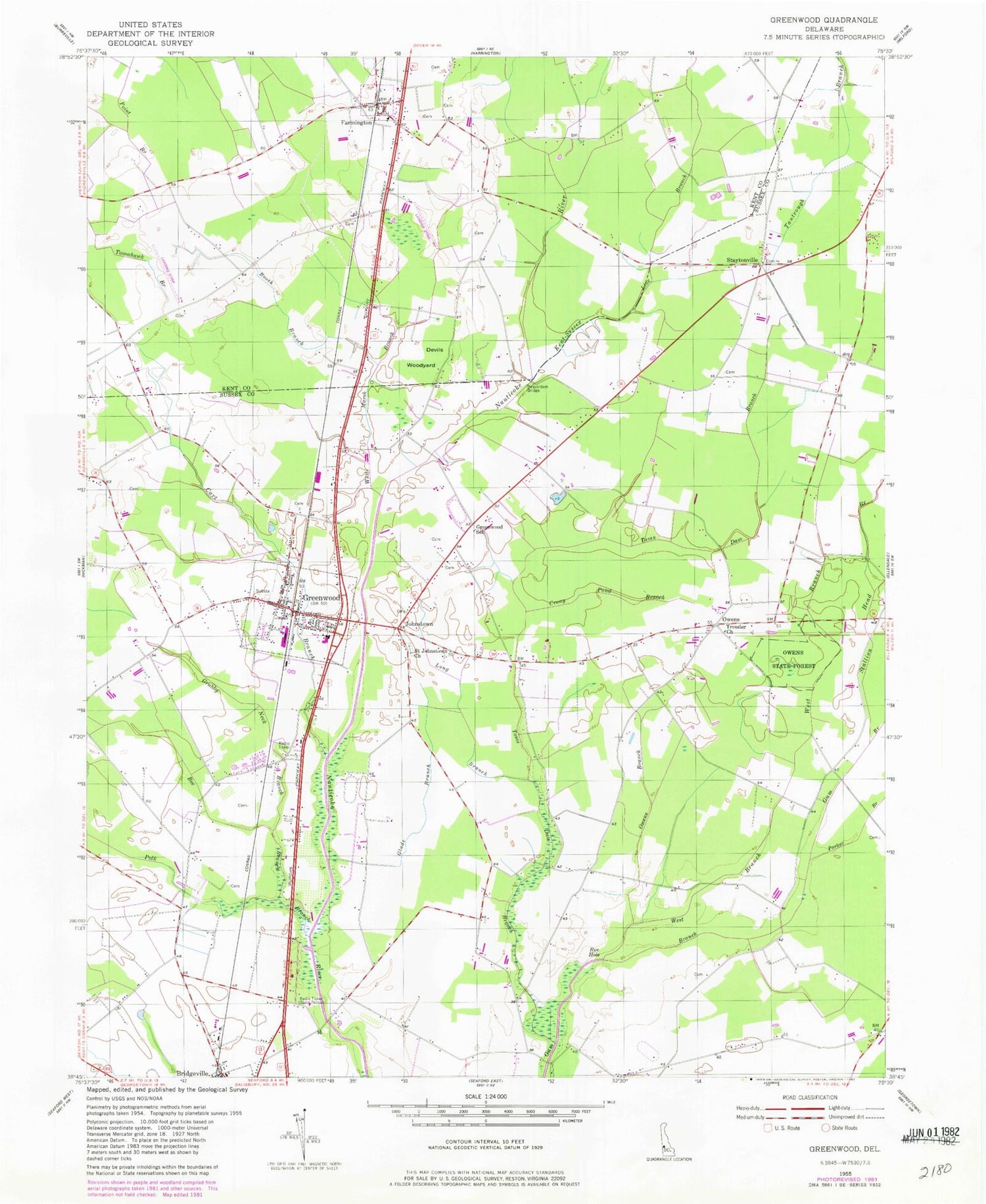
Classic USGS Greenwood Delaware 7.5'x7.5' Topo Map
Couldn't load pickup availability
Historical USGS topographic quad map of Greenwood in the state of Delaware. Map scale may vary for some years, but is generally around 1:24,000. Print size is approximately 24" x 27"
This quadrangle is in the following counties: Kent, Sussex.
The map contains contour lines, roads, rivers, towns, and lakes. Printed on high-quality waterproof paper with UV fade-resistant inks, and shipped rolled.
Contains the following named places: Beaverdam Bridge, Bee Branch, Bethany Church of the Brethren, Booth Branch, Bridgeville North, Bridgeville-Greenwood Division, Cart Branch, Chorman Airport, Cocked Hat, Crony Pond Branch, Deer Creek, Devils Woodyard, Ellendale State Forest, Farmington, Farmington Volunteer Fire Company Station 47, Farmington-Salem Methodist Episcopal Church, Glade Branch, Graham African Methodist Episcopal Church, Greenwood, Greenwood Gardens, Greenwood Mennonite Church, Greenwood Mennonite School, Greenwood Police Department, Greenwood Post Office, Greenwood Public Library, Greenwood School, Greenwood Town Hall, Greenwood United Methodist Church, Greenwood Volunteer Fire Company, Grubby Neck Branch, Hickory Ridge, Hickory Ridge Christian School, Kent-Sussex Line Branch, Long Branch, Nanticoke Business Park, Newton Woods, Owens, Owens Branch, Parker Branch, Polk Branch, Rye Hole, Saint Johnstown, Saint Johnstown Cemetery, Saint Johnstown Church, Sharps Pond, Stallion Head Branch, Staytonville, Sugar Hill Airport, The House of God Church, Toms Dam Branch, Town of Farmington, Town of Greenwood, Tressler Mennonite Church, United Assembly of Christ Church, West Branch Gum Branch, White Marsh Branch, Willaview Airport, Woodbridge Basics School, Woodbridge Elementary School, ZIP Code: 19950