
MyTopo
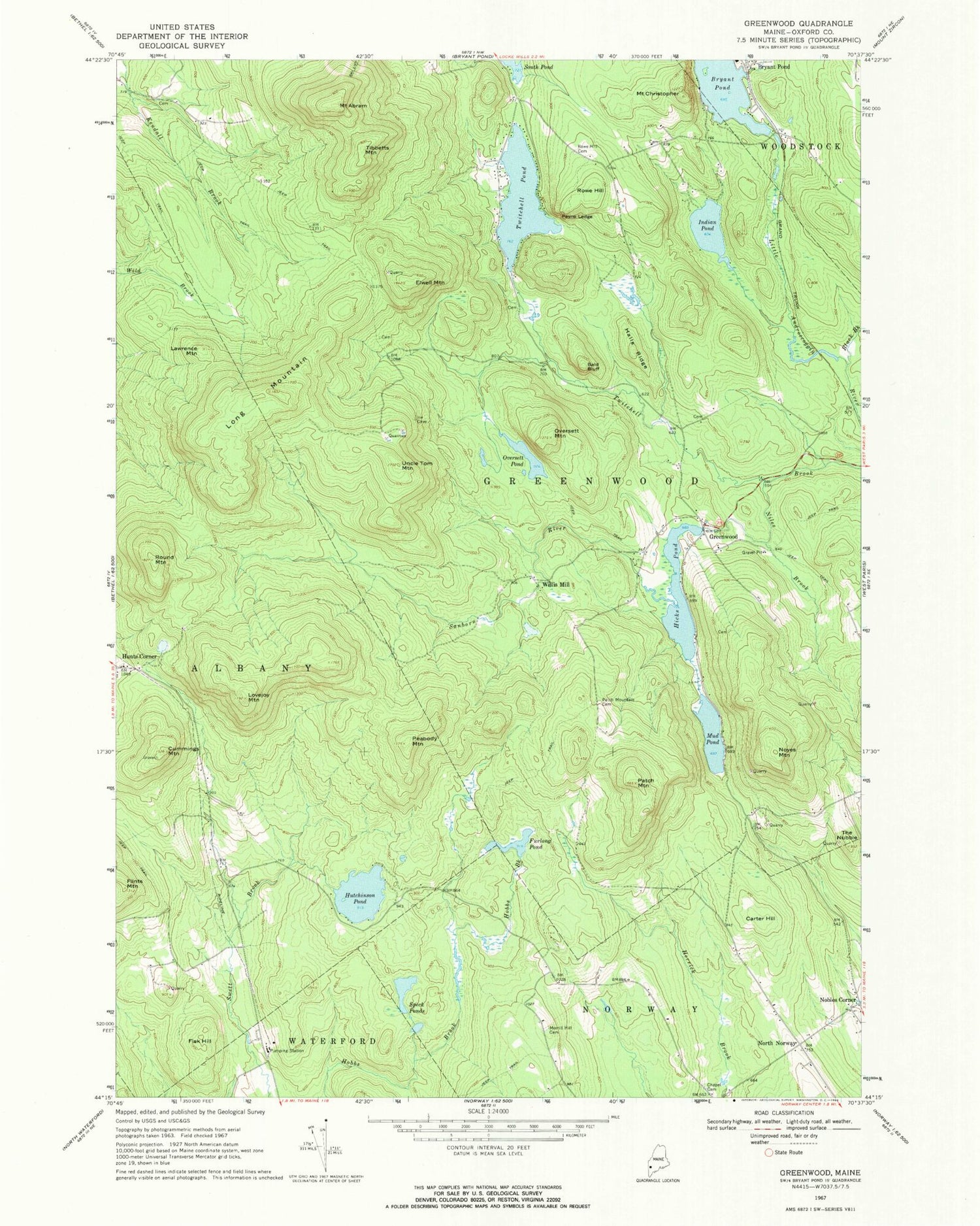
Classic USGS Greenwood Maine 7.5'x7.5' Topo Map
Couldn't load pickup availability
Historical USGS topographic quad map of Greenwood in the state of Maine. Map scale may vary for some years, but is generally around 1:24,000. Print size is approximately 24" x 27"
This quadrangle is in the following counties: Oxford.
The map contains contour lines, roads, rivers, towns, and lakes. Printed on high-quality waterproof paper with UV fade-resistant inks, and shipped rolled.
Contains the following named places: Ames Cemetery, Bald Bluff, Black Brook, Bryant Pond Dam, Carter Hill, Chapel Cemetery, Cummings Mountain, Elwell Mountain, Fisk Hill, Furlong Pond, Greenwood, Greenwood Center Cemetery, Greenwood Fire Department Station 2, Halls Ridge, Hicks Pond, Hicks Pond Dam, Hunts Corner, Hutchinson Pond, Indian Pond, Lawrence Mountain, Long Mountain, Lovejoy Mountain, Merrill Hill Cemetery, Mount Abram, Mount Christopher, Mud Pond, Niles Brook, North Norway, Noyes Mountain, Oversett Mountain, Oversett Pond, Patch Mountain, Patch Mountain Cemetery, Payne Ledge, Peabody Mountain, Round Mountain, Rowe Hill, Rowe Hill Cemetery, Sanborn River, Speck Ponds, The Nubble, Tibbetts Mountain, Town of Greenwood, Twitchell Pond, Twitchell Pond Dam, Uncle Tom Mountain, Willis Mill, ZIP Code: 04255


