MyTopo
Classic USGS Greenwood New York 7.5'x7.5' Topo Map
Couldn't load pickup availability
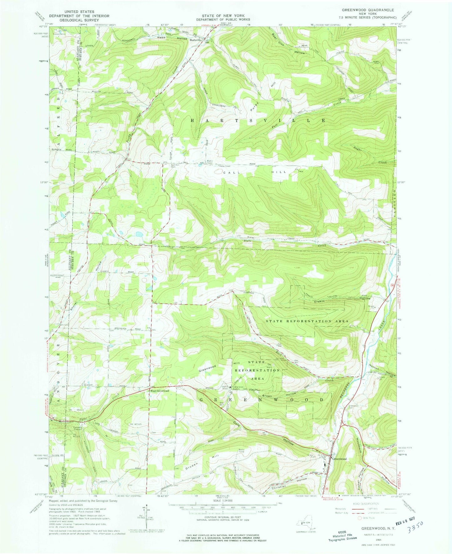
Historical USGS topographic quad map of Greenwood in the state of New York. Typical map scale is 1:24,000, but may vary for certain years, if available. Print size: 24" x 27"
This quadrangle is in the following counties: Allegany, Steuben.
The map contains contour lines, roads, rivers, towns, and lakes. Printed on high-quality waterproof paper with UV fade-resistant inks, and shipped rolled.
Contains the following named places: Brown Hollow, Call Hill, Call Hill Cemetery, Camp Harley, Christian Hollow, Colby Creek, Cole Hollow, Dryden Hill, Erskin Hollow, Fisher Hollow, Greenwood, Greenwood Cemetery, Greenwood Hill, Hartsville, Norton Hollow, Purdy Hill, Rock Creek, Webb Hollow, Woodward Hollow, West Greenwood, Town of Greenwood, Town of Hartsville, Fall Creek School (historical), White School (historical), Call Hill School (historical), Slate Creek School (historical), Rock Creek School (historical), Redmond School (historical), Meade School (historical), Lane School (historical), Dryden Hill School (historical), Woodward Hollow School (historical), Shovel Hollow School (historical), Stephens Tree Farm, Anson Brewster Cemetery, Atkins Cemetery, Krusen Cemetery, Letts Cemetery, Canisteo - Greenwood Middle School, Greenwood Post Office, Greenwood Volunteer Fire Department, Bar B R Farms