MyTopo
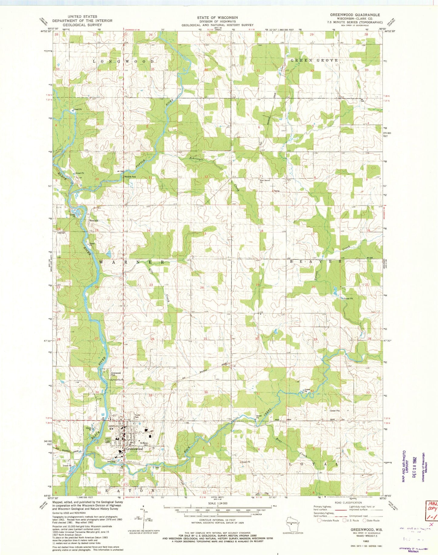
Classic USGS Greenwood Wisconsin 7.5'x7.5' Topo Map
Couldn't load pickup availability
Historical USGS topographic quad map of Greenwood in the state of Wisconsin. Map scale may vary for some years, but is generally around 1:24,000. Print size is approximately 24" x 27"
This quadrangle is in the following counties: Clark.
The map contains contour lines, roads, rivers, towns, and lakes. Printed on high-quality waterproof paper with UV fade-resistant inks, and shipped rolled.
Contains the following named places: Bear Creek, Behringer Creek, Christopherson School, City of Greenwood, Gile Creek, Grace United Methodist Church, Greenwood, Greenwood Area Volunteer Fire Department / Greenwood Area Ambulance Service, Greenwood City Cemetery, Greenwood Elementary School, Greenwood Middle / High School, Greenwood Park, Greenwood Police Department, Greenwood Post Office, Hemlock, LaTart School, Maple Center School, Nelson Creek, Our Saviours Lutheran Church, Popple River, Rock Creek, Saint Mary School, Saint Marys Cemetery, Town Line Airport, Town of Warner, Trondjem Church, West Beaver Church