
MyTopo
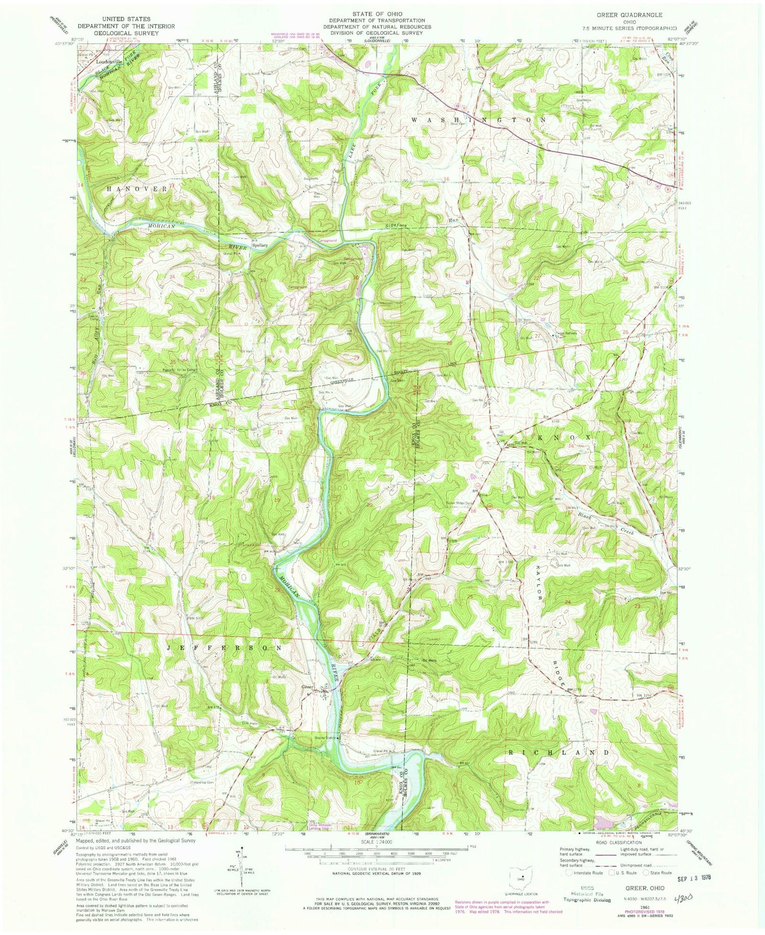
Classic USGS Greer Ohio 7.5'x7.5' Topo Map
Couldn't load pickup availability
Historical USGS topographic quad map of Greer in the state of Ohio. Typical map scale is 1:24,000, but may vary for certain years, if available. Print size: 24" x 27"
This quadrangle is in the following counties: Ashland, Holmes, Knox.
The map contains contour lines, roads, rivers, towns, and lakes. Printed on high-quality waterproof paper with UV fade-resistant inks, and shipped rolled.
Contains the following named places: Ball Alley Run, Camp Bethany, Harding Cemetery, Kaylor Ridge, Kaylor Ridge Cemetery, Peaceful Valley Camp, Sigafoos Run, Stout Cemetery, Ullman Cemetery, Ball Alley School (historical), Pleasant View School (historical), Walnut Grove School (historical), Jericho School (historical), Cross School (historical), Dino School (historical), Germany School (historical), Griggs Valley School (historical), Jance School (historical), Knox School (historical), Mosher School (historical), Pleasant Valley Campground, Spellacy, Greer, Lake Fork Mohican River, Turkey Ridge School (historical), New Wheeling (historical), Germany School (historical), Pine Grove Farm (historical), School Number 5 (historical), School Number 6 (historical), School Number 8 (historical), Walnut Farm (historical), Coy Lake Dam, Coy Lake, Township of Knox, Township of Jefferson, Wolf Cemetery, Kaylor Farm, Greer Post Office (historical)


