
MyTopo
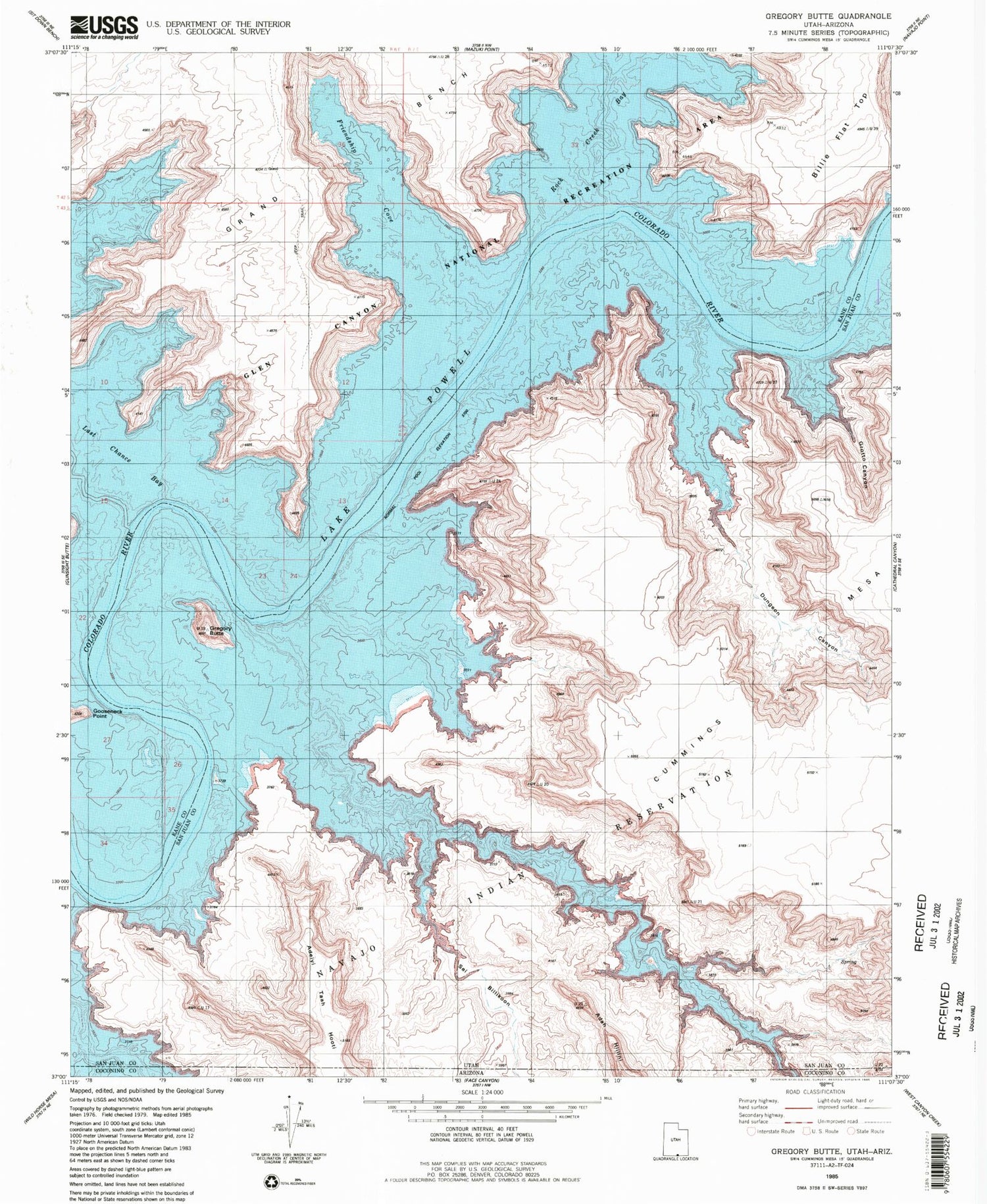
Classic USGS Gregory Butte Utah 7.5'x7.5' Topo Map
Regular price
$16.95
Regular price
Sale price
$16.95
Unit price
per
Couldn't load pickup availability
Historical USGS topographic quad map of Gregory Butte in the state of Utah. Map scale may vary for some years, but is generally around 1:24,000. Print size is approximately 24" x 27"
This quadrangle is in the following counties: Coconino, Kane, San Juan.
The map contains contour lines, roads, rivers, towns, and lakes. Printed on high-quality waterproof paper with UV fade-resistant inks, and shipped rolled.
Contains the following named places: Billie Flat Top, Dungeon Canyon, Friendship Cove, Gregory Butte, Grotto Canyon, Marigold Bar, Mesken Bar, Meskin Bar, Sei Billikoon, West Canyon, West Canyon Creek, Wild Horse Bar


