MyTopo
Classic USGS Gregory SW Arkansas 7.5'x7.5' Topo Map
Couldn't load pickup availability
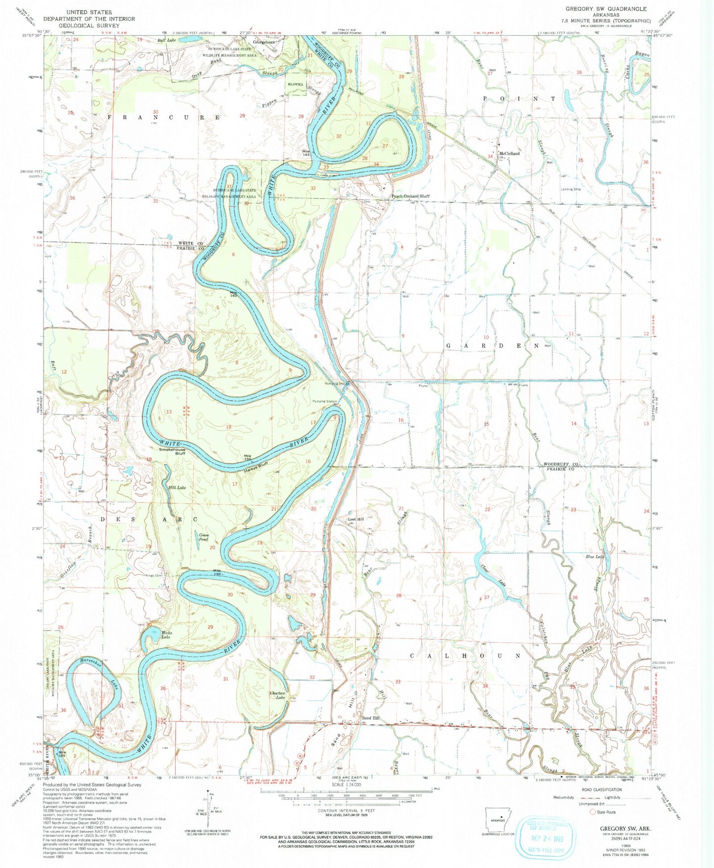
Historical USGS topographic quad map of Gregory SW in the state of Arkansas. Map scale may vary for some years, but is generally around 1:24,000. Print size is approximately 24" x 27"
This quadrangle is in the following counties: Prairie, White, Woodruff.
The map contains contour lines, roads, rivers, towns, and lakes. Printed on high-quality waterproof paper with UV fade-resistant inks, and shipped rolled.
Contains the following named places: Ball Lake, Bayou Des Arc, Bayou Des Arc State Game Area, Bear Slough, Blue Lake, Blue Lake Slough, Calhoun Bend, Canal Point, Choctaw Lake, Clear Lake, Deep Bank Slough, Goose Pond, Haleys Bluff, Hicks Bend, Hicks Lake, Hill Lake, Horseshoe Lake, Hughes Slough, Kings Bluff, Kings Cemetery, Kramer, Loggy Bayou, Lost Hill, Lundies Landing, McClelland, McCrutchen Bend, Orlando Bend, Pankey Landing, Peach Orchard Bluff, Pecan Bend, Pigpen Slough, Raft Creek, Sand Hill, Sandhill Fire Station, Smokehouse Bluff, Township of Garden, Upper Surrounded Hill, White Bluff