MyTopo
Classic USGS Gregory Arkansas 7.5'x7.5' Topo Map
Couldn't load pickup availability
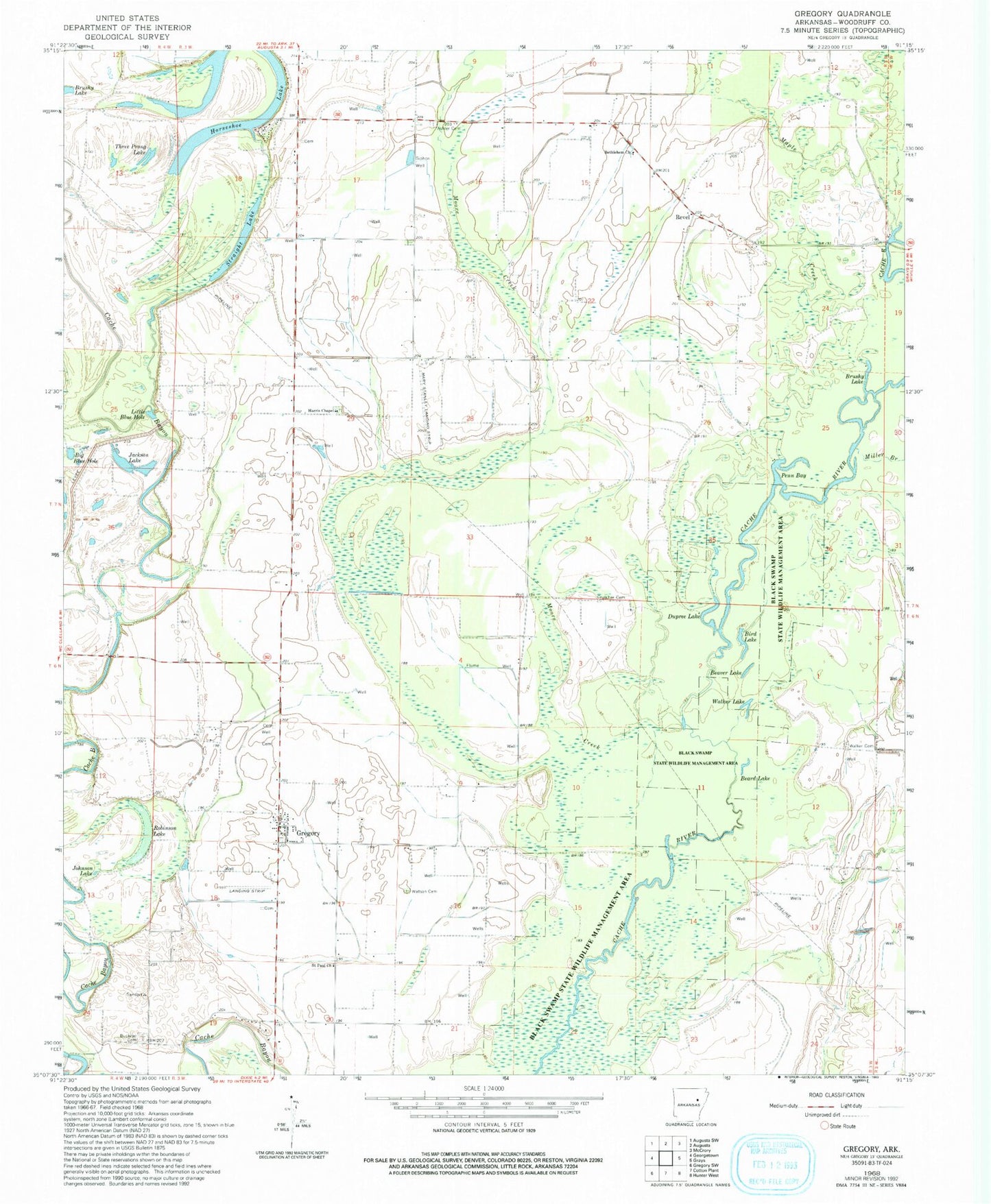
Historical USGS topographic quad map of Gregory in the state of Arkansas. Map scale may vary for some years, but is generally around 1:24,000. Print size is approximately 24" x 27"
This quadrangle is in the following counties: Woodruff.
The map contains contour lines, roads, rivers, towns, and lakes. Printed on high-quality waterproof paper with UV fade-resistant inks, and shipped rolled.
Contains the following named places: Ashler Cemetery, Beard, Beard Lake, Beaver Lake, Bethehem Church, Big Blue Hole, Bird Lake, Brushy Lake, Buckeye Cemetery, Crutcher Cemetery, David Stanley Memorial Airport, Dupree Lake, Eldridge Cemetery, First Baptist Church of Gregory, Flynn, Galloway Farms Airport, Gregory, Gregory Cemetery, Gregory Census Designated Place, Gregory Lake, Gregory Landing, Gregory Post Office, Gregory Public School, Gregory Training School, Guildfield Baptist Church, Harris Cemetery, Harris Chapel, Horseshoe Lake, Jackson Lake, Johnson Lake, Little Blue Hole, Maple Creek, Miller Branch, Moore Creek, Old Point Church, Penn Bay, Point Cemetery, Reeves Cemetery, Revel, Rex Hancock-Black Swamp Wildlife Management Area, Robinson Lake, Saint Paul African Methodist Episcopal Church, Straight Lake, Three Prong Lake, Township of Point, Walker Cemetery, Walker Lake, Walnut Grove Baptist Church, Walnut Grove Cemetery, Walnut Grove School, Watson Cemetery, Watsons Chapel-Saint Paul School, ZIP Codes: 72006, 72059