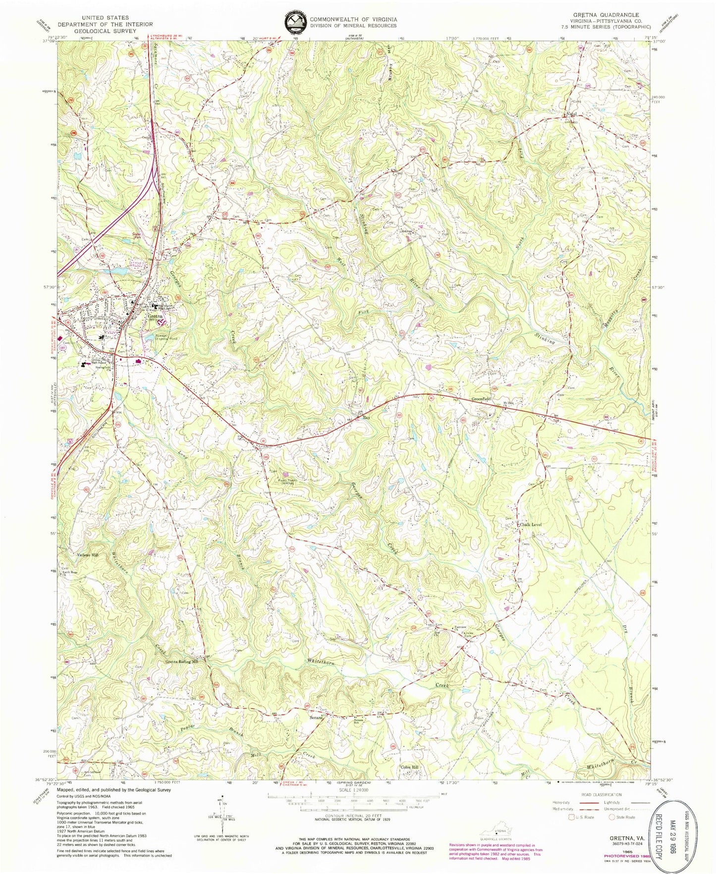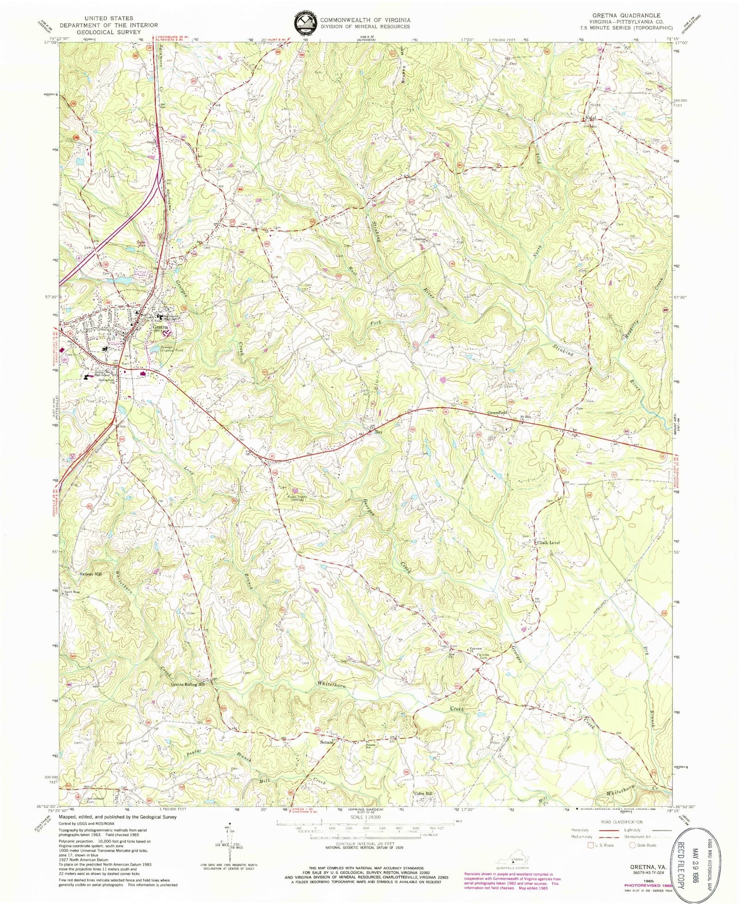
MyTopo
Classic USGS Gretna Virginia 7.5'x7.5' Topo Map
Couldn't load pickup availability
Historical USGS topographic quad map of Gretna in the state of Virginia. Map scale may vary for some years, but is generally around 1:24,000. Print size is approximately 24" x 27"
This quadrangle is in the following counties: Pittsylvania.
The map contains contour lines, roads, rivers, towns, and lakes. Printed on high-quality waterproof paper with UV fade-resistant inks, and shipped rolled.
Contains the following named places: Chalk Level, Coles Hill, Dalton School, Dry Branch, Fairview Cemetery, Fairview Church, Faith Hope Church, Galveston School, Georges Creek, Greenfield, Greenfield Baptist Church, Gretna, Gretna Dam, Gretna Elementary School, Gretna First Baptist Church, Gretna High School, Gretna Industrial Park, Gretna Lake, Gretna Middle School, Gretna Police Department, Gretna Post Office, Gretna Rescue Squad, Gretna Rolling Mill, Gretna Station, Gretna Town Park, Gretna Volunteer Fire Department, Long Branch, Meadow School, Midway Church, Midway School, Mill Creek, Mount Nebo School, Mount Zion Baptist Church, Natal, North Fork Stinking River, Poplar Branch, Ray, Ray School, Rockford School, Shelton Dam, Sonans, Sonans School, Springfield Church, Tates Mill, Town of Gretna, Vadens Mill, West Fork Stinking River, Whitethorn Cemetery, Whitethorn School, WMNA-AM (Gretna), WMNA-FM (Gretna), Yates Tavern, Zion Church, ZIP Code: 24557