MyTopo
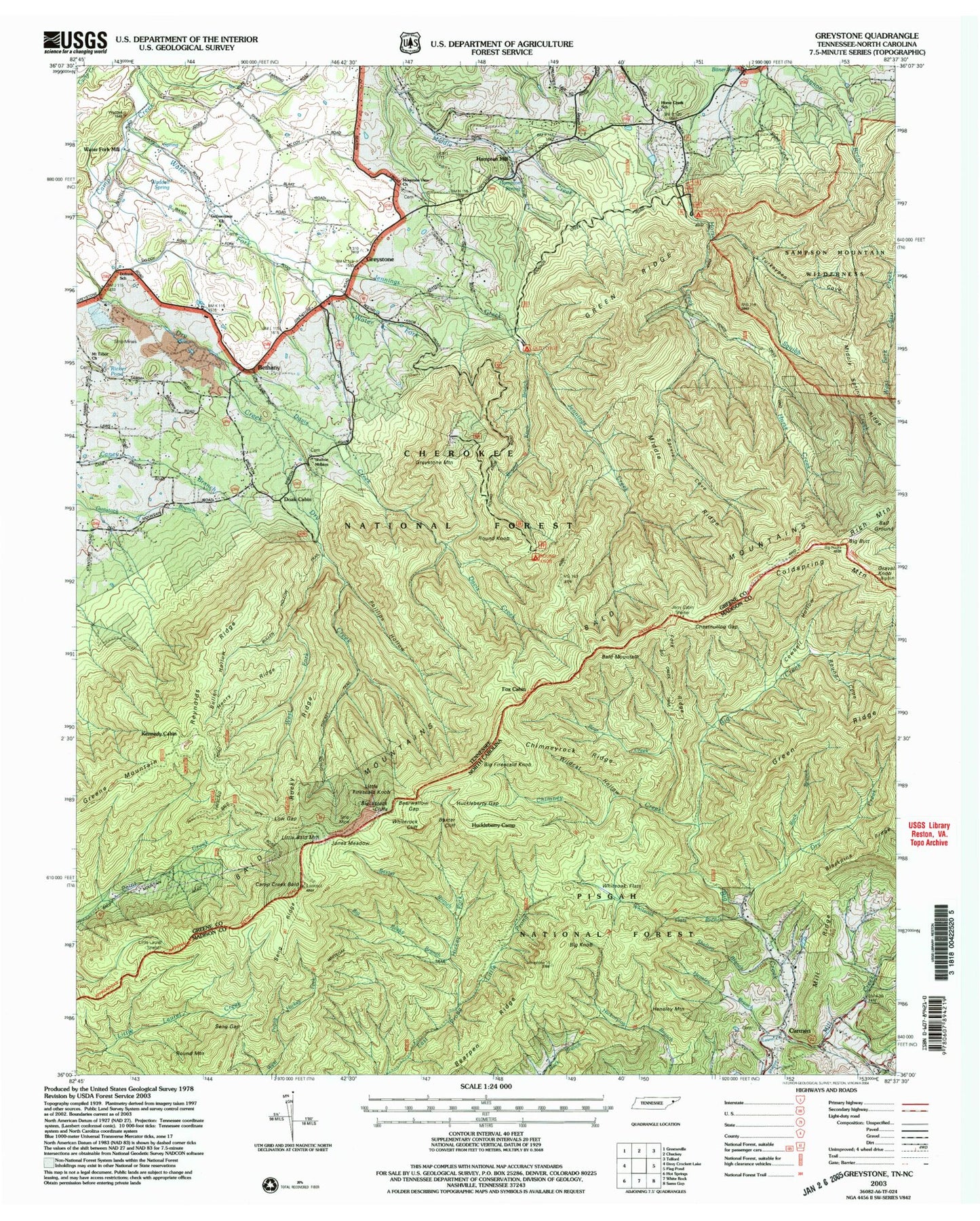
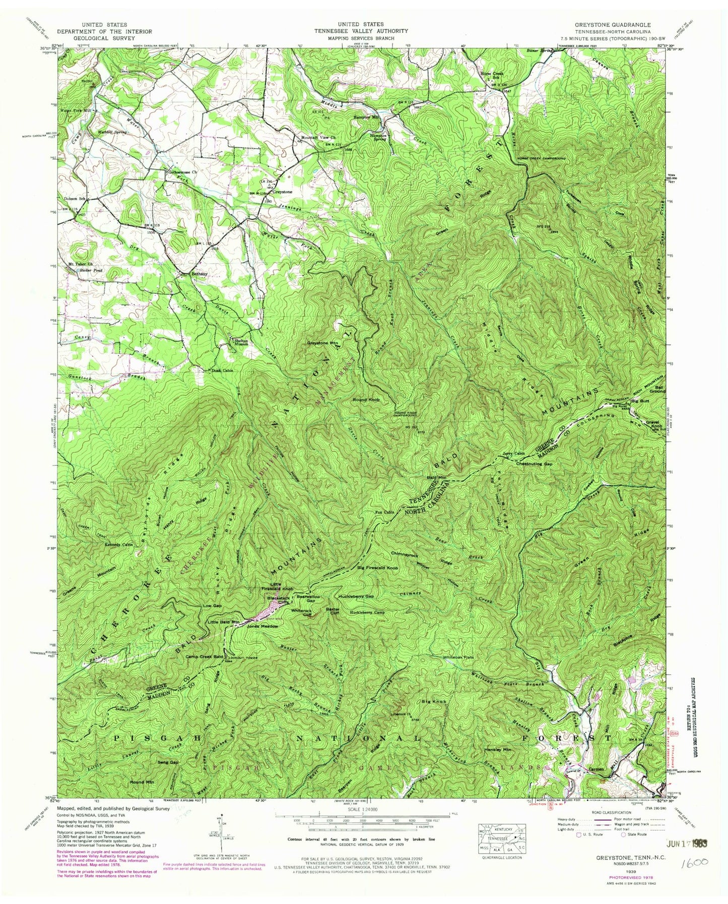
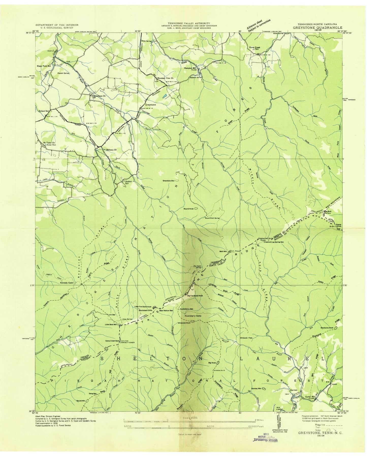
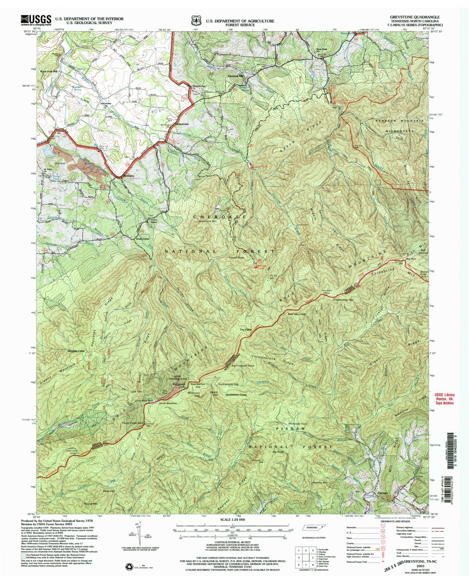
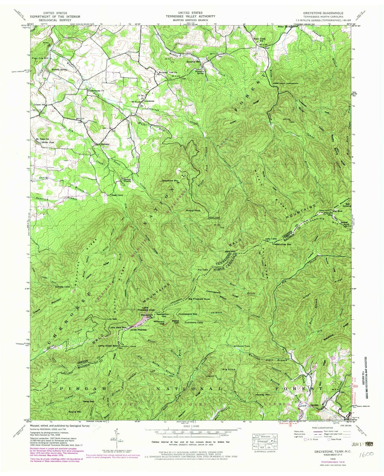
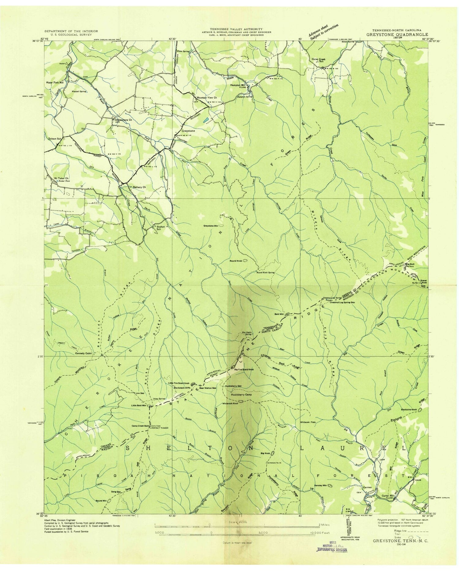
Classic USGS Greystone Tennessee 7.5'x7.5' Topo Map
Couldn't load pickup availability
Historical USGS topographic quad map of Greystone in the states of Tennessee, North Carolina. Typical map scale is 1:24,000, but may vary for certain years, if available. Print size: 24" x 27"
This quadrangle is in the following counties: Greene, Madison.
The map contains contour lines, roads, rivers, towns, and lakes. Printed on high-quality waterproof paper with UV fade-resistant inks, and shipped rolled.
Contains the following named places: Big Butt, Andrew Johnson Mountain, Fox Cabin Gap, Lick Log Gap, Shelton Mission, Spruce Thicket Trail, Squibb Creek, Squibb Creek Trail, Turkeypen Cove, Waddell Spring, Water Fork, Water Fork Mill, West Fork Dry Creek, Ball Ground, Bethany, Bitner Spring, Bullen Hollow, Bullen Hollow Trail, Davis Creek, Dixon Trail, Doak Cabin, Dobson School, Fox Cabin, Gethsemane Church, Green Ridge, Greene Mountain, Greystone, Greystone Mountain, Hampton Mill, Hampton Spring, Henry Ridge, Horse Creek Campground, Horse Creek School, Jennings Creek, Jerry Cabin, Jones Meadow, Kennedy Cabin, Low Gap, Middle Ridge, Mount Tabor Church, Mountain View Church, Phillips Hollow, Reynolds Ridge, Ricker Pond, Rocky Ridge, Round Knob, Round Knob Branch, Round Knob Campground, Sarvls Cove, WIKQ-FM (Greeneville), Greystone Elementary School, Sheltons School (historical), Camp Creek Bald Lookout, Horse Creek Picnic Area, Sarvis Cove Creek, Petes Branch, Petes Branch Trail, Poplar Cove Trail, Scarlet Oak Trail, Doctors Ridge, Old Forge Recreation Area, Jennings Creek Trail, Little Jennings Creek Trail, Cowbell Hollow, Cowbell Hollow Trail, David Creek Trail, Artie Hollow Trail, Phillips Hollow Trail, Margarette Falls Trail, Mountain View Cemetery, Mount Tabor Cemetery, Doctors Ridge Trail, Southeast Nolichucky Division (historical), Baxter Branch, Baxter Cliff, Bear Creek, Bearpen Ridge, Bearwallow Gap, Big Creek, Big Creek Trail, Big Rocky Branch, Blackstack Cliffs, Camp Creek Bald, Chimney Creek, Chimneyrock Ridge, Cowbell Hollow, Dry Creek, Fork Ridge, Hensley Branch, Huckleberry Camp, Huckleberry Gap, Jones Meadow, Little Prong, Mill Creek, Rock Branch, Round Cove, Seng Gap, Seng Ridge, Shelton Branch, Whiteoak Flats, Whiteoak Flats Branch, Whiteoak Flats Trail, Wildcat Hollow, Camp Creek Bald Lookout, Bald Mountain, Big Firescald Knob, Big Knob, Carmen, Chestnutlog Gap, Gravel Knob, Hensley Mountain, Little Bald Mountain, Little Firescald Knob, Mill Ridge, Whiterock Cliff, Round Mountain, Little Laurel Trail Shelter, Coldspring Mountain, Big Butt, Andrew Johnson Mountain, Fox Cabin Gap, Lick Log Gap, Shelton Mission, Spruce Thicket Trail, Squibb Creek, Squibb Creek Trail, Turkeypen Cove, Waddell Spring, Water Fork, Water Fork Mill, West Fork Dry Creek, Ball Ground, Bethany, Bitner Spring, Bullen Hollow, Bullen Hollow Trail, Davis Creek, Dixon Trail, Doak Cabin, Dobson School, Fox Cabin, Gethsemane Church, Green Ridge, Greene Mountain, Greystone, Greystone Mountain, Hampton Mill, Hampton Spring, Henry Ridge, Horse Creek Campground, Horse Creek School, Jennings Creek, Jerry Cabin, Jones Meadow, Kennedy Cabin, Low Gap, Middle Ridge, Mount Tabor Church, Mountain View Church, Phillips Hollow, Reynolds Ridge, Ricker Pond, Rocky Ridge, Round Knob, Round Knob Branch, Round Knob Campground, Sarvls Cove, WIKQ-FM (Greeneville), Greystone Elementary School, Sheltons School (historical), Camp Creek Bald Lookout, Horse Creek Picnic Area, Sarvis Cove Creek, Petes Branch, Petes Branch Trail, Poplar Cove Trail, Scarlet Oak Trail, Doctors Ridge, Old Forge Recreation Area, Jennings Creek Trail, Little Jennings Creek Trail, Cowbell Hollow, Cowbell Hollow Trail, David Creek Trail, Artie Hollow Trail, Phillips Hollow Trail, Margarette Falls Trail, Mountain View Cemetery, Mount Tabor Cemetery, Doctors Ridge Trail, Southeast Nolichucky Division (historical), Baxter Branch, Baxter Cliff, Bear Creek, Bearpen Ridge, Bearwallow Gap, Big Creek, Big Creek Trail, Big Rocky Branch, Blackstack Cliffs, Camp Creek Bald, Chimney Creek, Chimneyrock Ridge, Cowbell Hollow, Dry Creek, Fork Ridge, Hensley Branch, Huckleberry Camp, Huckleberry Gap, Jones Meadow, Little Prong, Mill Creek, Rock Branch, Round Cove, Seng Gap, Seng Ridge, Shelton Branch, Whiteoak Flats, Whiteoak Flats Branch, Whiteoak Flats Trail, Wildcat Hollow, Camp Creek Bald Lookout, Bald Mountain, Big Firescald Knob, Big Knob, Carmen, Chestnutlog Gap, Gravel Knob, Hensley Mountain, Little Bald Mountain, Little Firescald Knob, Mill Ridge, Whiterock Cliff, Round Mountain, Little Laurel Trail Shelter, Coldspring Mountain
