
MyTopo
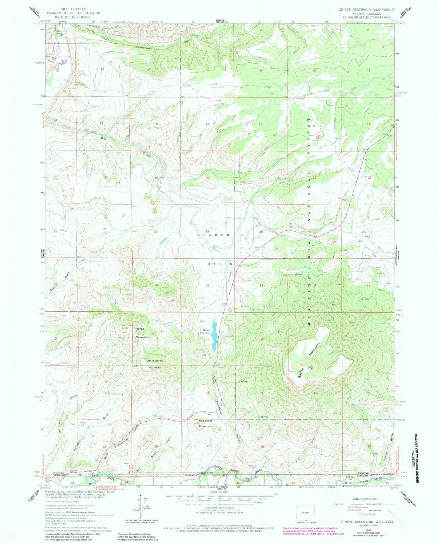
Classic USGS Grieve Reservoir Wyoming 7.5'x7.5' Topo Map
Couldn't load pickup availability
Historical USGS topographic quad map of Grieve Reservoir in the states of Wyoming, Colorado. Map scale may vary for some years, but is generally around 1:24,000. Print size is approximately 24" x 27"
This quadrangle is in the following counties: Carbon, Moffat, Routt.
The map contains contour lines, roads, rivers, towns, and lakes. Printed on high-quality waterproof paper with UV fade-resistant inks, and shipped rolled.
Contains the following named places: Anderson Cemetery, Battle Mountain, Boyer Ranch, Divide Headquarters Corral, East Sweetwater Gulch, Fly Creek, Grieve Reservoir, Highline Dam, Horse Mountain, Linde Opening Mine, Little Horse Mountain, Loco Creek, Lucksinger Opening Mine, McCagar Draw, Reader Basin, Rye Grass Gulch, Savery Corral, Spring Gulch, Sugarloaf Mountain, West Sweetwater Gulch, ZIP Code: 82332


