MyTopo
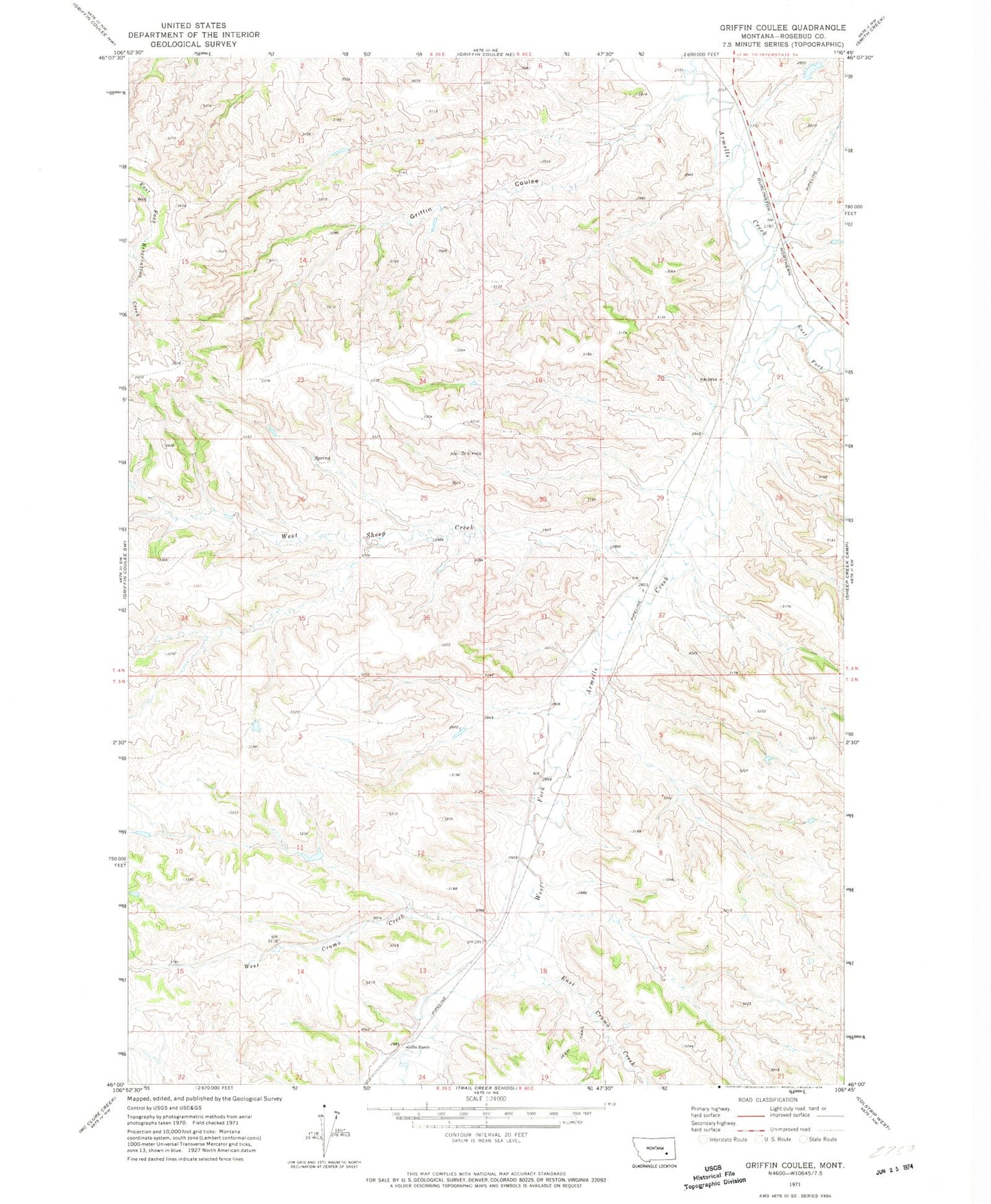
Classic USGS Griffin Coulee Montana 7.5'x7.5' Topo Map
Regular price
$16.95
Regular price
Sale price
$16.95
Unit price
per
Couldn't load pickup availability
Historical USGS topographic quad map of Griffin Coulee in the state of Montana. Map scale may vary for some years, but is generally around 1:24,000. Print size is approximately 24" x 27"
This quadrangle is in the following counties: Rosebud.
The map contains contour lines, roads, rivers, towns, and lakes. Printed on high-quality waterproof paper with UV fade-resistant inks, and shipped rolled.
Contains the following named places: 04N40E09ADDC01 Well, 04N40E21C___01 Well, 04N40E31DCAA01 Well, Ashenhurst Number 1 Dam, Dowlin, East Cromo Creek, East Fork Armells Creek, Gillin Ranch, Griffin Coulee, Lisle Post Office, West Cromo Creek, West Fork Armells Creek, West Sheep Creek