MyTopo
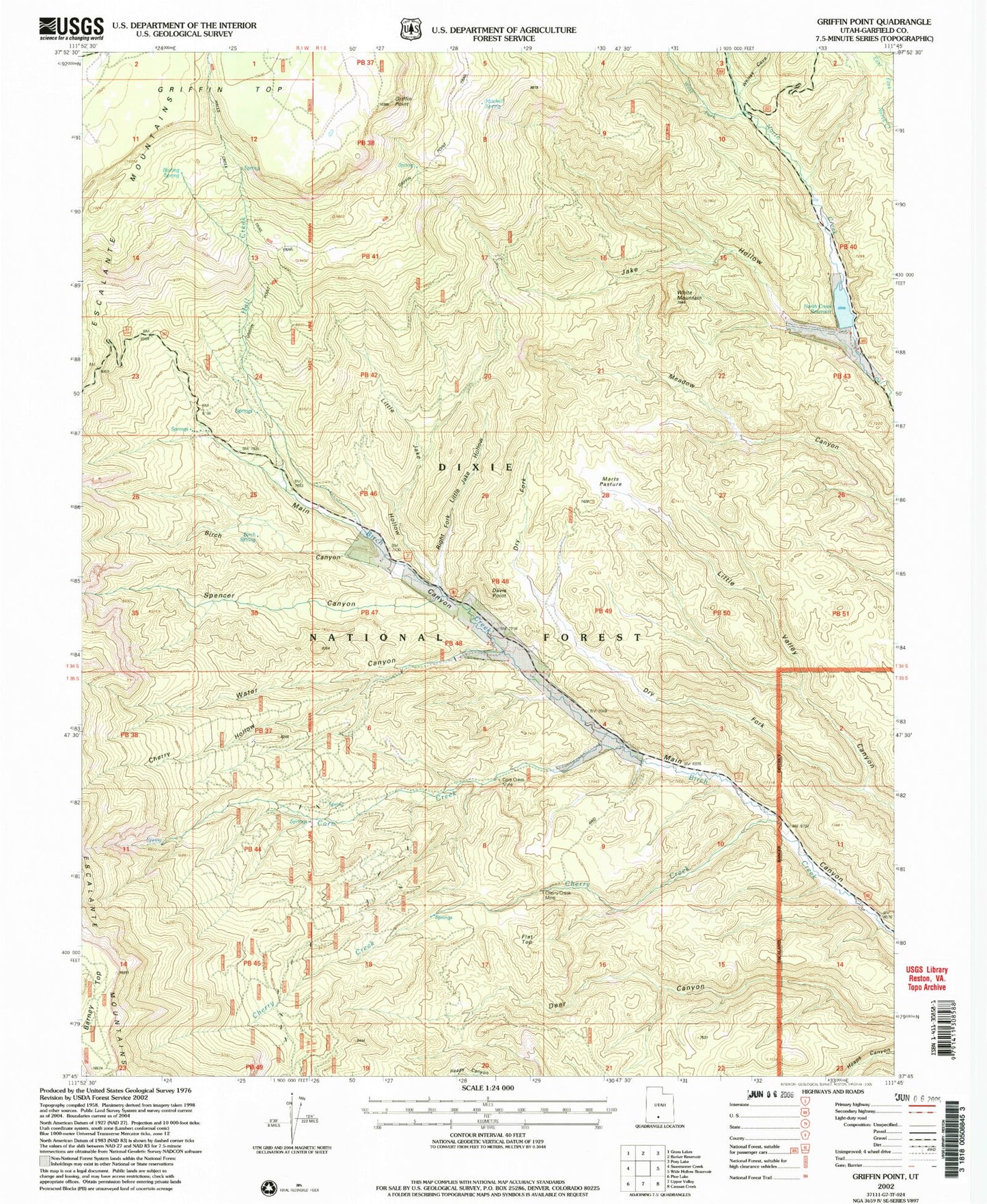
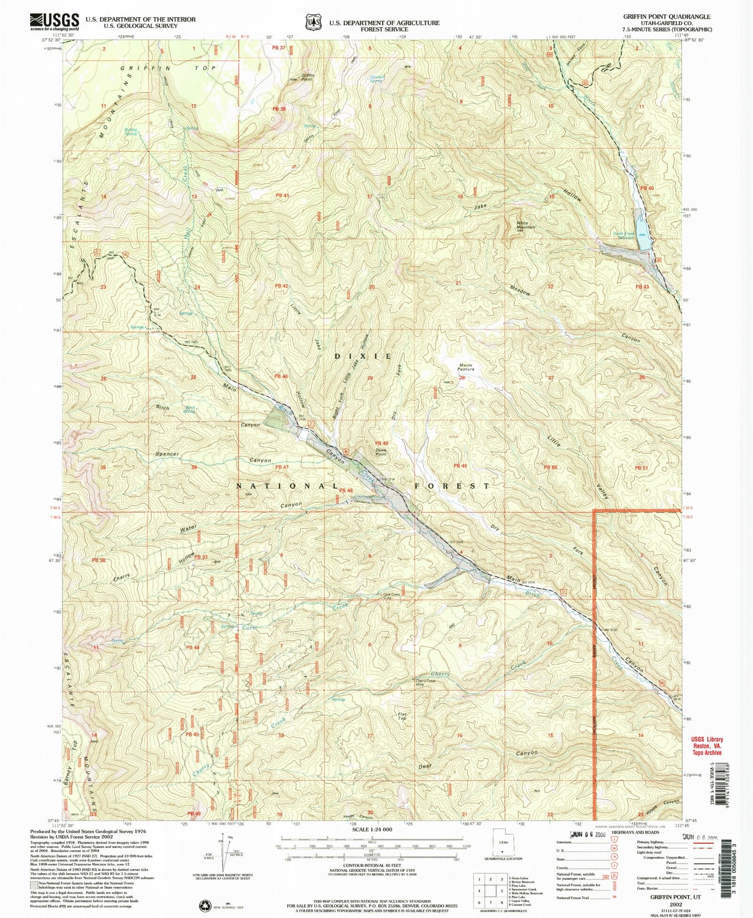
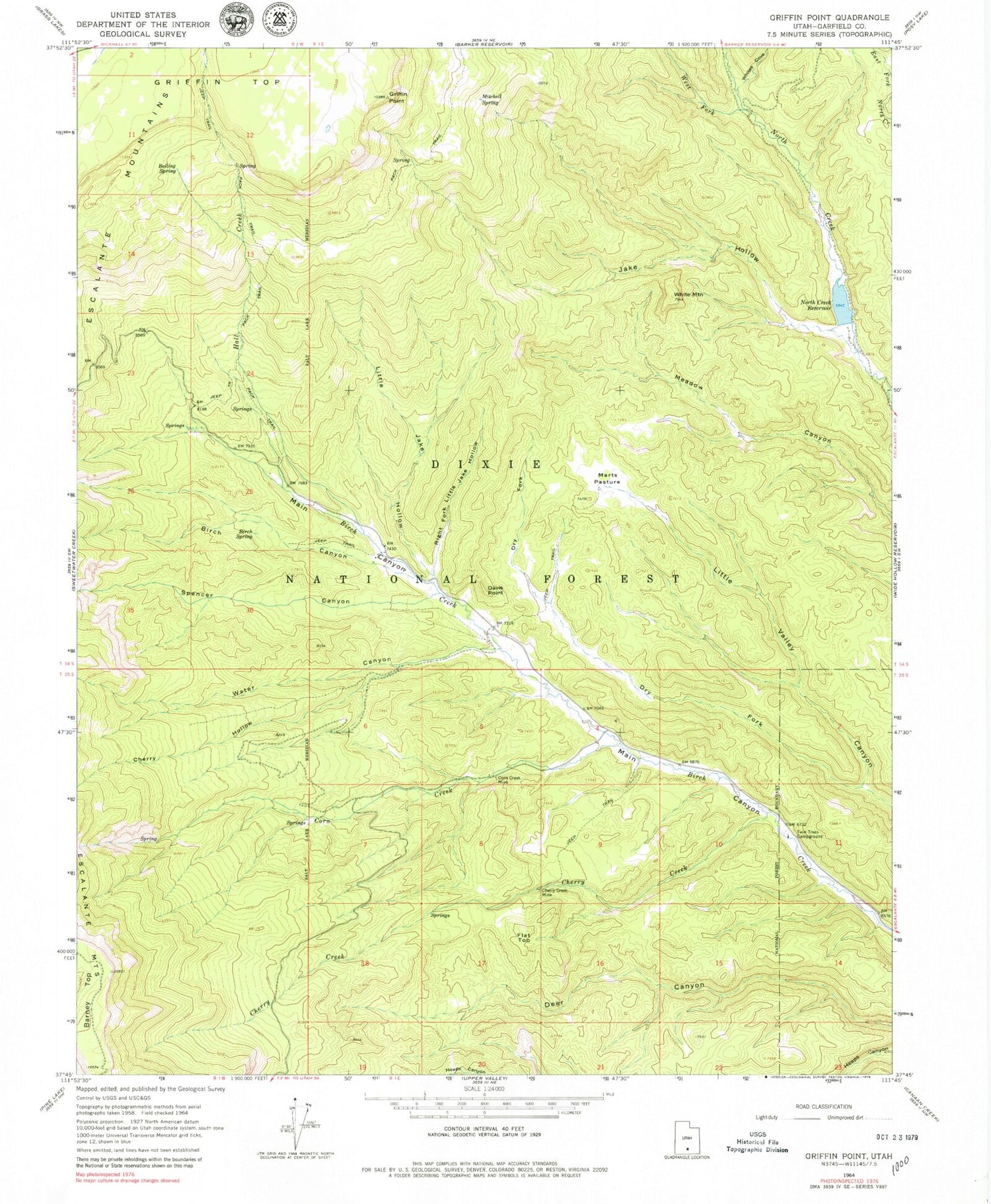
Classic USGS Griffin Point Utah 7.5'x7.5' Topo Map
Couldn't load pickup availability
Historical USGS topographic quad map of Griffin Point in the state of Utah. Map scale may vary for some years, but is generally around 1:24,000. Print size is approximately 24" x 27"
This quadrangle is in the following counties: Garfield.
The map contains contour lines, roads, rivers, towns, and lakes. Printed on high-quality waterproof paper with UV fade-resistant inks, and shipped rolled.
Contains the following named places: Barker Hollow, Barney Top, Birch Canyon, Birch Spring, Boiling Spring, Cherry Creek, Cherry Creek Mine, Cherry Hollow, Corn Creek, Corn Creek Mine, Davis Point, Dry Fork, Flat Top, Griffin Point, Hall Creek, Jake Hollow, Little Jake Hollow, Marts Pasture, Mitchell Spring, North Creek Dam, North Creek Reservoir, Right Fork Little Jake Hollow, Spencer Canyon, Twin Trees, Twin Trees Campground, Water Canyon, West Fork North Creek, White Mountain, Whites Cove, Whites Flat