MyTopo
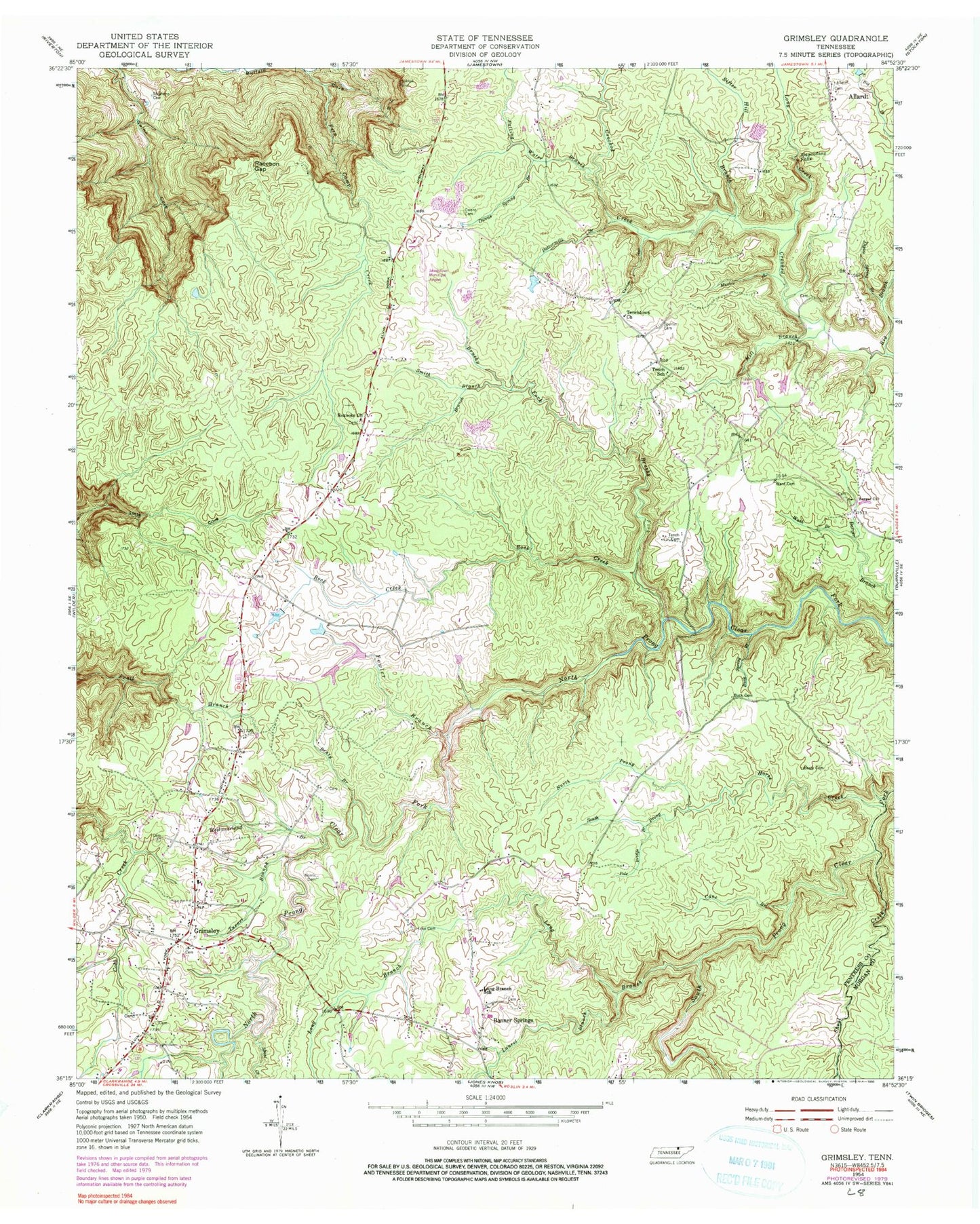
Classic USGS Grimsley Tennessee 7.5'x7.5' Topo Map
Couldn't load pickup availability
Historical USGS topographic quad map of Grimsley in the state of Tennessee. Map scale may vary for some years, but is generally around 1:24,000. Print size is approximately 24" x 27"
This quadrangle is in the following counties: Fentress, Morgan.
The map contains contour lines, roads, rivers, towns, and lakes. Printed on high-quality waterproof paper with UV fade-resistant inks, and shipped rolled.
Contains the following named places: Allardt Cemetery, Banner Springs Freewill Baptist Church, Barger Cemetery, Barger Church, Beaty Branch, Beaty Cemetery, Brushy Fork, Buck Cemetery, Buck Spring Branch, Buttermilk Branch, Cane Branch, Carney Hollow, Commissioner District 3, Conatser Dairy Farms, Falling Water Branch, Fentress County Volunteer Fire Department Station 3 Grimsley, Fern Camp Creek, Fowler Branch, Grimsley, Grimsley Census Designated Place, Grimsley Elementary School, Grimsley Post Office, Hicks Cemetery, Horse Creek, Jamestown Municipal Airport, Katron Sediment Basin Dam Number One, Katron Sediment Basin Number One Reservoir, Keese, Laurel Branch, Long Branch, Long Branch School, Long Creek, Lookout Point, Magendanz Falls, Mar-Jeanne Farm Lake, Mar-Jeanne Lake Dam, Mill Branch, Muckle Branch, Norris Cemetery, North Prong Horse Creek, Owens Cemetery, Owens Spring Branch, Pole Bridge Branch, Raccoon Gap, Roanoke Church, Roanoke United Methodist Church Cemetery, Rock Creek, Shoal Creek, Sifter Hill Branch, Smith Branch, South Prong Horse Creek, Spurlin Cemetery, Stephens Cemetery, Taylor Spring Branch, Tench, Tench Cemetery, Tench School, Tenchtown Church, Tinch, Turner Branch, Ward Cemetery, Wash Branch, Westmoreland Branch


