MyTopo
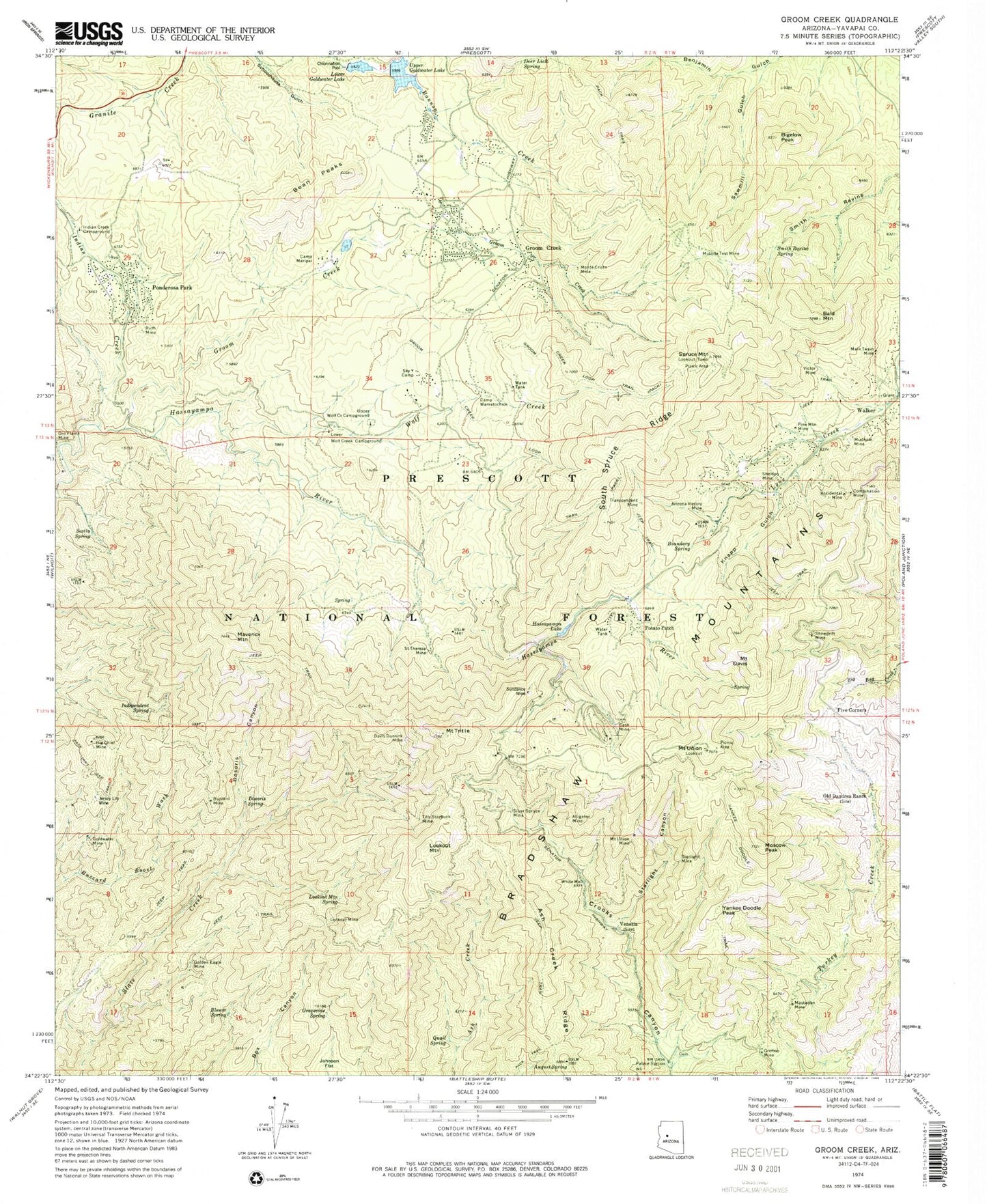
Classic USGS Groom Creek Arizona 7.5'x7.5' Topo Map
Couldn't load pickup availability
Historical USGS topographic quad map of Groom Creek in the state of Arizona. Typical map scale is 1:24,000, but may vary for certain years, if available. Print size: 24" x 27"
This quadrangle is in the following counties: Yavapai.
The map contains contour lines, roads, rivers, towns, and lakes. Printed on high-quality waterproof paper with UV fade-resistant inks, and shipped rolled.
Contains the following named places: Accidental Mine, Alligator Mine, Arizona Victory Mine, Ash Creek Ridge, August Spring, Bald Mountain, Bean Peaks, Big Chief Mine, Bigelow Peak, Blower Spring, Boundary Spring, Buzzard Mine, Camp Maripai, Camp Wamatochick, Cash Mine, Combination Mine, Davis Dunkirk Mine, Mount Davis, Deer Lick Spring, Dosoris Canyon, Dosoris Spring, Five Corners, Golden Eagle Mine, Goldwater Mine, Grapevine Spring, Groom Creek, Groom Creek, Groom Creek Loop Trail, Hassayampa Lake, Independent Spring, Indian Creek, Indian Creek Campground, Jersey Lily Mine, Knapp Gulch, Lookout Mine, Lookout Mountain, Lookout Mountain Spring, Lower Goldwater Lake, Lower Wolf Creek Campground, Mark Twain Mine, Mastadon Mine, Maverick Mountain, Midnite Test Mine, Monte Cristo Mine, Moscow Peak, Mount Union Mine, Mudhole Mine, Old Dandrea Ranch, Orofino Mine, Palace Station, Pine Mountain Mine, Ponderosa Park, Potato Patch, Quail Spring, Ruth Mine, Saint Theresa Mine, Sawmill Gulch, Scotty Spring, Sheldon Mine, Silver Spruce Mine, Sky Y Camp, Smith Ravine Spring, Snowdrift Mine, South Spruce Ridge, Spruce Mountain, Starlight Mine, Sundance Mine, Tilly Starbuck Mine, Transcendent Mine, Mount Tritle, Mount Union, Upper Goldwater Lake, Upper Wolf Creek Campground, Venezia, Victor Mine, Walker, White Well, Wolf Creek, Yankee Doodle Peak, Yankee Doodle Trail, Bones Spring, Camp Good News, Church Assembly Campground, E Cross L Trail Number Two Hundred Eighty One, Friendly Pines Camp, Hassayampa Check Dam, Hidden Smith Ravine Spring, Kendall Camp, King Benjamin Mine, Lower Goldwater Dam, Midnite Spring, Mount Union Family Picnic Ground, Mount Union Recreational Area, Patterdell Pines Convent, Scotty Spring Mine, Spruce Mountain Lookout Family Picnic Area, Starlight Canyon, Upper Lake Goldwater Dam, Yankee Girl Mine, Storm Ranch, Prescott Picnic Area, Hidden Spring, Payoff Spring, Pine Summit Camp, Horse Camp Forest Service Facility, Smith Spring, Pear Spring, Snow Drift Mine, Groom Creek Forest Service Facility, Whitespar Station, Senator Mine, Groom Creek Work Center, Phoenix YMCA Camp, Sparks Place, Pear Spring, Smith Spring, Hidden Spring, Groom Creek Horse Camp, White Spar Station, Bradshaw Ranger District, Money Medals Mine, Hidden Treasure - Golden Fleece Mine, Goldwater Lake Picnic Area, Groom Creek Fire Station, Central Yavapai Fire District Reserve Station 56