
MyTopo
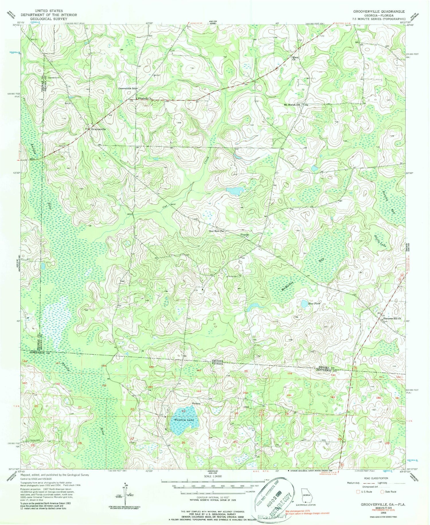
Classic USGS Grooverville Georgia 7.5'x7.5' Topo Map
Couldn't load pickup availability
Historical USGS topographic quad map of Grooverville in the states of Georgia, Florida. Map scale may vary for some years, but is generally around 1:24,000. Print size is approximately 24" x 27"
This quadrangle is in the following counties: Brooks, Jefferson, Thomas.
The map contains contour lines, roads, rivers, towns, and lakes. Printed on high-quality waterproof paper with UV fade-resistant inks, and shipped rolled.
Contains the following named places: African Methodist Episcopal Cemetery, Alico Company Dam, Alico Company Lake, Aucilla Swamp, Blue Pond, Cat Creek, Dixie Division, Elam Church, Elizabeth Church, Grooverville, Grooverville Cemetery, Grooverville Methodist Church, Grooverville School, Jesus Christ Church, Liberty Baptist Church, Long Lake, Long Lake Dam, McMullen Bay, Mount Moriah Church, Mount Moriah School, New Zion Church, Pine Hill Church, Piscola, Ramsey Cemetery, Saint Philip Cemetery, Saint Philip Church, Simmons Hill Church, Stanley Bay, Stella Lake, Summer Hill Cemetery, Windom Lake


