MyTopo
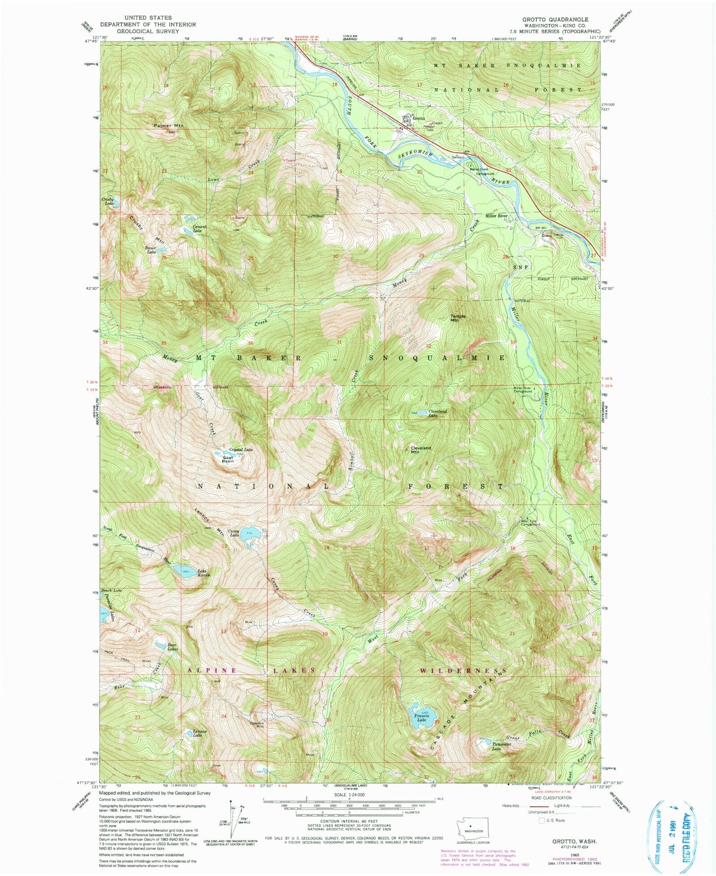
Classic USGS Grotto Washington 7.5'x7.5' Topo Map
Couldn't load pickup availability
Historical USGS topographic quad map of Grotto in the state of Washington. Typical map scale is 1:24,000, but may vary for certain years, if available. Print size: 24" x 27"
This quadrangle is in the following counties: King.
The map contains contour lines, roads, rivers, towns, and lakes. Printed on high-quality waterproof paper with UV fade-resistant inks, and shipped rolled.
Contains the following named places: Bear Lakes, Boner Lake, Cement Lake, Cleopatra Mine, Cleveland Lake, Cleveland Mountain, Coney Creek, Coney Lake, Crosby Lake, Crosby Mountain, Crystal Lake, East Fork Miller River, Francis Lake, Goat Basin, Goat Creek, Great Falls Creek, Grotto, Lake Kanim, Kimball Creek, Lennox Lake, Lennox Mountain, Lowe Creek, Miller River, Miller River, Miller River Campground, Money Creek, Money Creek Campground, Palmer Mountain, Temple Mountain, Tumwater Lake, West Fork Campground, West Fork Miller River, Engle Creek, Tunnel on US 2, Cascade Stevens Highway Bridge