MyTopo
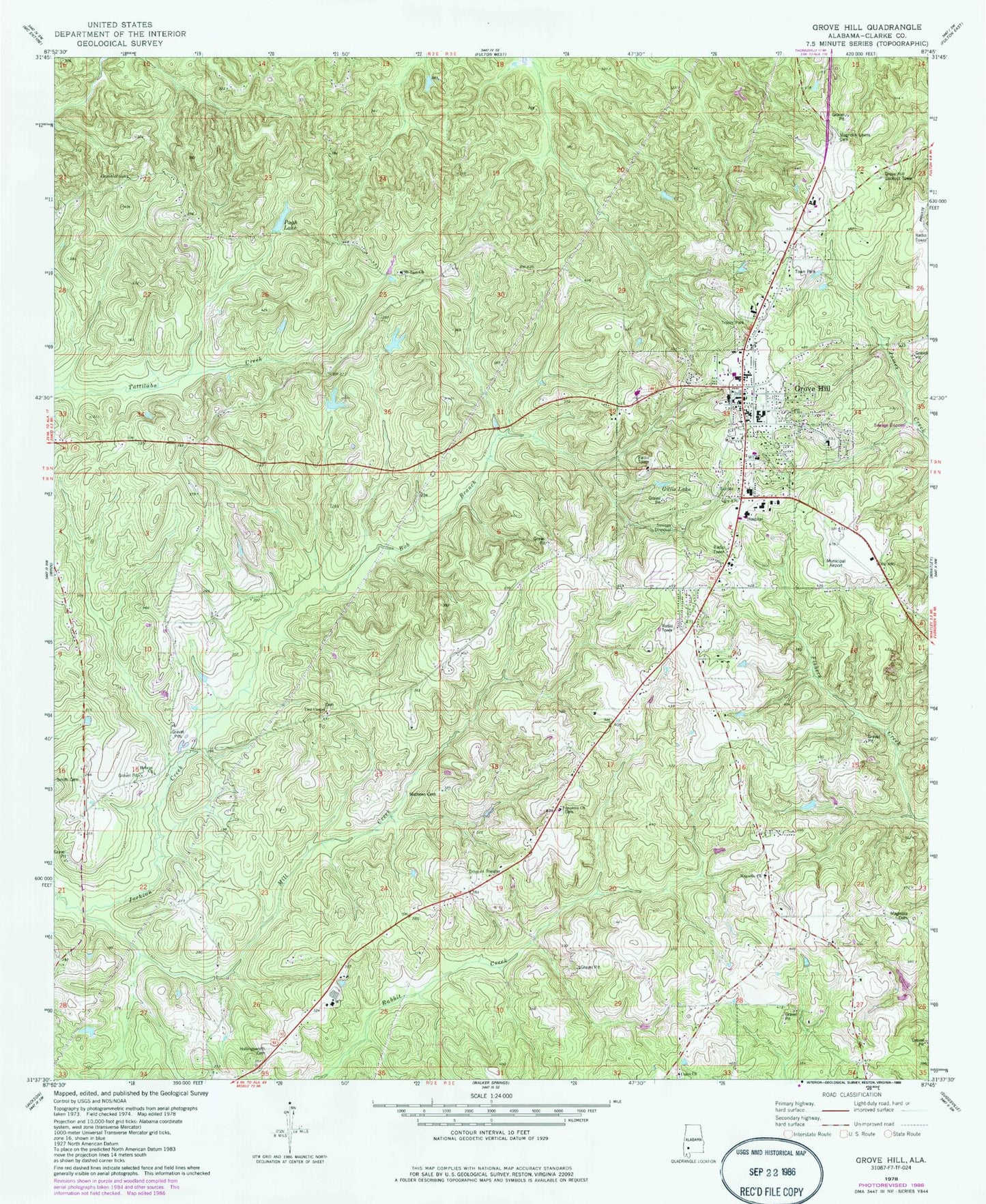
Classic USGS Grove Hill Alabama 7.5'x7.5' Topo Map
Couldn't load pickup availability
Historical USGS topographic quad map of Grove Hill in the state of Alabama. Map scale may vary for some years, but is generally around 1:24,000. Print size is approximately 24" x 27"
This quadrangle is in the following counties: Clarke.
The map contains contour lines, roads, rivers, towns, and lakes. Printed on high-quality waterproof paper with UV fade-resistant inks, and shipped rolled.
Contains the following named places: Alabama State Troopers, Bob Branch, Burge Lake, Burge Lake Dam, Chapman Lake, Chapman Lake Dam, Church of Christ, Clarke County, Clarke County Courthouse, Clarke County Farm, Clarke County High School, Clarke County Historical Museum, Clarke County Museum, Clarke County Sheriff's Office, Clarkesville Apostolic Overcoming Holiness Church of God, Finch Pit, Gillis Lake, Grove Hill, Grove Hill Academy, Grove Hill Area Chamber of Commerce, Grove Hill Baptist Church, Grove Hill Cemetery, Grove Hill Church, Grove Hill Elementary School, Grove Hill Lookout Tower, Grove Hill Memorial Hospital, Grove Hill Municipal Airport, Grove Hill Municipal Park, Grove Hill Post Office, Grove Hill Public Library, Grove Hill United Methodist Church, Grove Hill Volunteer Fire Department, Hebron Church, Helwestern Fire Department, Hollingsworth Cemetery, Magnolia Cemetery, Magnolia Church, Magnolia Lawn Cemetery, Mathews Cemetery, Matthews Chapel, Matthews School, Mill Creek, Mount Zion Baptist Church, Pine Chapel, Prim Stadium, Pugh, Pugh Cemetery, Pugh Lake, Sacred Heart Church, Smith Cemetery, South Alabama Infirmary, The Church of Jesus Christ of Latter Day Saints, Tompkins Baptist Church, Town of Grove Hill, Union, Union Baptist Church, Wilson Chapel African Methodist Episcopal Church, Wilson Chapel Cemetery, ZIP Code: 36451