MyTopo
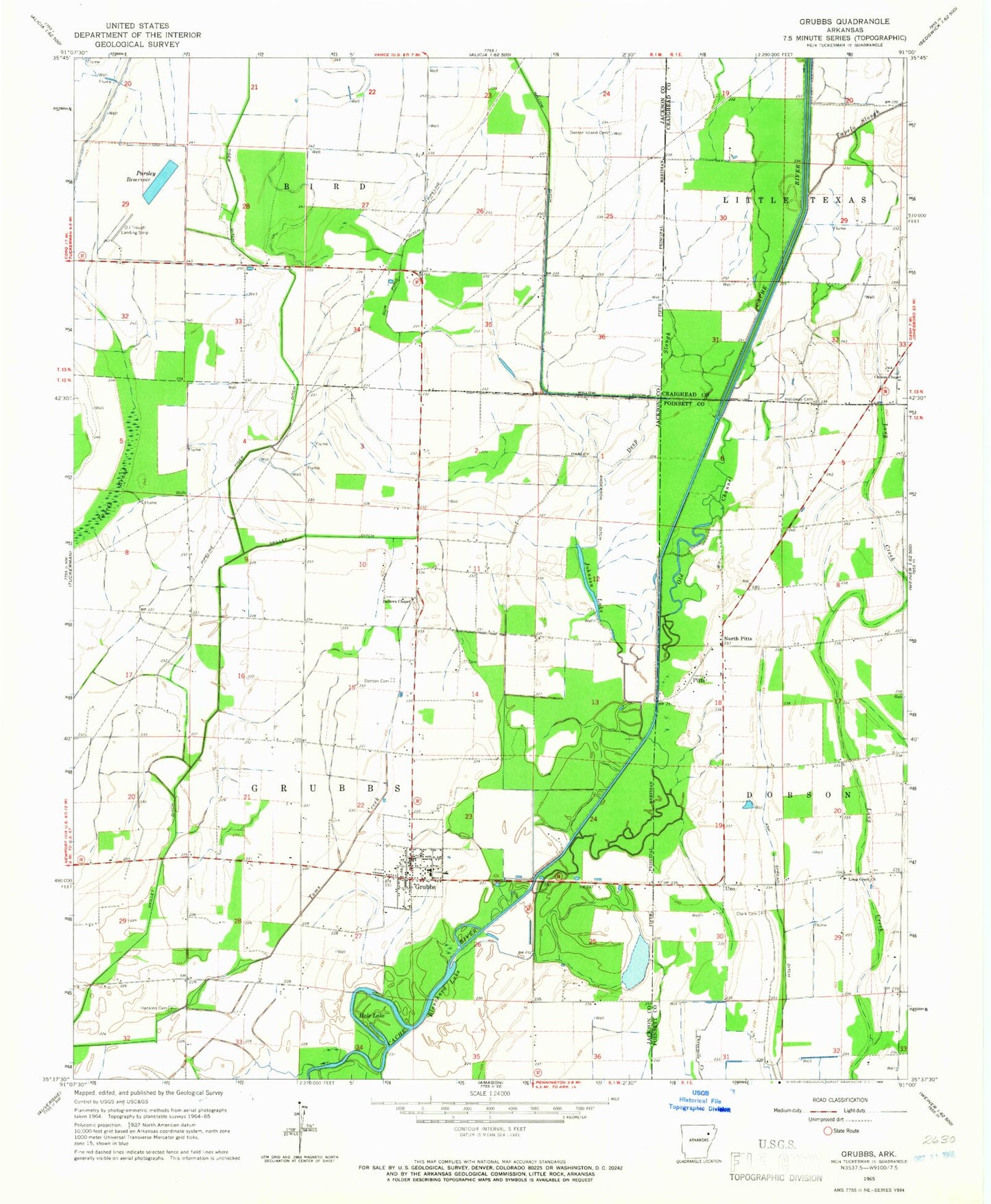
Classic USGS Grubbs Arkansas 7.5'x7.5' Topo Map
Couldn't load pickup availability
Historical USGS topographic quad map of Grubbs in the state of Arkansas. Map scale may vary for some years, but is generally around 1:24,000. Print size is approximately 24" x 27"
This quadrangle is in the following counties: Craighead, Jackson, Poinsett.
The map contains contour lines, roads, rivers, towns, and lakes. Printed on high-quality waterproof paper with UV fade-resistant inks, and shipped rolled.
Contains the following named places: Adams School, Ash Spread Ditch, Ballews Chapel, Blanchard Lake, Chilson, Chilson Chapel, Chilson Church, City of Grubbs, Clark Cemetery, Credit, Deep Slough, Denton Cemetery, Denton Island Cemetery, Grubbs, Grubbs Elementary School, Grubbs High School, Grubbs Post Office, Grubbs Volunteer Fire Department, Gum Pond Ditch, Hale, Hale Lake, Hankins - Sullins Cemetery, Harley Anderson Ditch, Holloway Cemetery, Johnson Lake, Long Creek Church, Milltown Auxiliary Army Airfield, North Pitts, Oil Trough Landing Strip, Old Channel Cache River, Parsley Reservoir, Pitts, Skillet Ditch, Tiger Ditch, Township of Grubbs, Tupelo Slough, Tuscany, Uno, ZIP Code: 72431