MyTopo
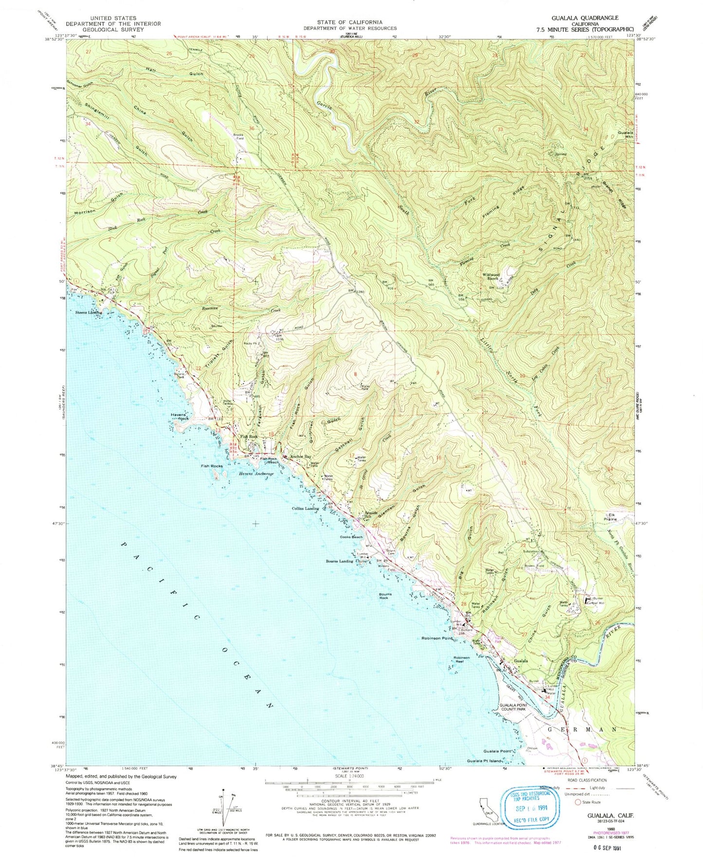
Classic USGS Gualala California 7.5'x7.5' Topo Map
Couldn't load pickup availability
Historical USGS topographic quad map of Gualala in the state of California. Typical map scale is 1:24,000, but may vary for certain years, if available. Print size: 24" x 27"
This quadrangle is in the following counties: Mendocino, Sonoma.
The map contains contour lines, roads, rivers, towns, and lakes. Printed on high-quality waterproof paper with UV fade-resistant inks, and shipped rolled.
Contains the following named places: Big Gulch, Bourn Cemetery, Bowers Field, Brandt Ridge, China Gulch, China Gulch, Cooks Beach, Doty Creek, Elk Prairie, Ferguson Gulch, Fish Rock Beach, Fish Rock Gulch, Fish Rocks, Fleming Creek, Fleming Ridge, Fox Gulch, Getchell Gulch, Glennen Gulch, Gualala, Gualala Point, Gualala Point Regional Park, Gualala Point Island, Hall Gulch, Havens Anchorage, Havens Neck, Little North Fork Gualala River, Log Cabin Creek, Robinson Point, Robinson Reef, Roseman Creek, Saint Orres Creek, Seaside School, Signal Port Creek, South Fork Garcia River, Triplett Gulch, Wildwood Ranch, Wilsons Field, Saint Orres Gulch, Gualala River, Quinliven Gulch, Sail Rock, Bourns Gulch, Bourns Rock, Robinson Gulch, Anderson Ranch, Anderson Ranch (historical), Butler Ranch, Craig Ranch, Everson Ranch, Johnson Ranch, McNamees Ranch, Reimert Ranch, Riser Ranch, Smith Ranch, Lofty Redwoods Airport, Ocean Ridge Airport, Wilsons Field (historical), Anchor Bay, Bourns Landing, Collins Landing, Fish Rock, Gualala Mountain, Steens Landing, Signal Port (historical), South Coast Fire District, South Coast Fire Protection District, Anchor Bay Census Designated Place, Coast Life Support District, Fish Rocks Arch, Fish Rock Cemetery, Bourn Cemetery, Gualala Post Office, Big Gulch, Bourn Cemetery, Bowers Field, Brandt Ridge, China Gulch, China Gulch, Cooks Beach, Doty Creek, Elk Prairie, Ferguson Gulch, Fish Rock Beach, Fish Rock Gulch, Fish Rocks, Fleming Creek, Fleming Ridge, Fox Gulch, Getchell Gulch, Glennen Gulch, Gualala, Gualala Point, Gualala Point Regional Park, Gualala Point Island, Hall Gulch, Havens Anchorage, Havens Neck, Little North Fork Gualala River, Log Cabin Creek, Robinson Point, Robinson Reef, Roseman Creek, Saint Orres Creek, Seaside School, Signal Port Creek, South Fork Garcia River, Triplett Gulch, Wildwood Ranch, Wilsons Field, Saint Orres Gulch, Gualala River, Quinliven Gulch, Sail Rock, Bourns Gulch, Bourns Rock, Robinson Gulch, Anderson Ranch, Anderson Ranch (historical), Butler Ranch, Craig Ranch, Everson Ranch, Johnson Ranch, McNamees Ranch, Reimert Ranch, Riser Ranch, Smith Ranch, Lofty Redwoods Airport, Ocean Ridge Airport, Wilsons Field (historical), Anchor Bay, Bourns Landing, Collins Landing, Fish Rock, Gualala Mountain, Steens Landing, Signal Port (historical), South Coast Fire District, South Coast Fire Protection District, Anchor Bay Census Designated Place, Coast Life Support District, Fish Rocks Arch, Fish Rock Cemetery, Bourn Cemetery, Gualala Post Office


