
MyTopo
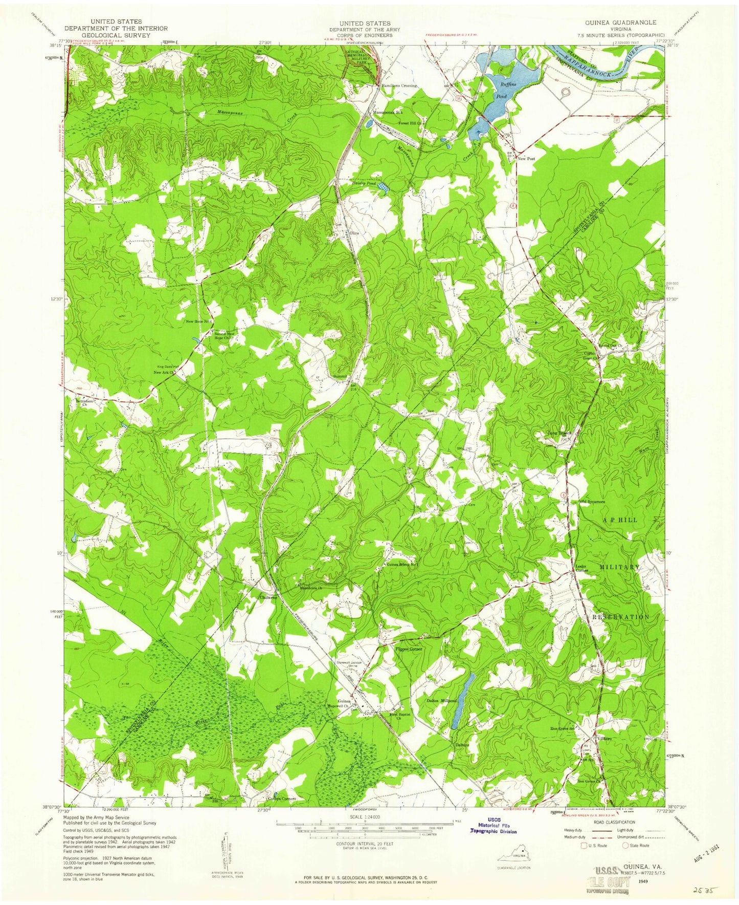
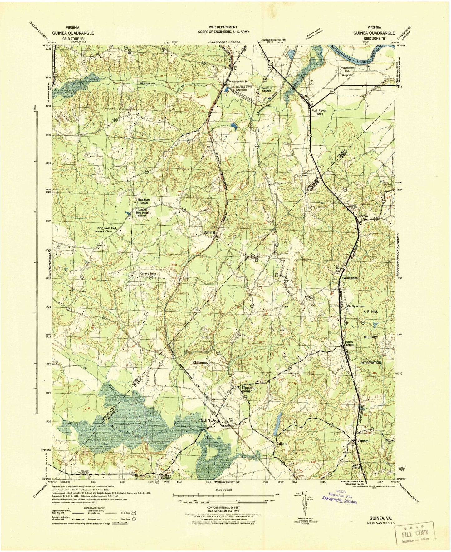
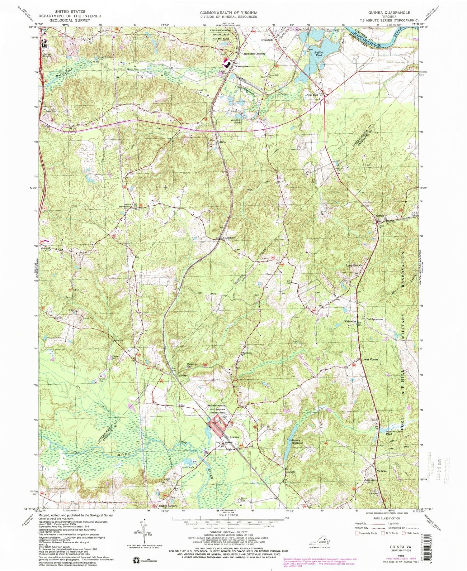
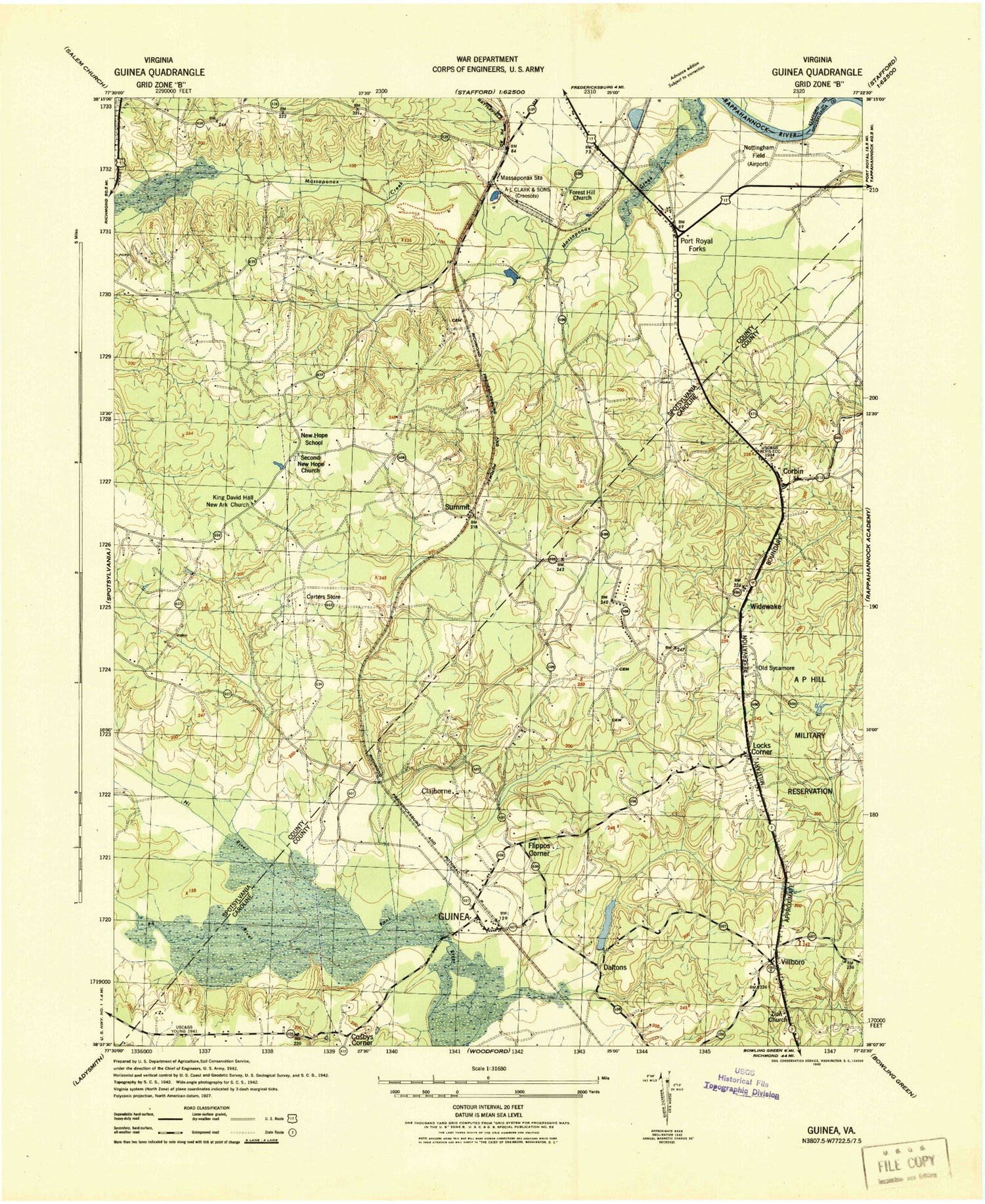
Classic USGS Guinea Virginia 7.5'x7.5' Topo Map
Couldn't load pickup availability
Historical USGS topographic quad map of Guinea in the state of Virginia. Typical map scale is 1:24,000, but may vary for certain years, if available. Print size: 24" x 27"
This quadrangle is in the following counties: Caroline, Spotsylvania, Stafford.
The map contains contour lines, roads, rivers, towns, and lakes. Printed on high-quality waterproof paper with UV fade-resistant inks, and shipped rolled.
Contains the following named places: Bethlehem Church, Cosbys Corners, Dalton Millpond, Forest Hill Church, Grace Church, Haislip Pond, Hopewell Church, Jackson Shrine, Macedonia Cemetery, Macedonia Church, Meadow Creek Pond, Mount Lawn Cemetery, Ni River, Old Sycamore, Po River, Round Oak Church, Ruffins Pond, Second New Hope Baptist Church, Zion Grove Church, Summit, Widewake, Daltons, Belvedere, Dangerfield Short Turn, Daltons Dam, E H Mills Memorial Dam, Ruffins Pond, Claiborne, Corbin, Greenfield, Guinea, Hamilton Crossing, Locks Corner, Long Branch, Massaponax, New Post, Olive, Villboro, First Baptist Church, Flippos Corner, Grace Church Cemetery, Guinea Number 1 School (historical), Hopewell Methodist Church Cemetery, Macedonia Church (historical), Round Oak Baptist Church Cemetery, Zion Grove School (historical), Carters Store, New Ark Church (historical), Crossroads Baptist Church, Forest Hill Cemetery, Lee Hill Elementary School, Lee Hill Park, Second New Hope Baptist Church Cemetery, Lee Hill District, Caroline County Fire and Rescue / Upper Caroline Volunteer Fire Department Company 6, Fredericksburg Christian Upper School, Germanna Community College Fredericksburg Campus, Lees Hill Professional Office Center, Ninetyfive Commerce Place, Ninetyfive Business Park, Hall Industrial Park, Massaponax Business Park, Crossroads Industrial Park, Lees Hill Golfers Club, The Oaks Mobile Home Park, Lee's Hill Mobile Home Park, Glenwood Mobile Home Court, Spotsylvania Regional Medical Center, Corbin Post Office, Bethlehem Church, Cosbys Corners, Dalton Millpond, Forest Hill Church, Grace Church, Haislip Pond, Hopewell Church, Jackson Shrine, Macedonia Cemetery, Macedonia Church, Meadow Creek Pond, Mount Lawn Cemetery, Ni River, Old Sycamore, Po River, Round Oak Church, Ruffins Pond, Second New Hope Baptist Church, Zion Grove Church, Summit, Widewake, Daltons, Belvedere, Dangerfield Short Turn, Daltons Dam, E H Mills Memorial Dam, Ruffins Pond, Claiborne, Corbin, Greenfield, Guinea, Hamilton Crossing, Locks Corner, Long Branch, Massaponax, New Post, Olive, Villboro, First Baptist Church, Flippos Corner, Grace Church Cemetery, Guinea Number 1 School (historical), Hopewell Methodist Church Cemetery, Macedonia Church (historical), Round Oak Baptist Church Cemetery, Zion Grove School (historical), Carters Store, New Ark Church (historical), Crossroads Baptist Church, Forest Hill Cemetery, Lee Hill Elementary School, Lee Hill Park, Second New Hope Baptist Church Cemetery, Lee Hill District, Caroline County Fire and Rescue / Upper Caroline Volunteer Fire Department Company 6, Fredericksburg Christian Upper School, Germanna Community College Fredericksburg Campus, Lees Hill Professional Office Center, Ninetyfive Commerce Place, Ninetyfive Business Park, Hall Industrial Park, Massaponax Business Park, Crossroads Industrial Park, Lees Hill Golfers Club, The Oaks Mobile Home Park, Lee's Hill Mobile Home Park, Glenwood Mobile Home Court, Spotsylvania Regional Medical Center, Corbin Post Office