MyTopo
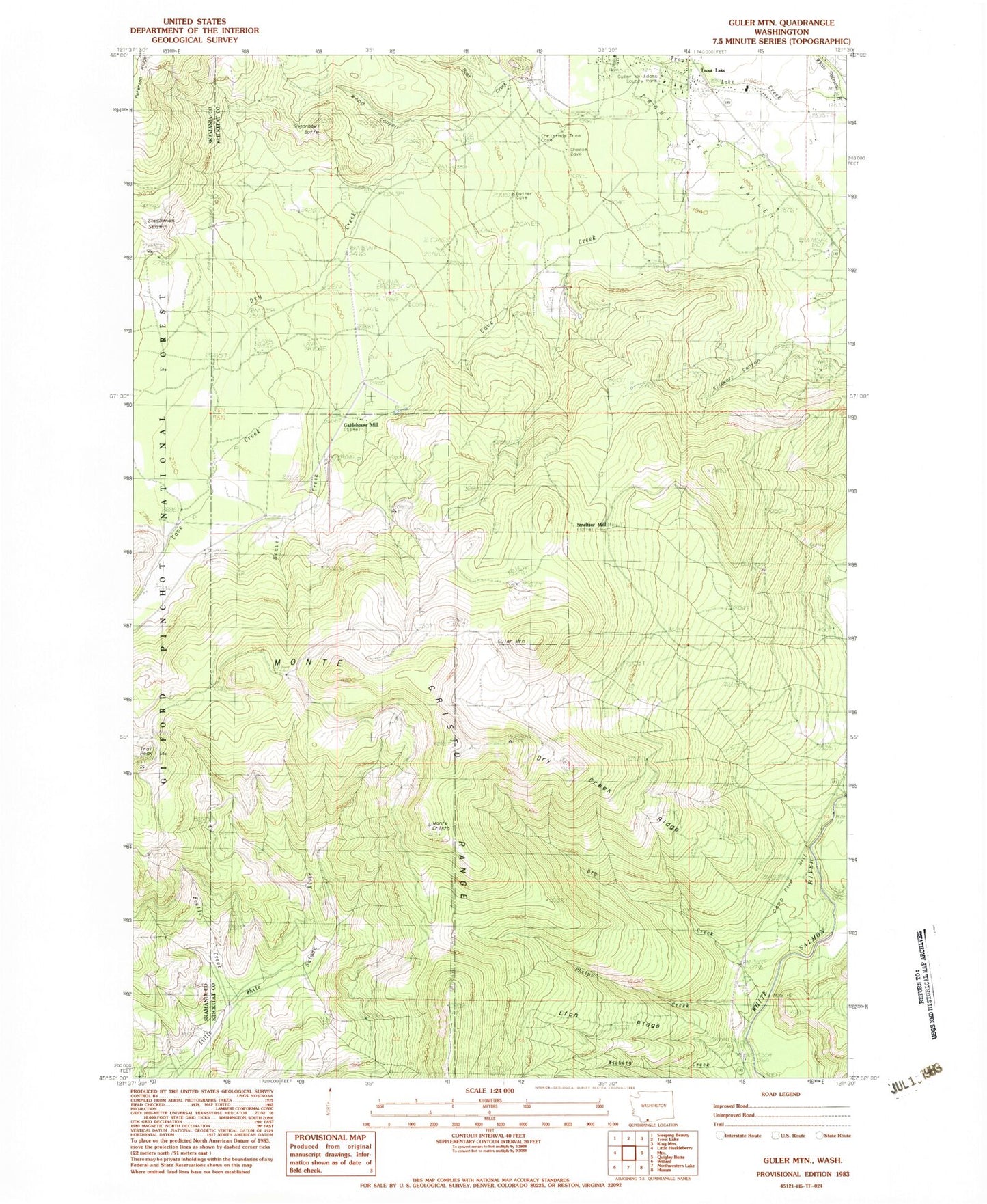
Classic USGS Guler Mountain Washington 7.5'x7.5' Topo Map
Couldn't load pickup availability
Historical USGS topographic quad map of Guler Mountain in the state of Washington. Map scale may vary for some years, but is generally around 1:24,000. Print size is approximately 24" x 27"
This quadrangle is in the following counties: Klickitat, Skamania.
The map contains contour lines, roads, rivers, towns, and lakes. Printed on high-quality waterproof paper with UV fade-resistant inks, and shipped rolled.
Contains the following named places: Bear Creek, Bear Valley, Beaver Creek, Beetle Creek, Camp Five Hill, Cave Creek, Dry Creek, Dry Creek Ridge, Eton Ridge, Gablehouse Mill, Guler, Guler Mount Adams County Park, Guler Mountain, Kilowatt Canyon, Lava Bridge, Little White Salmon Trail, Monte Cristo, Monte Cristo Range, Mount Adams Ranger Station, Oklahoma Trail, Phelps Creek, Smeltzer Mill, Spring Creek, Stadleman Swamp, Sugarbowl Butte, Trout Lake, Trout Lake Census Designated Place, Trout Lake Creek, Trout Lake Elementary School, Trout Lake Junior-Senior High School, Trout Lake Post Office, Wang Canyon, Wieberg Creek, ZIP Code: 98650