
MyTopo
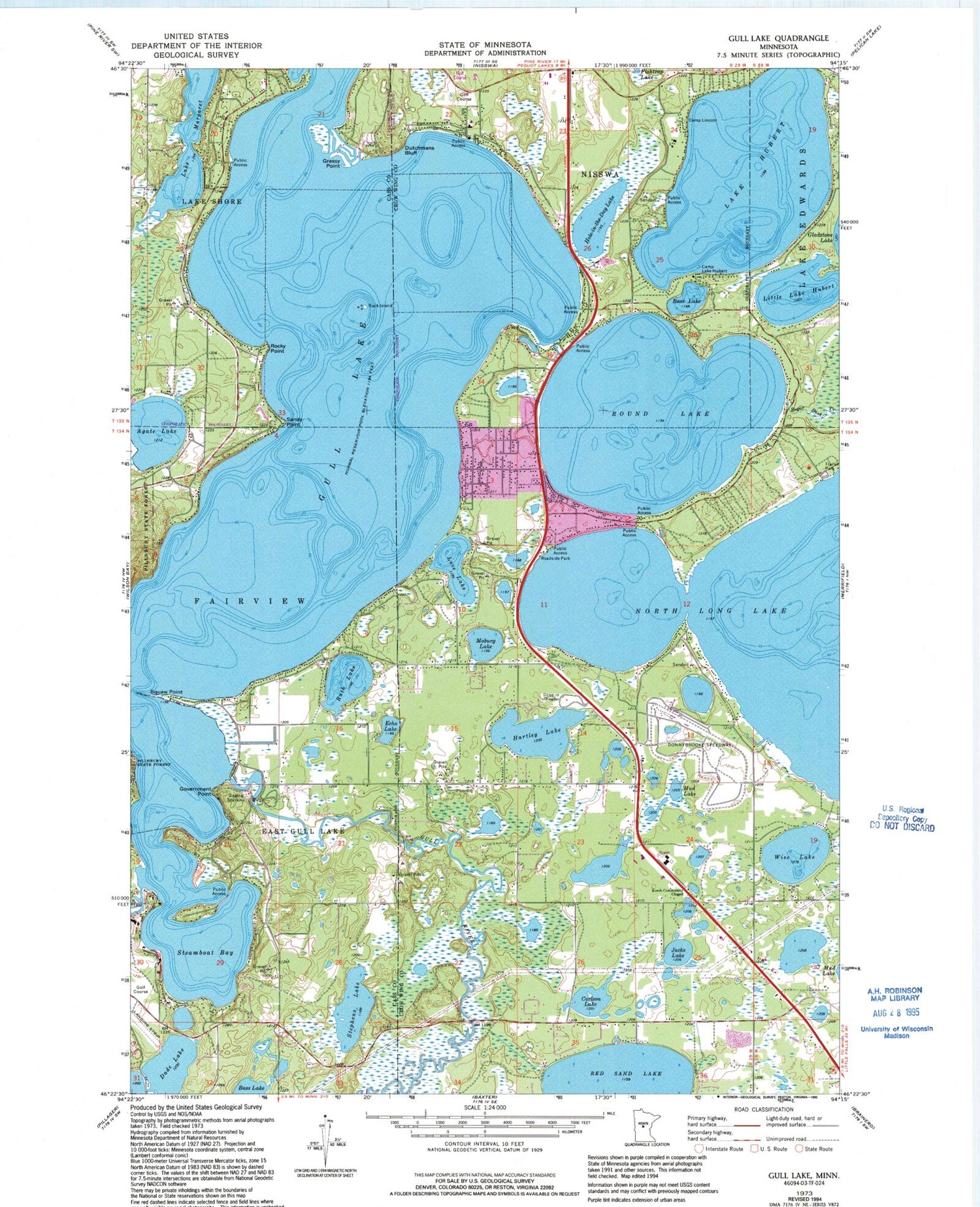
Classic USGS Gull Lake Minnesota 7.5'x7.5' Topo Map
Couldn't load pickup availability
Historical USGS topographic quad map of Gull Lake in the state of Minnesota. Typical map scale is 1:24,000, but may vary for certain years, if available. Print size: 24" x 27"
This quadrangle is in the following counties: Cass, Crow Wing.
The map contains contour lines, roads, rivers, towns, and lakes. Printed on high-quality waterproof paper with UV fade-resistant inks, and shipped rolled.
Contains the following named places: Agate Lake, Bass Lake, Bass Lake, Camp Lake Hubert, Camp Lincoln, Carlson Lake, Dade Lake, Dutchmans Bluff, East Gull Lake, Echo Lake, Government Point, Grassy Point, Gull Lake, Hartley Lake, Hole-in-the-Day Lake, Home Brook, Lake Hubert, Jacks Lake, Kerch Community Chapel, Lake Shore, Little Lake Hubert, Love Lake, Moburg Lake, Mud Lake, Rock Island, Rocky Point, Round Lake, Ruth Lake, Sandy Point, Gull Point, Steamboat Bay, Stephens Lake, Sugar Bush Creek, Wise Lake, Donnybrooke Speedway, Lake Margaret, B I R Airport (historical), East Gull Lake Airport, Eastman Seaplane Base, Pauls Seaplane Base, Gull Lake Dam, Gull Lake Reservoir, East Gull Lake City Hall, Living Savior Lutheran Church, Gull and Love Lake Campground, Agape Christian Church, Church of the Nazarene, Birch Bay Golf Club, The Garden Course at Grand View Lodge, Legacy Courses at Cragun's Reversible Par Three, Legacy Courses at Cragun's - Bobby's 18, Legacy Courses at Cragun's - Dutch 18, Madden's the Classic Golf Course, Brainerd Region Geological Marker, North Long Lake Rest Area, City of East Gull Lake, Lake Shore Police Department


