
MyTopo
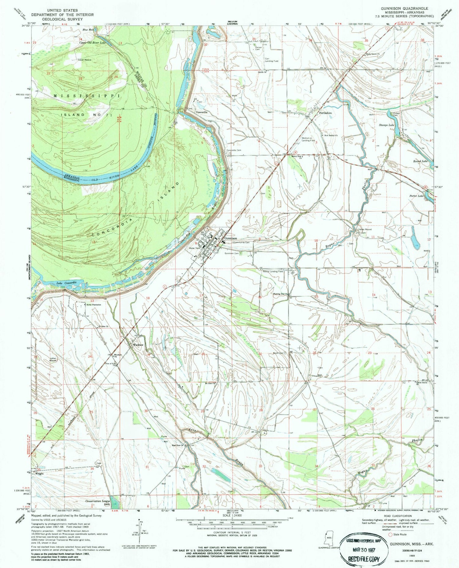
Classic USGS Gunnison Mississippi 7.5'x7.5' Topo Map
Couldn't load pickup availability
Historical USGS topographic quad map of Gunnison in the states of Mississippi, Arkansas. Map scale may vary for some years, but is generally around 1:24,000. Print size is approximately 24" x 27"
This quadrangle is in the following counties: Bolivar, Desha.
The map contains contour lines, roads, rivers, towns, and lakes. Printed on high-quality waterproof paper with UV fade-resistant inks, and shipped rolled.
Contains the following named places: Bassie Landing Field, Blue Hole, Bob Woods Elementary School, Bolivar County Fire Department District 4 Station 1 Gunnison, Carr Landing Field, Carsons Landing, Concordia, Concordia Bayou, Concordia Cemetery, Dalton Taylor Catfish Ponds Dam, Ditch Number Fourteen, Ditch Number Seven, Ditch Number Sixteen, Ditch Number Twelve, East Star Church, Ernest Finley Pond Dam, Gunnison, Gunnison Cemetery, Gunnison Post Office, Island Number 71, Island Number Seventy, Kirks Plantation, Lake Concordia, Mercy Seat Church, Morning Star Church, Mount Zion Church, New Bethel Church, Old River Lake, Person Cemetery, Perthshire, Perthshire Landing Field, Pickett Cemetery, Round Lake, Saint John Church, Scott Cemetery, Shady Grove Church, Shiloh Church, Sledge Crevasse, Stamps Lake, Town of Gunnison, Tree of Life Church, Union Grove Church, Upper Old River Lake, Waxhaw, Waxhaw Church, Wright, ZIP Code: 38746


