
MyTopo
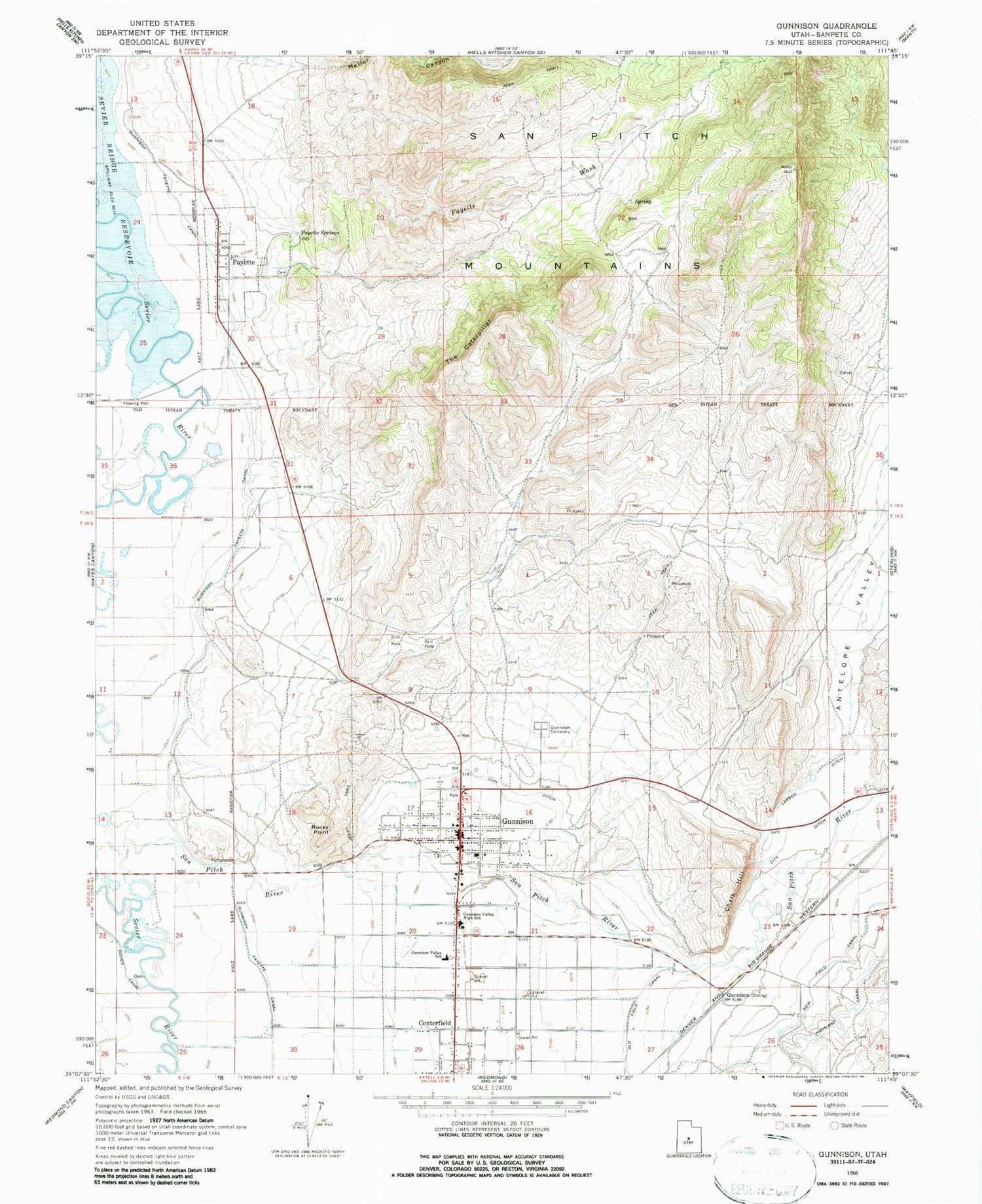
Classic USGS Gunnison Utah 7.5'x7.5' Topo Map
Couldn't load pickup availability
Historical USGS topographic quad map of Gunnison in the state of Utah. Map scale may vary for some years, but is generally around 1:24,000. Print size is approximately 24" x 27"
This quadrangle is in the following counties: Sanpete.
The map contains contour lines, roads, rivers, towns, and lakes. Printed on high-quality waterproof paper with UV fade-resistant inks, and shipped rolled.
Contains the following named places: Antelope Valley, Centerfield, Centerfield Post Office, Central Utah Correctional Facility, Chalk Hill, Christianburg, City Ditch, City of Gunnison, Fayette, Fayette Cemetery, Fayette Spring, Fayette Wash, Fieldstone Academy, Gunnison, Gunnison Cemetery, Gunnison Division, Gunnison Fayette Canal, Gunnison Police Department, Gunnison Post Office, Gunnison Valley Ambulance, Gunnison Valley High School, Gunnison Valley Hospital, Gunnison Valley Volunteer Fire Department, KGVH-FM (Gunnison), Lunds Campground, Mellor Canyon, New Field Canal, Rocky Point, The Caterpillar, The Church of Jesus Christ of Latter Day Saints, Town of Centerfield, Town of Fayette, ZIP Code: 84634


