MyTopo
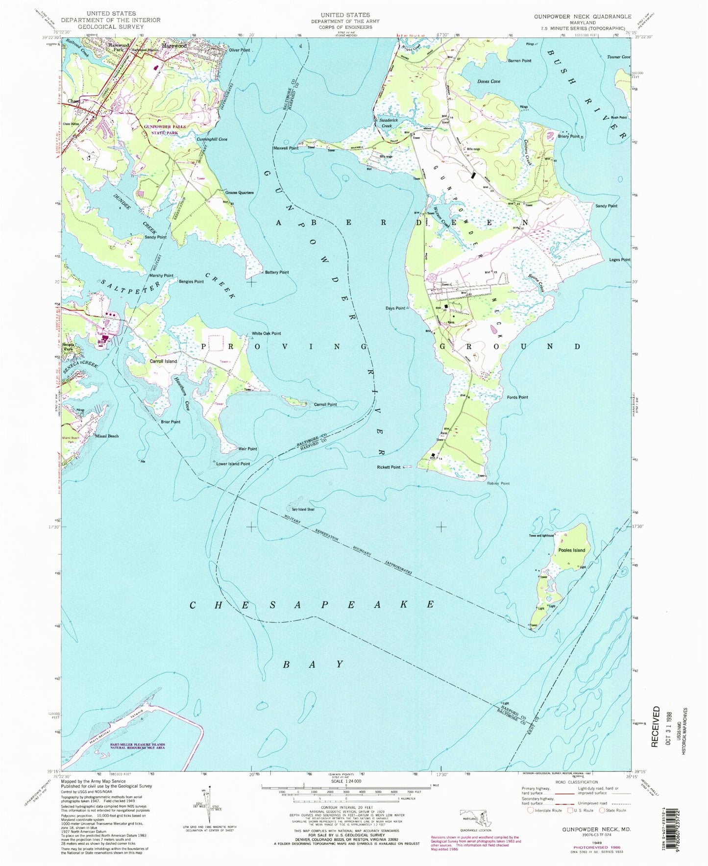
Classic USGS Gunpowder Neck Maryland 7.5'x7.5' Topo Map
Couldn't load pickup availability
Historical USGS topographic quad map of Gunpowder Neck in the state of Maryland. Map scale may vary for some years, but is generally around 1:24,000. Print size is approximately 24" x 27"
This quadrangle is in the following counties: Baltimore, Harford, Kent.
The map contains contour lines, roads, rivers, towns, and lakes. Printed on high-quality waterproof paper with UV fade-resistant inks, and shipped rolled.
Contains the following named places: Baltimore County Fire Department Chase - Station 54, Barren Point, Battery Point, Bengies Point, Boone Creek, Brier Point, Briery Point, Bush Point, Carroll Island, Carroll Point, Chase, Chase Post Office, Chase Station, Christian Fellowship Church, Coopers Creek, Cunninghill Cove, Days Point, Doves Cove, Dundee Creek, Dundee Natural Environment Area, Ford Point, Goose Harbor Marina, Grace Church of God, Graces Quarters, Gunpowder Neck, Gunpowder River, Gunpowder State Park, Harewood, Harewood Station, Hart-Miller Island, Hart-Miller Pleasure Islands Natural Resources Management Park, Hawthorn Cove, J and C Unity Christian Church, Lego Point, Lower Island Point, Marshy Point, Marshy Point Nursery, Maxwell Point, Miami Beach, Miami Beach Park, Oliver Beach, Oliver Beach Elementary School, Oliver Point, Phillips Island, Pooles Island, Pooles Island Light, Porters Seneca Park Marina, Rickett Point, Robins Point, Saltpeter Creek, Sandy Point, Seneca Creek, Seneca Park, Spry Island, Spry Island Shoal, Swaderick Creek, Tripcellar Swamp, Watson Creek, Weir Point, White Oak Point, Woods at Bay Country, Wright Creek