
MyTopo
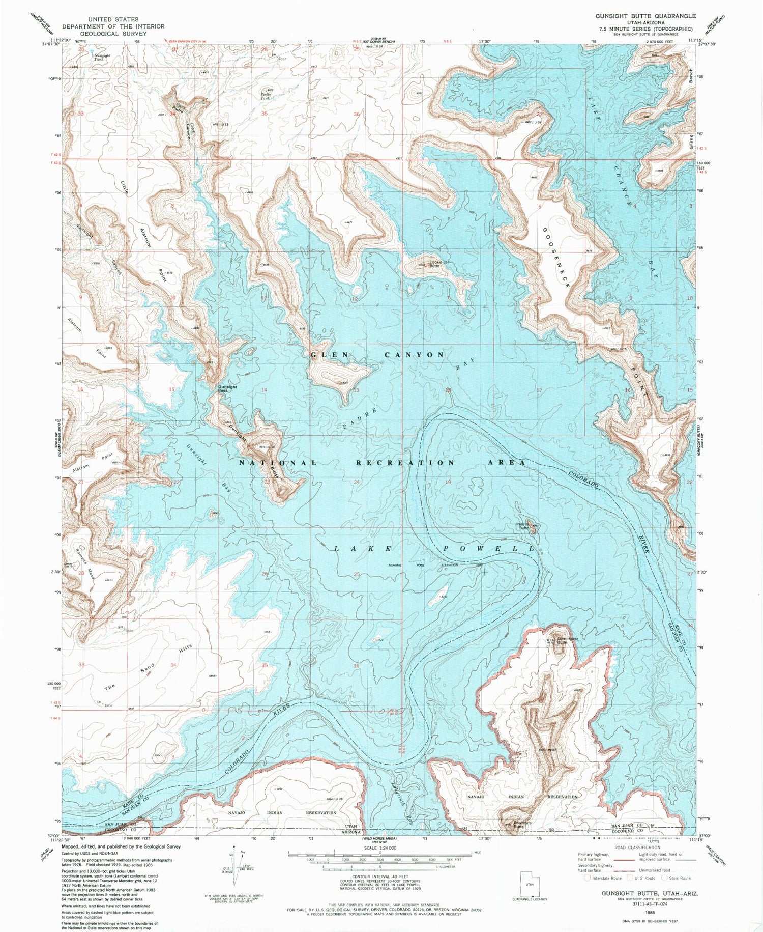
Classic USGS Gunsight Butte Utah 7.5'x7.5' Topo Map
Couldn't load pickup availability
Historical USGS topographic quad map of Gunsight Butte in the states of Utah, Arizona. Typical map scale is 1:24,000, but may vary for certain years, if available. Print size: 24" x 27"
This quadrangle is in the following counties: Coconino, Kane, San Juan.
The map contains contour lines, roads, rivers, towns, and lakes. Printed on high-quality waterproof paper with UV fade-resistant inks, and shipped rolled.
Contains the following named places: Center Fork Kane Wash, Gunsight Bay, Gunsight Butte, Gunsight Canyon, Gunsight Pass, Kane Point, Kane Wash (historical), Labyrinth Bay, Last Chance Bay, Left Fork Kane Wash, Padre Bay, Padre Canyon, Padre Creek, Padres Butte, Right Fork Kane Wash, Romana Mesa, Cookie Jar Butte, Gunsight Tank, Little Alstrom Point, Padre Point, Padre Tank, The Sand Hills, Dominguez Butte, Face Canyon, Crossing of the Fathers (historical), Gunsight Bar, Powell Camps (historical), Alstrom Point, Mystery Canyon (historical), Boundary Butte, Labyrinth Bay


