MyTopo
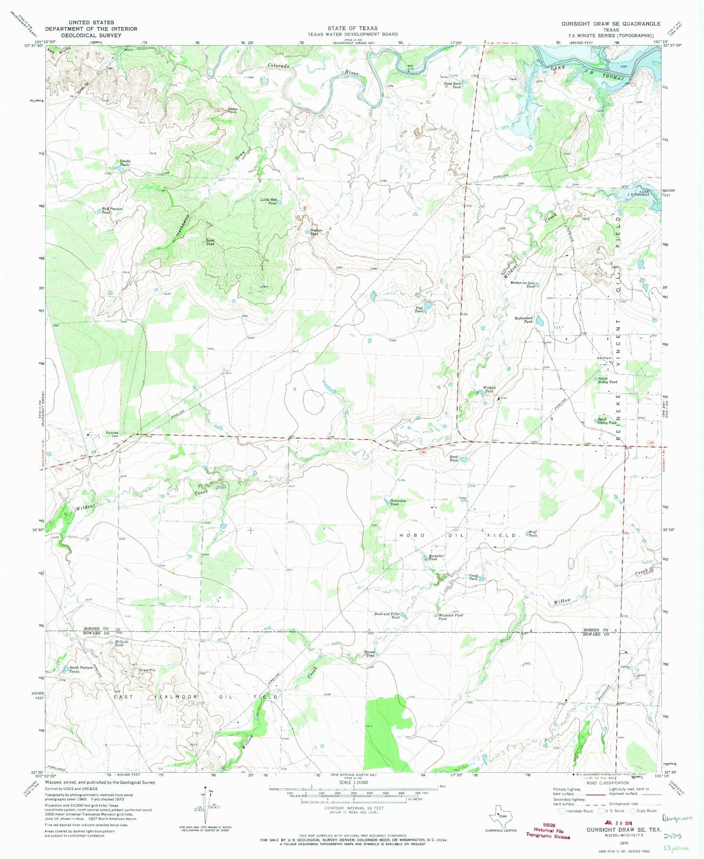
Classic USGS Gunsight Draw SE Texas 7.5'x7.5' Topo Map
Couldn't load pickup availability
Historical USGS topographic quad map of Gunsight Draw SE in the state of Texas. Map scale may vary for some years, but is generally around 1:24,000. Print size is approximately 24" x 27"
This quadrangle is in the following counties: Borden, Howard.
The map contains contour lines, roads, rivers, towns, and lakes. Printed on high-quality waterproof paper with UV fade-resistant inks, and shipped rolled.
Contains the following named places: Boedecker Tank, Bull Pasture Tank, Bush and Tiller Tank, Cedar Point, Creek Tank, Double Tanks, East Vealmoor Oil Field, Fairview Cemetery, Flat Tank, Hackberry Draw, Hillside Tank, Hobo Oil Field, Horseshoe Tank, Hudson Tank, Hullem Creek, Little Red Tank, Mother-in-Law Tank, North Holley Tank, Red Bluffs, Reineke Vincent Oil Field, Road Tank, Round Tank, Rutherford Tank, Sand Rock Tank, Sand Tank, Simer Lake, Simer Lake Dam, South Holley Tank, South Pasture Tanks, Whitaker Field Tank, Wildcat Tank, Wolf Tank