MyTopo
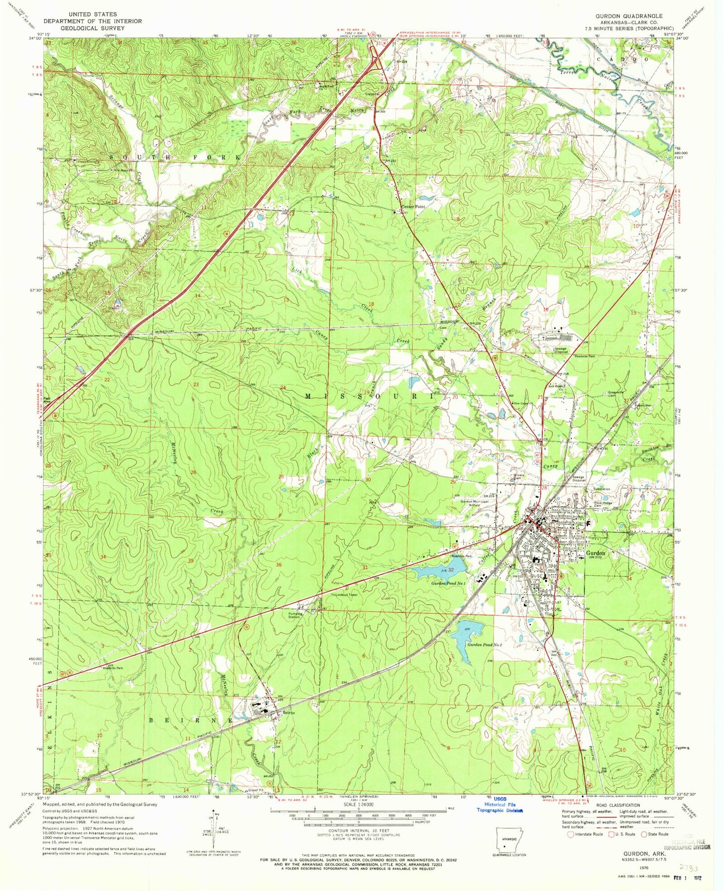
Classic USGS Gurdon Arkansas 7.5'x7.5' Topo Map
Couldn't load pickup availability
Historical USGS topographic quad map of Gurdon in the state of Arkansas. Map scale may vary for some years, but is generally around 1:24,000. Print size is approximately 24" x 27"
This quadrangle is in the following counties: Clark.
The map contains contour lines, roads, rivers, towns, and lakes. Printed on high-quality waterproof paper with UV fade-resistant inks, and shipped rolled.
Contains the following named places: Beech Street Baptist Church, Beirne, Beirne Baptist Church, Beirne Census Designated Place, Beirne Post Office, Beirne Rural Volunteer Fire Department, Black Branch, Brown Cemetery, Cabe Middle School, Caney Creek, Center Grove United Methodist Church, Center Point, Center Point Baptist Church, City of Gurdon, Coffee Creek, Curtis Fire Department, Eastern Star Church, First Baptist Church, First United Methodist Church, Greenville Cemetery, Gurdon, Gurdon Fire Department, Gurdon High School, Gurdon Lowe Field, Gurdon Middle School, Gurdon Police Department, Gurdon Pond One, Gurdon Pond One Dam, Gurdon Pond Two, Gurdon Pond Two Dam, Gurdon Post Office, Gurdon Primary School, Keyton, KGAP-FM (Gurdon), Lick Creek, Mount Canaan Baptist Church, New Caney Church, New Home Church, New Ronok Church, North Boat Ditch, Pruitt Creek, Rose Hedge Cemetery, Sandy Branch, Scrouge Creek, Smithton, South Fork Baptist Church, Township of Missouri, Township of South Fork, White Oak Creek