MyTopo
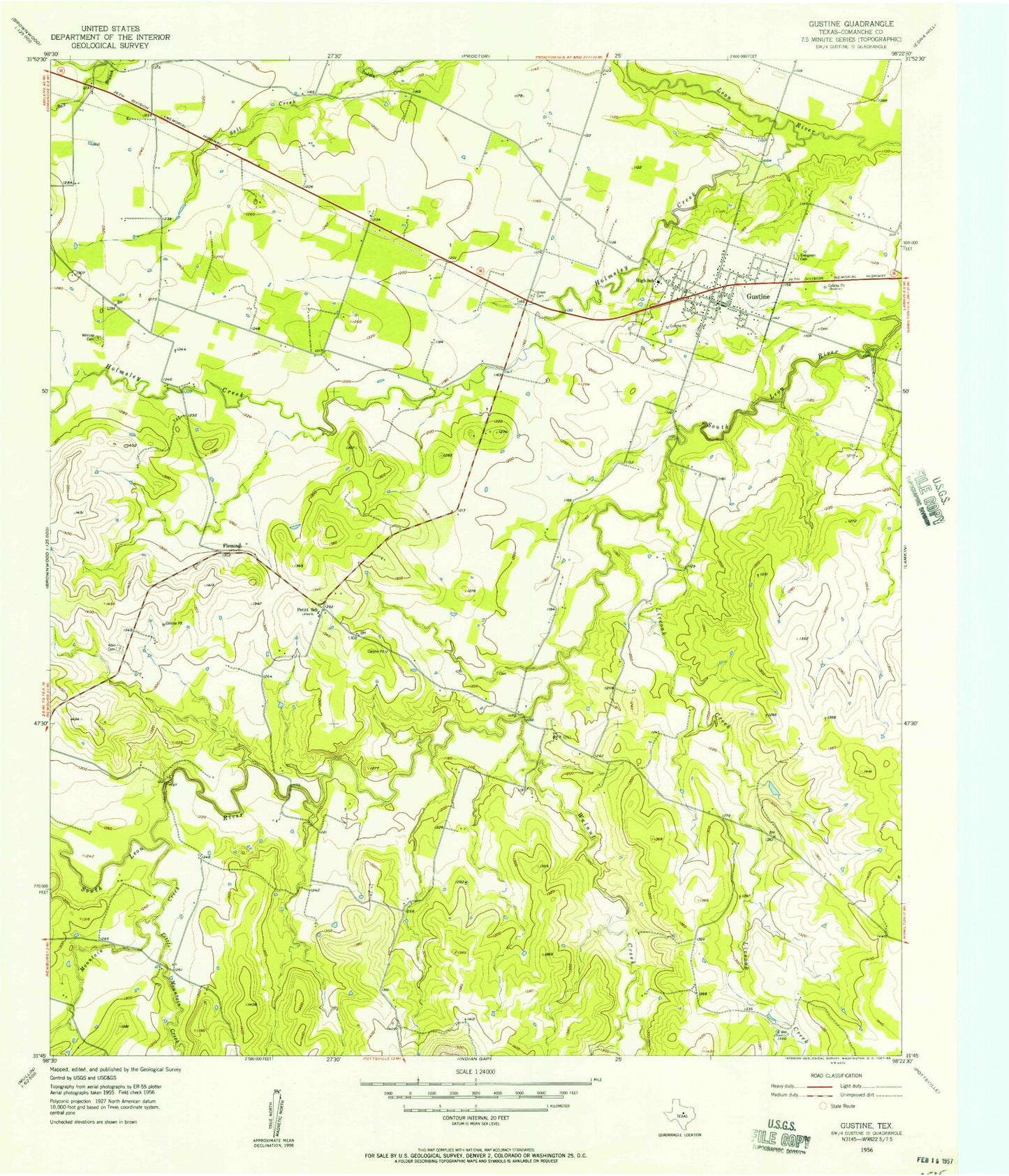
Classic USGS Gustine Texas 7.5'x7.5' Topo Map
Couldn't load pickup availability
Historical USGS topographic quad map of Gustine in the state of Texas. Map scale may vary for some years, but is generally around 1:24,000. Print size is approximately 24" x 27"
This quadrangle is in the following counties: Comanche.
The map contains contour lines, roads, rivers, towns, and lakes. Printed on high-quality waterproof paper with UV fade-resistant inks, and shipped rolled.
Contains the following named places: Albin Cemetery, Evergreen Cemetery, Fleming, Gustine, Gustine Post Office, Gustine Stadium, Gustine Volunteer Fire Department, Gustine Volunteer Volunteer Fire Department, Holmsley Creek, L M Whitely Dam, L M Whitely Lake, Little Mountain Creek, Live Oak Creek, Mountain Creek, Petitt School, Salt Creek, Town of Gustine, Union Cemetery, Walnut Creek, Whitney Cemetery, Yoakum Airport, ZIP Code: 76455