MyTopo
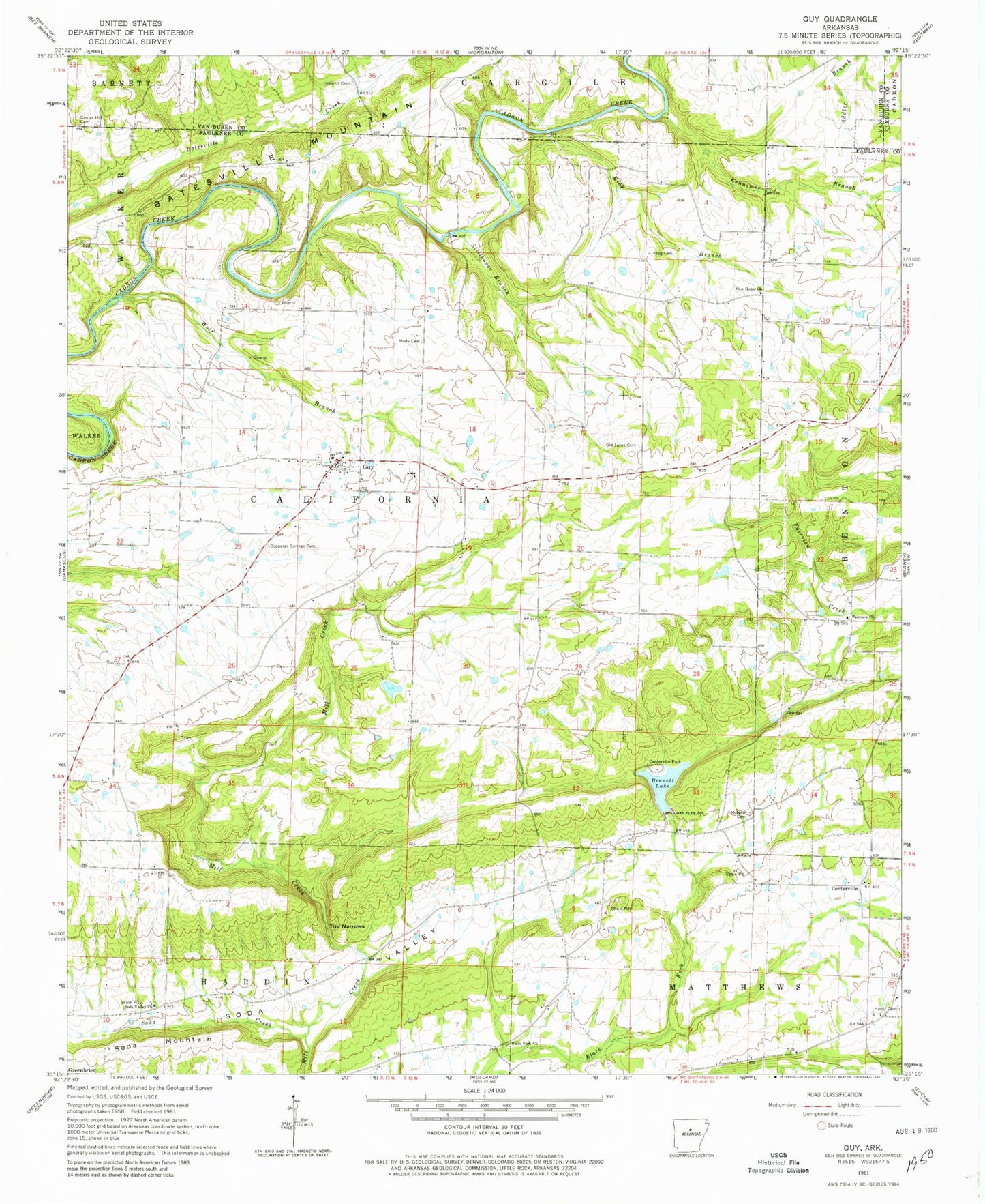
Classic USGS Guy Arkansas 7.5'x7.5' Topo Map
Couldn't load pickup availability
Historical USGS topographic quad map of Guy in the state of Arkansas. Typical map scale is 1:24,000, but may vary for certain years, if available. Print size: 24" x 27"
This quadrangle is in the following counties: Cleburne, Faulkner, Van Buren.
The map contains contour lines, roads, rivers, towns, and lakes. Printed on high-quality waterproof paper with UV fade-resistant inks, and shipped rolled.
Contains the following named places: Center Hill Cemetery, Centerville Park, Copperas Springs Cemetery, Fairview Church, Guy, Hardy Cemetery, Holland Cemetery, Kennimer Branch, King Branch, King Cemetery, McNew Cemetery, Mode Cemetery, New Home Church, Old Texas Cemetery, Soda Creek, Soda Valley, Stillhouse Branch, The Narrows, Wolf Branch, Centerville, Batesville Mountain, Soda Mountain, Bearden-Fowler Store (historical), Black Fork School (historical), Fairview School (historical), Glover School (historical), Guy - Perkins Elementary School, Guy - Perkins High School, Hartwick Mill (historical), Hendrickson School (historical), Perkins School (historical), Rowlett (historical), Rowlett School (historical), Soda Valley, Union Grove School (historical), Wooley Hollow, Township of California, Fowler School (historical), Old Texas, Union Grove United Methodist Church, Black Fork Missionary Baptist Church, Soda Valley Free Will Baptist Church, McNew Chapel (historical), Bivans Lake Dam, Bivans Lake, Montgomery Lake Dam, Montgomery Lake, Lake Bennett Dam, Lake Bennett, Guy Perkins School, Centerville Volunteer Fire Department, Guy Volunteer Fire Department, Guy Police Department, City of Guy, Rak Airport, Guy Post Office