MyTopo
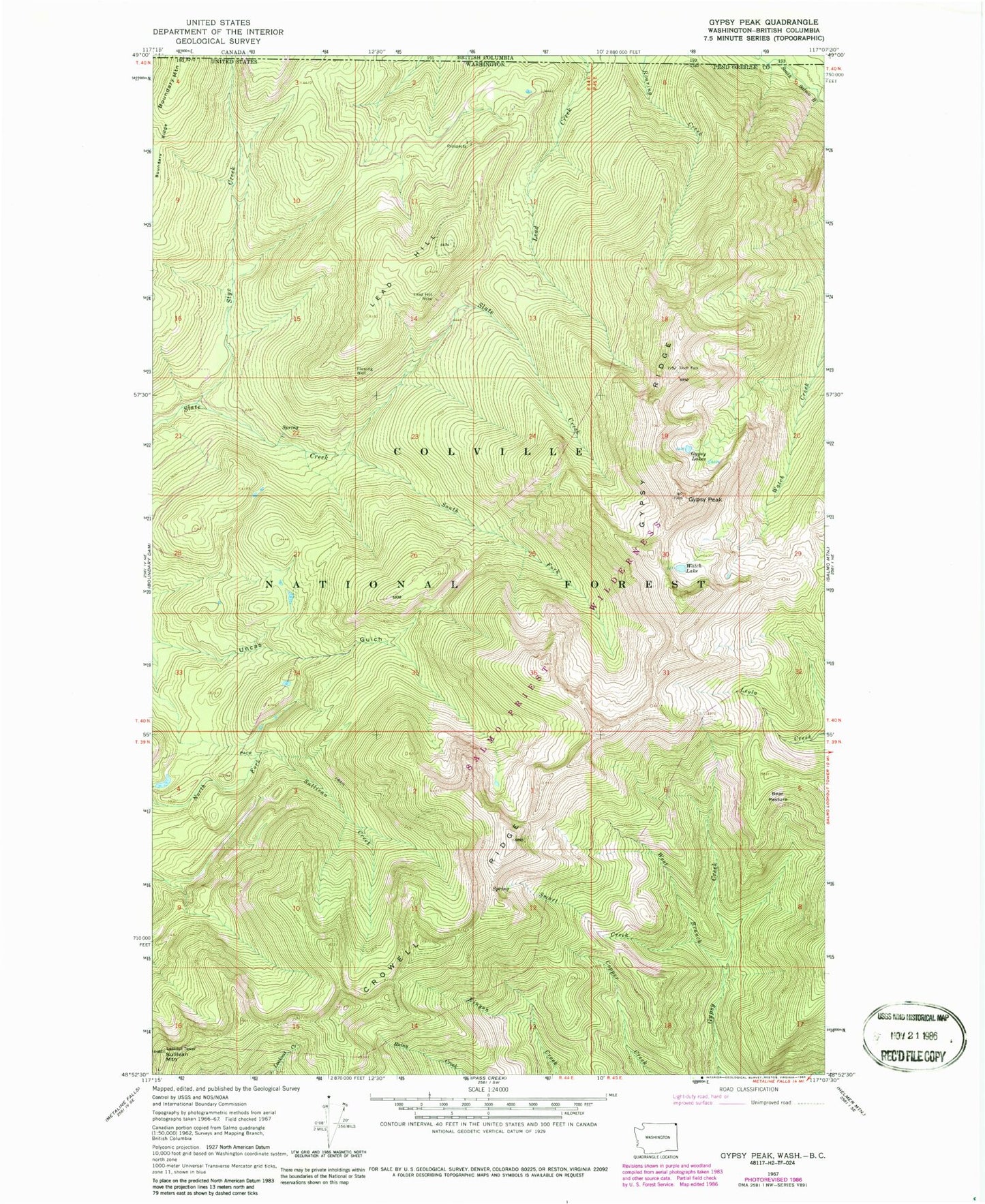
Classic USGS Gypsy Peak Washington 7.5'x7.5' Topo Map
Regular price
$16.95
Regular price
Sale price
$16.95
Unit price
per
Couldn't load pickup availability
Historical USGS topographic quad map of Gypsy Peak in the state of Washington. Typical map scale is 1:24,000, but may vary for certain years, if available. Print size: 24" x 27"
This quadrangle is in the following counties: Pend Oreille.
The map contains contour lines, roads, rivers, towns, and lakes. Printed on high-quality waterproof paper with UV fade-resistant inks, and shipped rolled.
Contains the following named places: Bear Pasture, Boundary Mountain, Boundary Ridge, Crowell Ridge, Gypsy Lakes, Gypsy Peak, Gypsy Ridge, Lead Hill, Lead Hill Mine, Smart Creek, South Fork Slate Creek, Styx Creek, Sullivan Mountain, Watch Lake, West Branch Gypsy Creek, Salmo-Priest Wilderness, State Creek Lookout