MyTopo
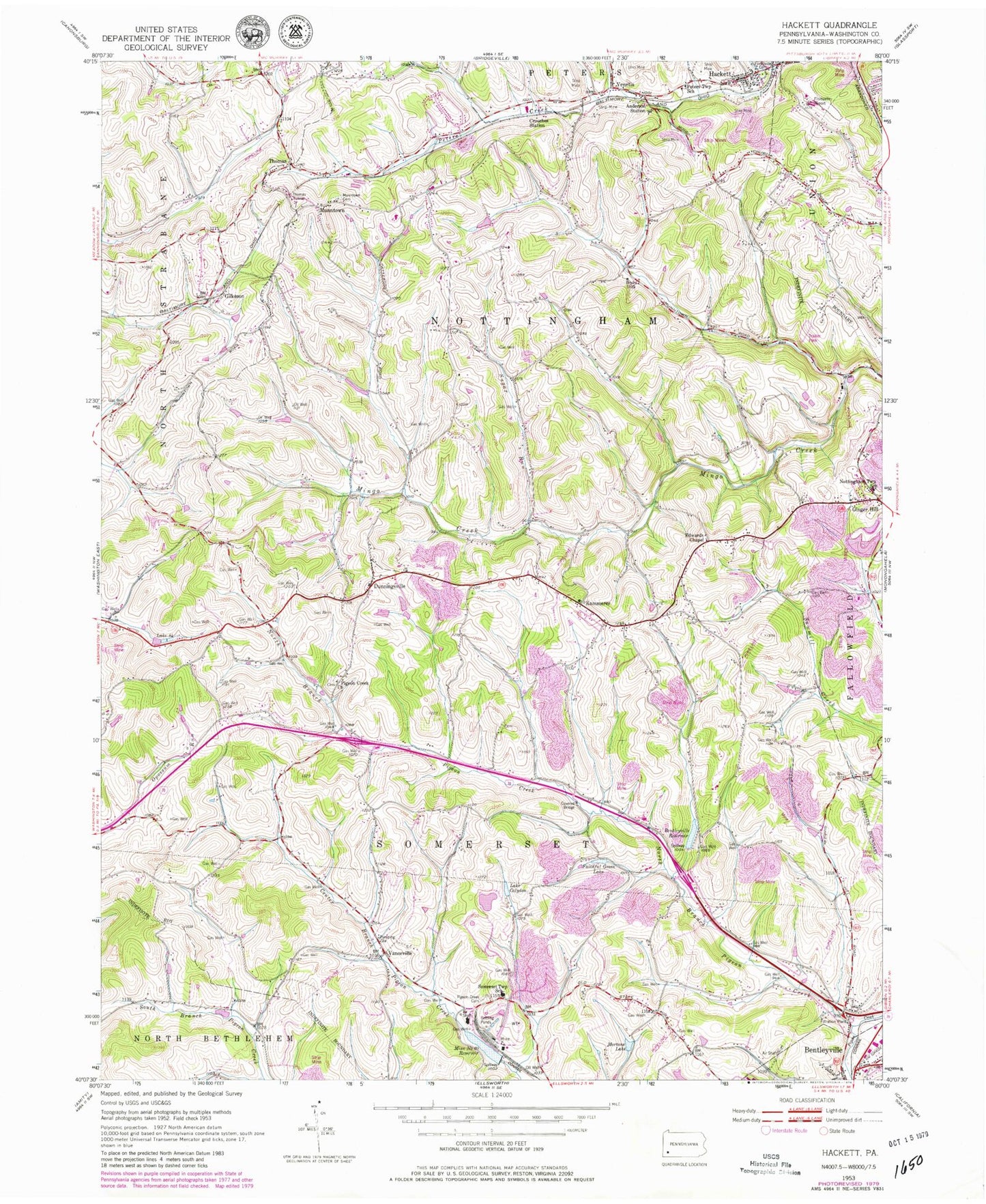
Classic USGS Hackett Pennsylvania 7.5'x7.5' Topo Map
Couldn't load pickup availability
Historical USGS topographic quad map of Hackett in the state of Pennsylvania. Typical map scale is 1:24,000, but may vary for certain years, if available. Print size: 24" x 27"
This quadrangle is in the following counties: Washington.
The map contains contour lines, roads, rivers, towns, and lakes. Printed on high-quality waterproof paper with UV fade-resistant inks, and shipped rolled.
Contains the following named places: Anderson Station, Bentleyville Reservoir, Lake Calydon, Crouches Station, Dunningsville, Edwards Chapel, Faithful Green Lake, Hackett, Kammerer, Mine Number Sixty Reservoir, Mortons Lake, Munntown, Fairview Cemetery, North Branch Pigeon Creek, Nottingham Township School, Peters Township School, Pigeon Creek Cemetery, Pigeon Creek Church, Somerset Township School, Sugar Run, Thomas, Thomas Tunnel, Vanceville, Venetia, Lake Eightyfour, Bandel Airport, Finleyville Airpark, Steel Dam, Mine Number Sixty-Pond Five Dam, Pond Five, Bentleyville Dam, Pond Six, Mine Number Six-Pond Six Dam, Treated Water Pond Dam, Refuse Stilling Basin Dam, Raw Water Pond Dam, Farquhar, Emery, Gilkeson, Rolling Green, Hern, Mingo Creek County Park, Township of Nottingham, Township of Somerset, Lil Tots Day Care Center, Somerset Township Municipal Building, Nottingham Christian Center, Thomas Presbyterian Church, Wrights United Methodist Church, Venetia Post Office, North Strabane Volunteer Fire Department Station 2 Substation, Bentworth Ambulance Service, Ebenezer Covered Bridge, Henry Covered Bridge