MyTopo
Classic USGS Hackleburg Alabama 7.5'x7.5' Topo Map
Couldn't load pickup availability
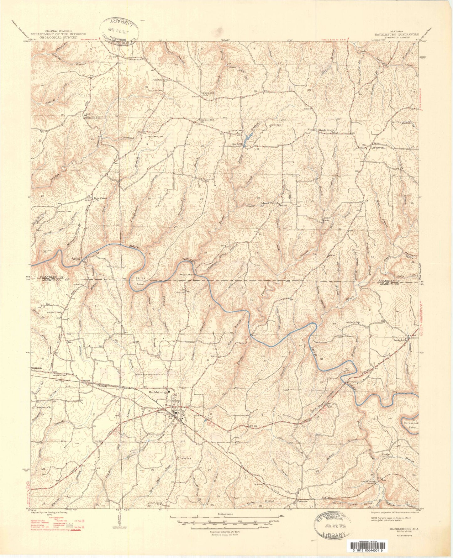
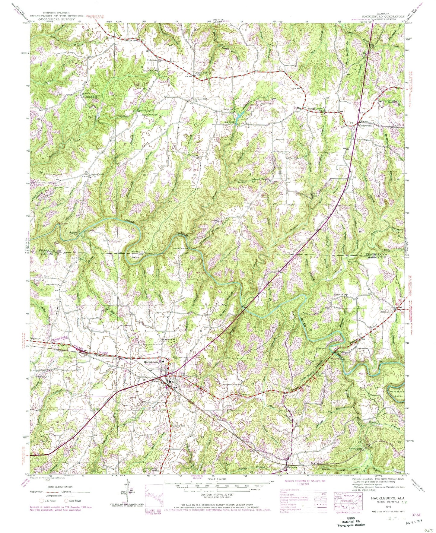
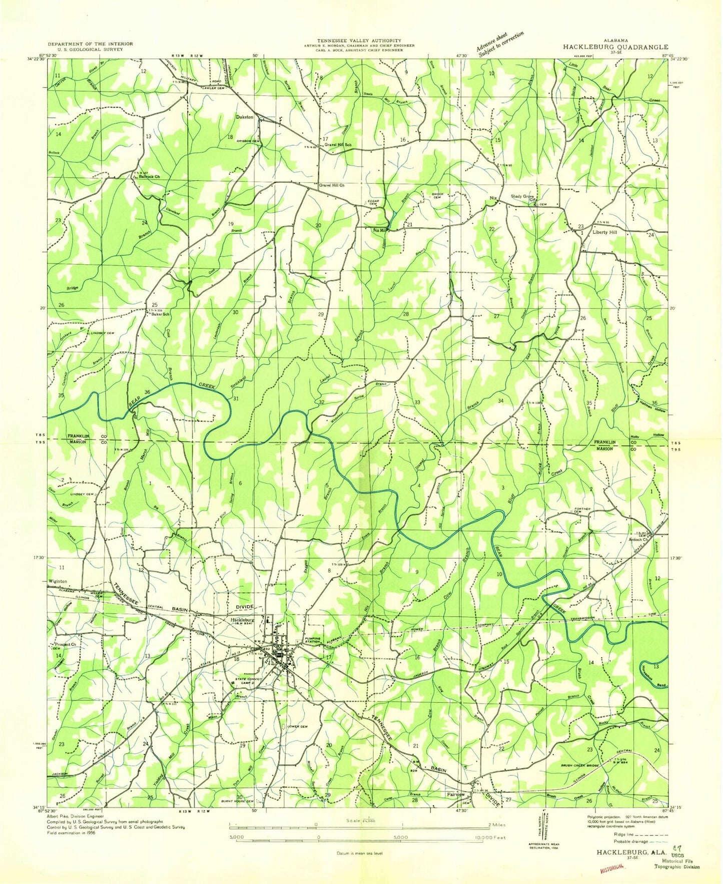
Historical USGS topographic quad map of Hackleburg in the state of Alabama. Map scale may vary for some years, but is generally around 1:24,000. Print size is approximately 24" x 27"
This quadrangle is in the following counties: Franklin, Marion.
The map contains contour lines, roads, rivers, towns, and lakes. Printed on high-quality waterproof paper with UV fade-resistant inks, and shipped rolled.
Contains the following named places: Abison Branch, Adams Creek, Adams Memorial Church, Adams Poultry Farm, Antioch Branch, Antioch Cemetery, Antioch Missionary Baptist Church, Baggett Branch, Bailey Bend, Ball Park Church, Ballrock School, Bear Creek Church, Big Branch, Bluff Creek, Bluff Spring Branch, Brock Cemetery, Brodrick Branch, Brush Creek, Brush Creek Bridge, Brush Creek Hollow, Burfield Branch, Burnt House Cemetery, Cedar Tree Cemetery, Cleveland Branch, Cleveland Cemetery, Cochran Family Cemetery, Cold Spring Branch, Cook Branch, Cooper Branch, Cow Branch, Devil Den Branch, Dismal Branch, Dismals Wonder Gardens, Duketon, East Prong Dismal Branch, Edgar Branch, Edgar Cemetery, Edgar Chapel, Evans Branch, Ezzell Branch, Fairview, Fairview Cemetery, Fairview Church, First Baptist Church, First Methodist Church, Fortner Cemetery, Gravel Hill, Gravel Hill Church, Gravel Hill School, Gravel Hill Volunteer Fire Department, Grissom Cemetery, Gum Spring Branch, Hackleburg, Hackleburg Church of Christ, Hackleburg Church of God of Prophecy, Hackleburg Division, Hackleburg Fire Department, Hackleburg Freewill Baptist Church, Hackleburg High School, Hackleburg Police Department, Hackleburg Post Office, Hallman Hollow, Hill Spring Branch, Holly Hollow, Holly Springs School, Howard Branch, Isom Branch, Ivy Branch, Jackson Branch, King Branch, Lauderdale Branch, Laurel Branch, Lawler Cemetery, Lawler Chapel Church, Liberty Hill, Liberty Hill Cemetery, Liberty Hill Church, Liberty Hill School, Lindsey Cemetery, Lower Cemetery, March Branch, McBrayer Branch, McCaig Branch, McDonald Spring Branch, McNair Branch, Middle Church, Military Bridge, Miller Cemetery, Mitchell Spring Branch, Mixon Springs Branch, Moore Branch, New Prospect Baptist Church, New Prospect Cemetery, Nix, Nix Branch, Nix Mill, Nix Mill Pond, Nix Mill Pond Dam, Prices Bridge, Purcell Branch, Rock Quarry Branch, Rocky Branch, Scharnagle Branch, Scott Branch, Shady Grove Cemetery, Shady Grove Church, Shingle Post Office, Steele Mill Branch, Stone Cemetery, Strickland Branch, Sugar Hill School, Tessner, Town of Hackleburg, Wade Cemetery, Whitehead Spring Branch, Wildcat Branch, ZIP Code: 35564