MyTopo
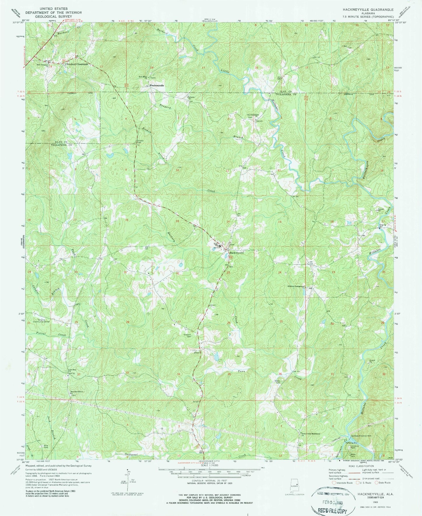
Classic USGS Hackneyville Alabama 7.5'x7.5' Topo Map
Couldn't load pickup availability
Historical USGS topographic quad map of Hackneyville in the state of Alabama. Map scale may vary for some years, but is generally around 1:24,000. Print size is approximately 24" x 27"
This quadrangle is in the following counties: Clay, Tallapoosa.
The map contains contour lines, roads, rivers, towns, and lakes. Printed on high-quality waterproof paper with UV fade-resistant inks, and shipped rolled.
Contains the following named places: Bice Cemetery, Broken Arrow Creek, Candler Branch, Cleveland Crossroads, Cross Key Baptist Church, Denny Lake, Dillard Cemetery, Enitachopco Creek, Futral Creek, Graham Cemetery, Gramble Mill, Guthrie Creek, Hackney Creek, Hackneyville, Hackneyville Cemetery, Hackneyville Census Designated Place, Hackneyville Church, Hackneyville High School, Hackneyville Presbyterian Cemetery, Hackneyville Presbyterian Church, Hackneyville Volunteer Fire Department, Harbuck Creek, Hillabee Campground Cemetery, Hillabee Campground Methodist Church, Hillabi, Hutchinson Ford, Liberty, Liberty Cemetery, Liberty Methodist Church, Little Hillabee Creek, Moore Creek, New Hope Cemetery, New Hope Church, New Prospect Cemetery, New Prospect Primitive Baptist Church, New Providence, New Providence Baptist Church, Oaktasasi Creek, Old Providence, Old Providence Baptist Church, Old Providence Cemetery, Osborne Dam, Pinkneyville, Sandy Ford, Seleta Cemetery, Smyrna Community Center, Tanyard Branch, Town Creek, Town Creek Missionary Church, Victory Church