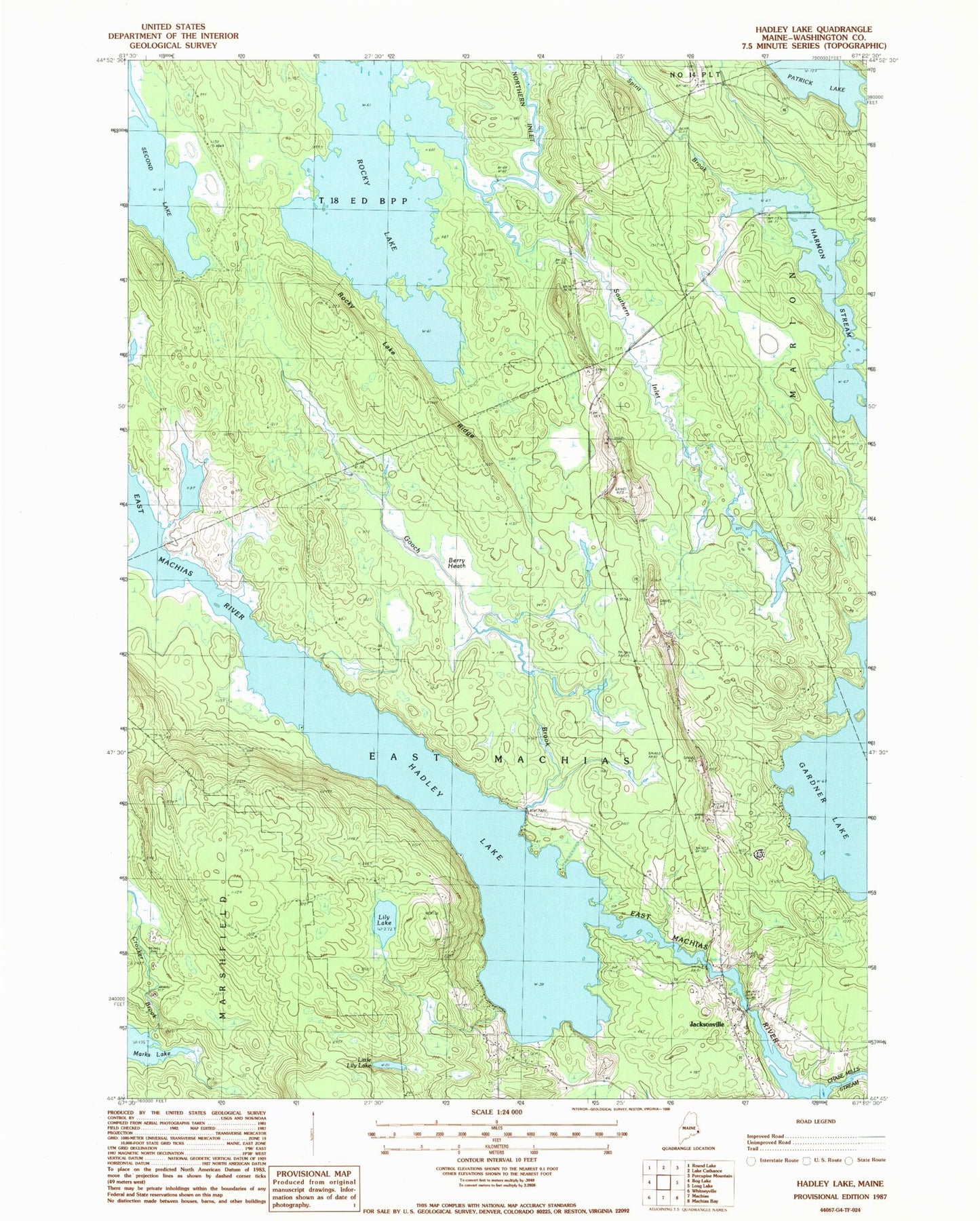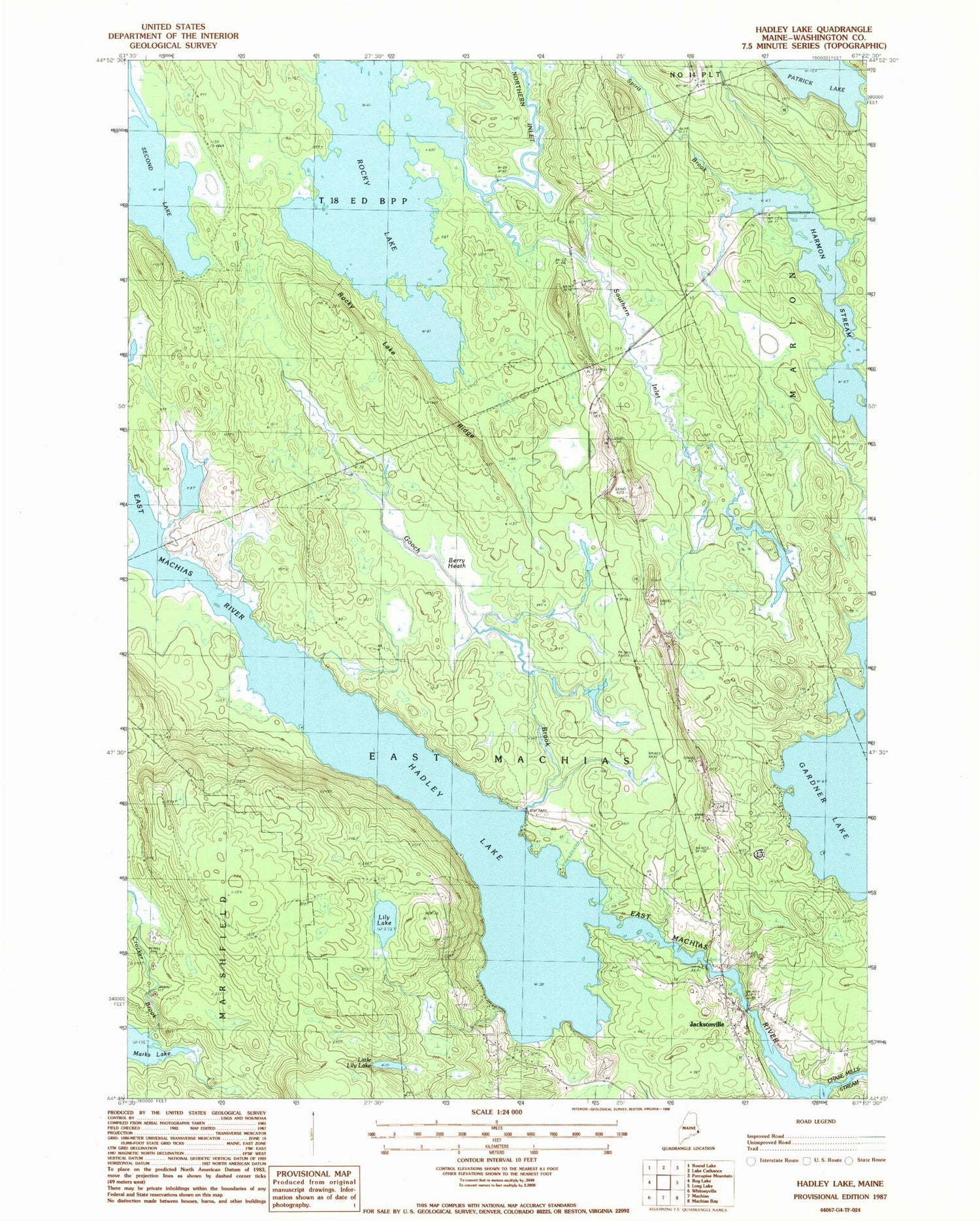
MyTopo
Classic USGS Hadley Lake Maine 7.5'x7.5' Topo Map
Couldn't load pickup availability
Historical USGS topographic quad map of Hadley Lake in the state of Maine. Typical map scale is 1:24,000, but may vary for certain years, if available. Print size: 24" x 27"
This quadrangle is in the following counties: Washington.
The map contains contour lines, roads, rivers, towns, and lakes. Printed on high-quality waterproof paper with UV fade-resistant inks, and shipped rolled.
Contains the following named places: Berry Heath, Chase Mills Stream, Crocker Brook, Gooch Brook, Hadley Lake, Hadley Lake School, Jacksonville, Lily Lake, Little Lily Lake, Northern Inlet, Patrick Brook, Rocky Lake, Rocky Ridge, Second Lake, Southern Inlet, Spirit Brook, Mud Landing, Town of East Machias, Town of Marshfield, Berry Township