MyTopo
Classic USGS Hadsell Spring Wyoming 7.5'x7.5' Topo Map
Regular price
$16.95
Regular price
Sale price
$16.95
Unit price
per
Couldn't load pickup availability
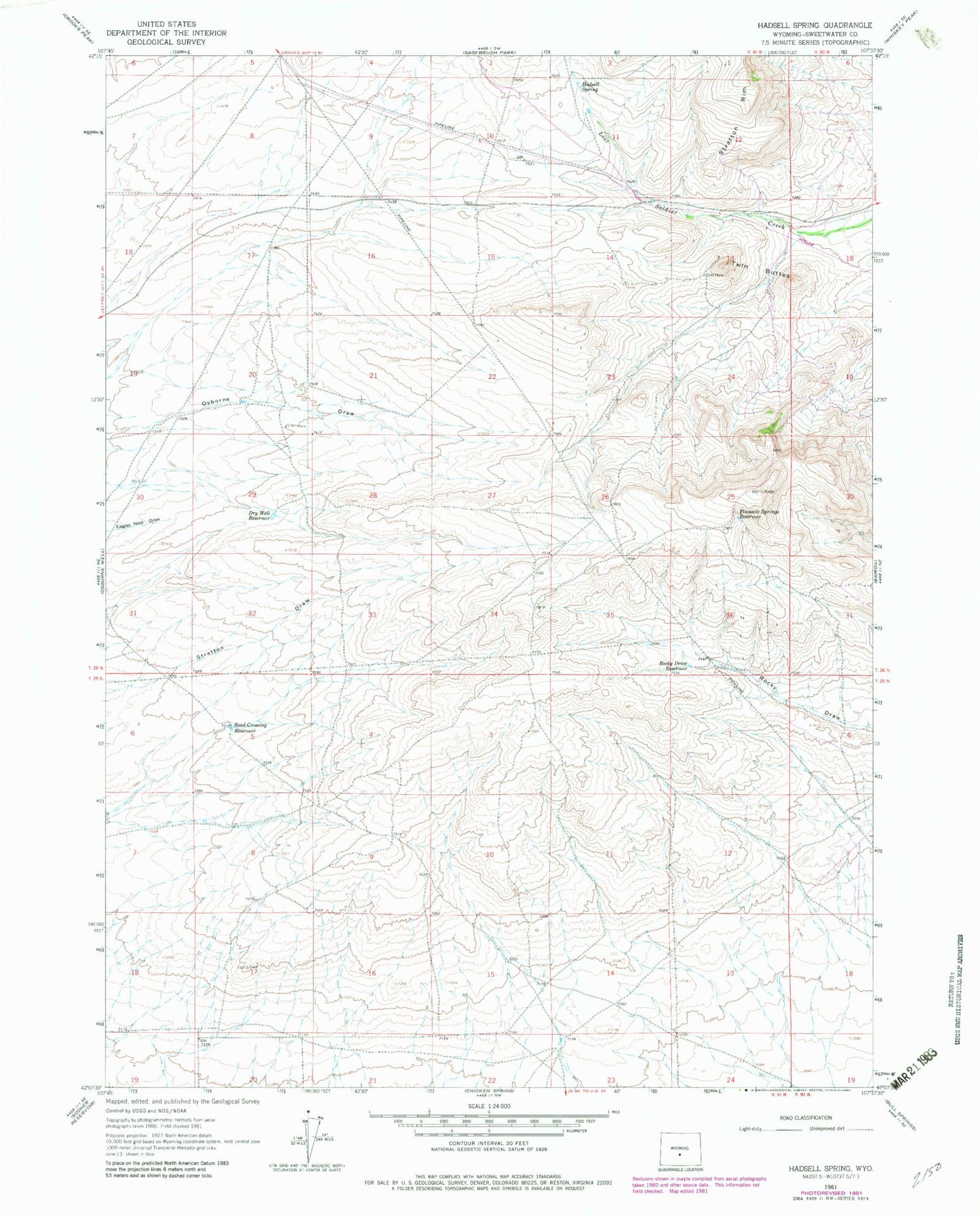
Historical USGS topographic quad map of Hadsell Spring in the state of Wyoming. Map scale may vary for some years, but is generally around 1:24,000. Print size is approximately 24" x 27"
This quadrangle is in the following counties: Sweetwater.
The map contains contour lines, roads, rivers, towns, and lakes. Printed on high-quality waterproof paper with UV fade-resistant inks, and shipped rolled.
Contains the following named places: Bab Mine, Black Eagle Mine, Dry Well Reservoir, Hadsell Spring, Jayhawk Mine, Lost Soldier Mine, Pinnacle Springs Reservoir, Road Crossing Reservoir, Rocky Draw Reservoir, Twin Buttes, Valley View Mine