MyTopo
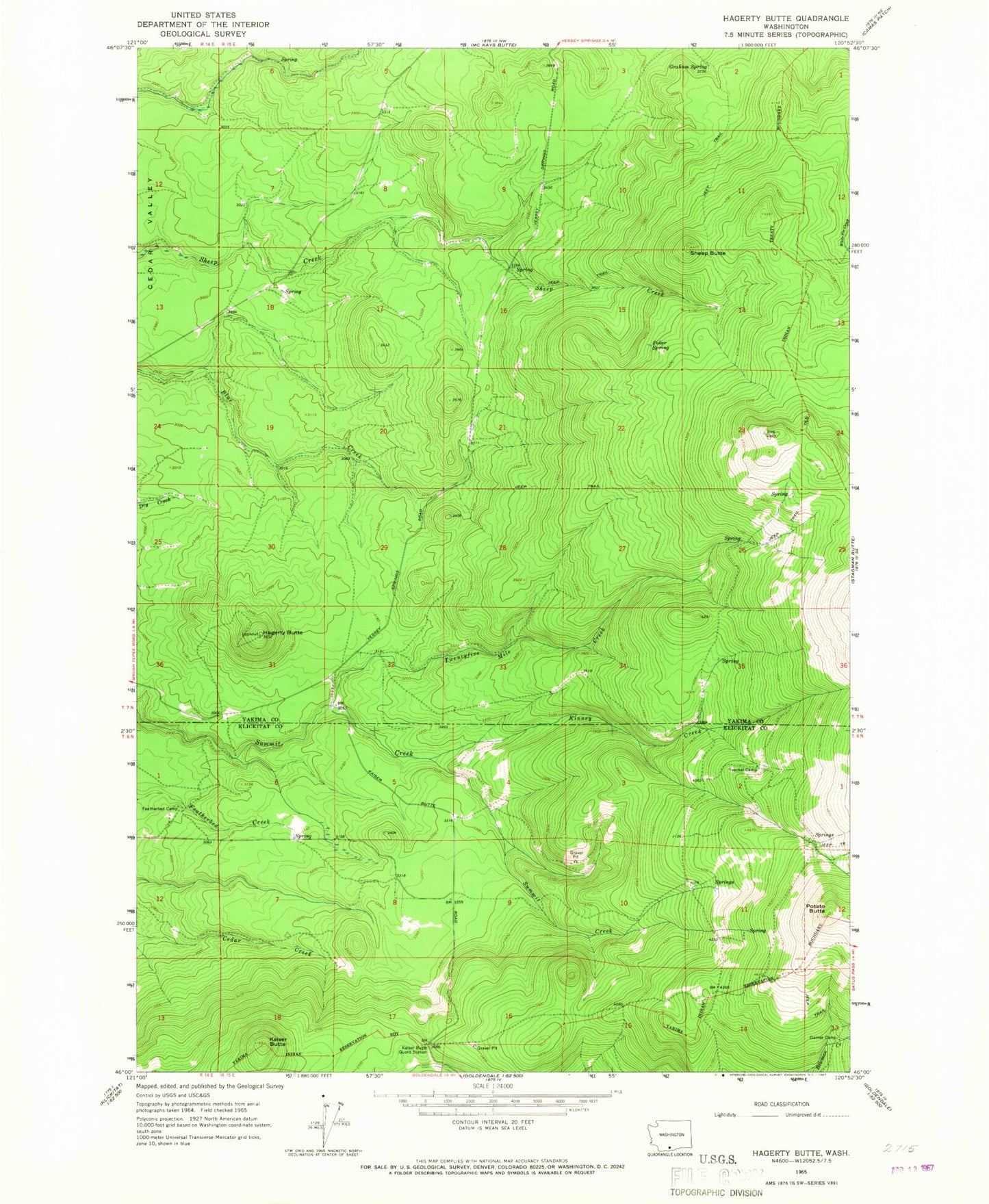
Classic USGS Hagerty Butte Washington 7.5'x7.5' Topo Map
Regular price
$16.95
Regular price
Sale price
$16.95
Unit price
per
Couldn't load pickup availability
Historical USGS topographic quad map of Hagerty Butte in the state of Washington. Map scale may vary for some years, but is generally around 1:24,000. Print size is approximately 24" x 27"
This quadrangle is in the following counties: Klickitat, Yakima.
The map contains contour lines, roads, rivers, towns, and lakes. Printed on high-quality waterproof paper with UV fade-resistant inks, and shipped rolled.
Contains the following named places: Featherbed Camp, Garner Camp, Graham Spring, Hagerty Butte, Kaiser Butte, Kaiser Butte Guard Station, Kinney Creek, Poker Spring, Potato Butte, Sheep Butte, Twentyfive Mile Creek, Yeackel Camp