MyTopo
Classic USGS Halalii Lake Hawaii 7.5'x7.5' Topo Map
Couldn't load pickup availability
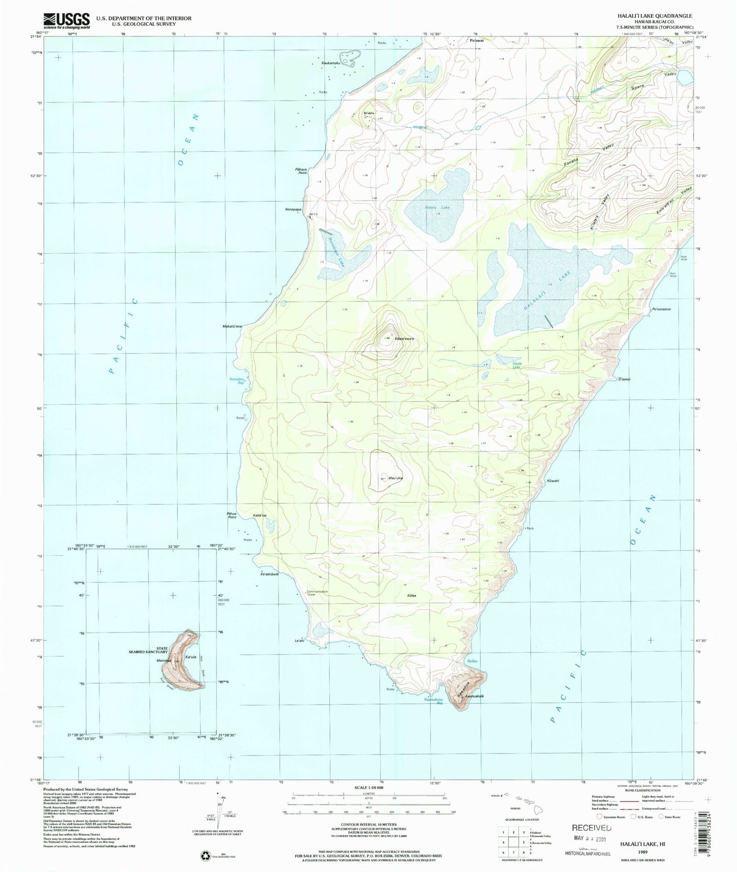
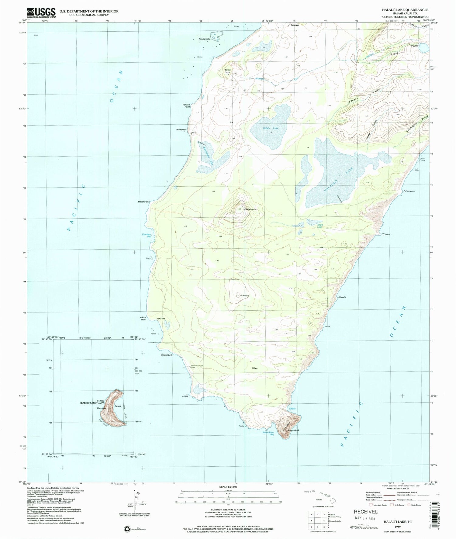
Historical USGS topographic quad map of Halalii Lake in the state of Hawaii. Map scale may vary for some years, but is generally around 1:24,000. Print size is approximately 24" x 27"
This quadrangle is in the following counties: Kauai.
The map contains contour lines, roads, rivers, towns, and lakes. Printed on high-quality waterproof paper with UV fade-resistant inks, and shipped rolled.
Contains the following named places: Apana Valley, Halali'i Lake, Halulu Lake, Kaha'ino, Kala'ala'au Valley, Kamalino, Kamalino Bay, Kamalino Beach, Kanaha Valley, Kaumuhonu Bay, Kawa Point, Kawa'ewa'e, Kawaihoa, Kealea, Keanahaki Beach, Ke'elinawi Point, Ke'elinawili, Ki'eki'e, Ki'eki'e Beach, Ki'iala'a Valley, Kiloi'a Bay, Kuakamoku Reef, Kuakamoku Rock, Le'ahi, Le'ahi Point, Makahu'ena, Mau'uloa, Niihau Division, Nonopapa, Nonopapa Beach, 'O'iamoi, Pahau Point, Pakaua Point, Po'ooneone, Po'ooneone Beach, Yam Bay