MyTopo
Classic USGS Halder Wisconsin 7.5'x7.5' Topo Map
Couldn't load pickup availability
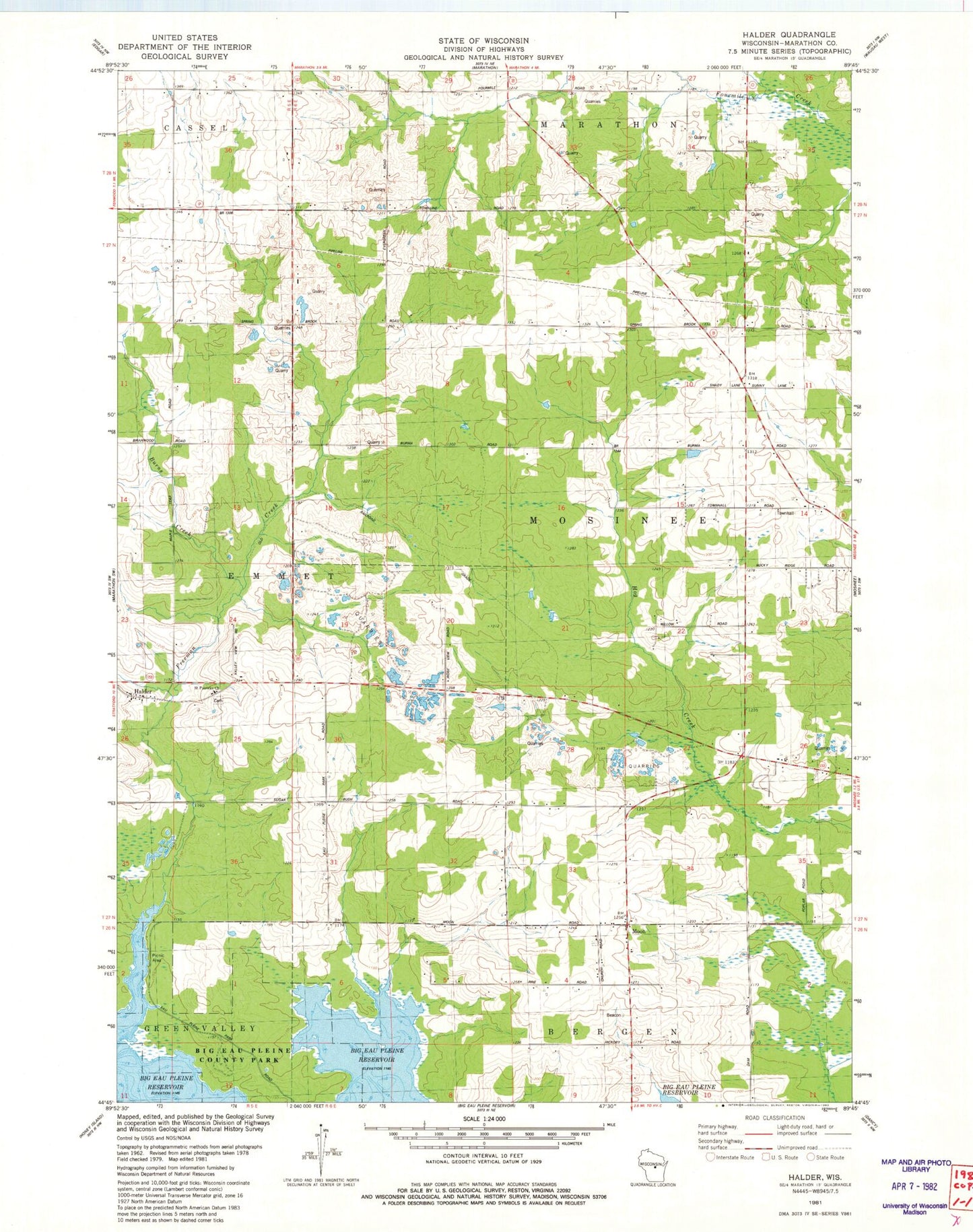
Historical USGS topographic quad map of Halder in the state of Wisconsin. Map scale may vary for some years, but is generally around 1:24,000. Print size is approximately 24" x 27"
This quadrangle is in the following counties: Marathon.
The map contains contour lines, roads, rivers, towns, and lakes. Printed on high-quality waterproof paper with UV fade-resistant inks, and shipped rolled.
Contains the following named places: Burns Creek, Daul Dairy Farm, Freeman Creek, Freeman Creek Farms, Gottschalk Quarry, Grabow Farms, Granite Hill School, Halder, K and S Dairy Farm, Ladick and Belanger Quarry, Ladick Quarry, Moon, Oleson School, Rocky Ridge School, Saint Patricks Church, Saint Roberts School, Scherrico Meadows Airport, Stubbe Farm, Town of Mosinee, Wind Valley Farms