MyTopo
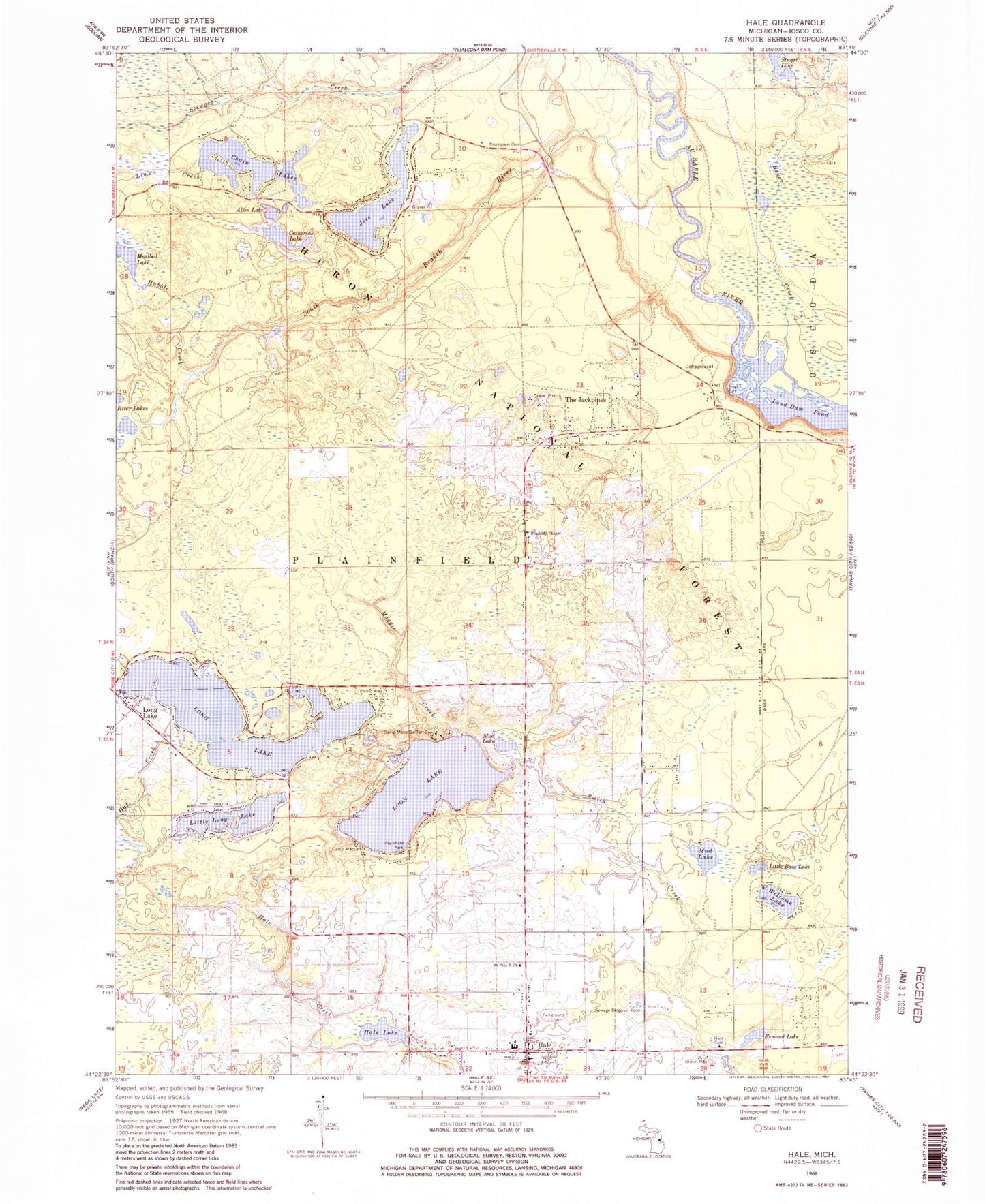
Classic USGS Hale Michigan 7.5'x7.5' Topo Map
Couldn't load pickup availability
Historical USGS topographic quad map of Hale in the state of Michigan. Map scale may vary for some years, but is generally around 1:24,000. Print size is approximately 24" x 27"
This quadrangle is in the following counties: Iosco.
The map contains contour lines, roads, rivers, towns, and lakes. Printed on high-quality waterproof paper with UV fade-resistant inks, and shipped rolled.
Contains the following named places: Alice Lake, Baker Creek, Camp Mahn-Go-Tah-See, Camp Maqua, Catherine Lake, Chain Lakes, Esmond Lake, Hale, Hale Baptist Church, Hale Cemetery, Hale Elementary/Middle School, Hale Lake, Hale Plainfield Township park Campground and Picnic Area, Hale Post Office, Hale Saint Joseph Medical Clinic, Hale Station, Hale United Methodist Church, Harvest Tabernacle Assembly Church, Hubble Creek, Iosco County Emergency Medical Services Station 2, Iosco County Fairgrounds, Jose Lake, Kingdom Hall of Jehovah's Witnesses, Lime Creek, Little Bass Lake, Little Long Lake, Long Lake, Long Lake Post Office, Long Lake Station, Loon Lake, Maggie Creek, Marlbed Lake, Mud Lake, North Ridge Family Practice Clinic, Plainfield Library, Plainfield Park, Plainfield Township Fire Department, Plainfield Township Hall, Primary Care Practice Clinic, River Lakes, Roadside Chapel, Rollways Campground, Rollways Picnic Area, Saint Pius X Church, South Branch River, South Branch Trailcamp, Stuart Lake, The Jackpines, Thompson Cemetery, Township of Plainfield, Welcome Lake, Wicker Hills Golf Club, ZIP Code: 48743