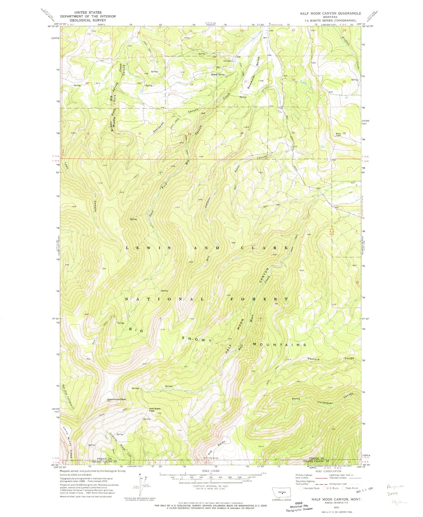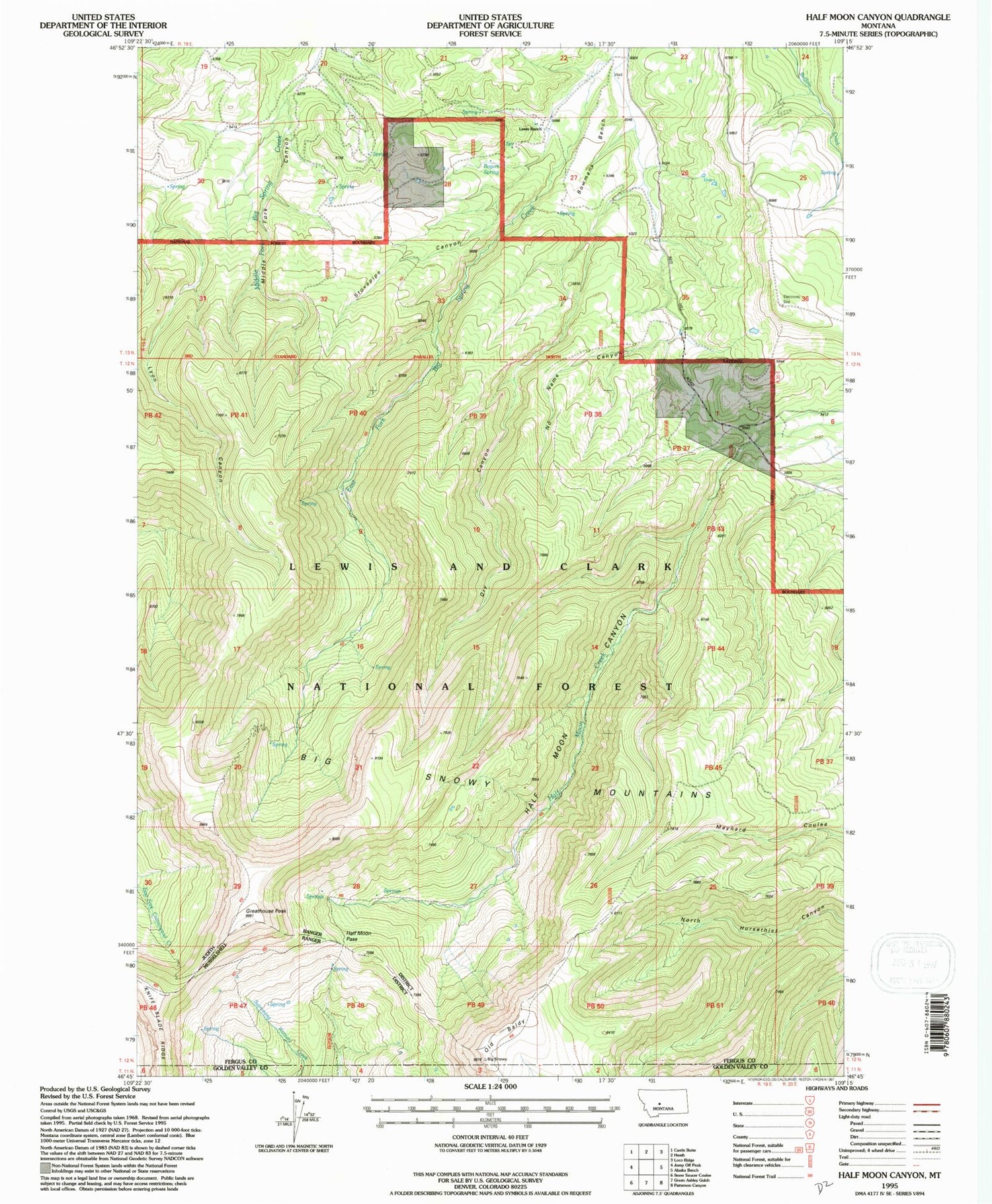
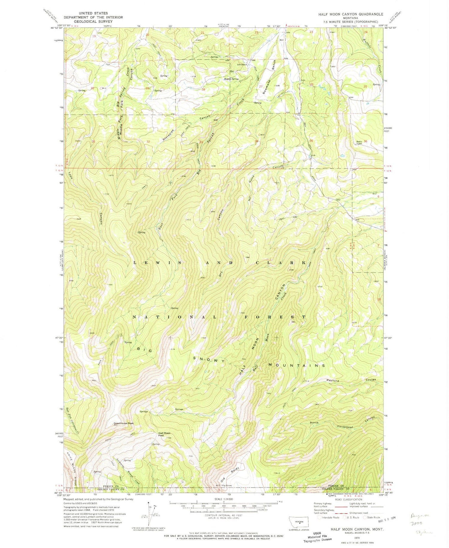
MyTopo
Classic USGS Half Moon Canyon Montana 7.5'x7.5' Topo Map
Regular price
$16.95
Regular price
Sale price
$16.95
Unit price
per
Couldn't load pickup availability
Historical USGS topographic quad map of Half Moon Canyon in the state of Montana. Map scale may vary for some years, but is generally around 1:24,000. Print size is approximately 24" x 27"
This quadrangle is in the following counties: Fergus, Golden Valley.
The map contains contour lines, roads, rivers, towns, and lakes. Printed on high-quality waterproof paper with UV fade-resistant inks, and shipped rolled.
Contains the following named places: Bowmans Bench, Dry Canyon, Greathouse Peak, Half Moon Canyon, Half Moon Pass, Lewis Ranch, No Name Canyon, Old Baldy, Rogers Post Office, Rogers Spring, Stovepipe Canyon