MyTopo
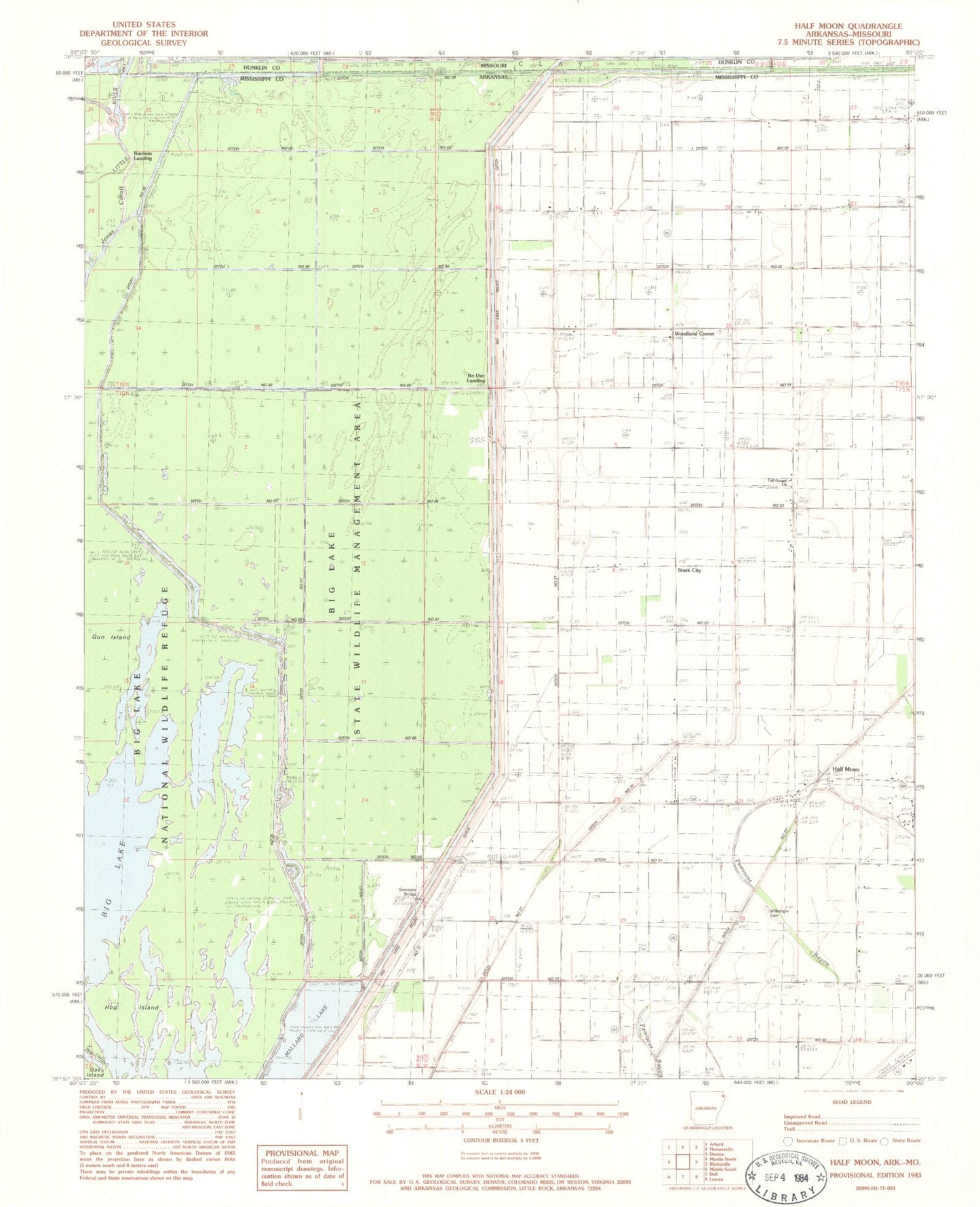
Classic USGS Half Moon Arkansas 7.5'x7.5' Topo Map
Couldn't load pickup availability
Historical USGS topographic quad map of Half Moon in the state of Arkansas. Map scale may vary for some years, but is generally around 1:24,000. Print size is approximately 24" x 27"
This quadrangle is in the following counties: Dunklin, Mississippi.
The map contains contour lines, roads, rivers, towns, and lakes. Printed on high-quality waterproof paper with UV fade-resistant inks, and shipped rolled.
Contains the following named places: Acorn School, Barnum Landing, Big Lake, Big Lake National Wildlife Refuge, Big Lake Relief Ditch, Big Lake State Wildlife Management Area, Big Lake Wilderness, Bo Doc Landing, Brahnon Cypress Slough, Ditch Number 21, Ditch Number 22, Ditch Number 23, Ditch Number 24, Ditch Number 25, Ditch Number 26, Ditch Number 28, Ditch Number 57, Ditch Number 58, Ditch Number 59, Ditch Number 60, Ditch Number 61, Ditch Number 62, Ditch Number 63, Ditch Number 64, Ditch Number 65, Ditch Number 66, Ditch Number 67, Ditch Number 68, Ditch Number 69, Ditch Number 70, Ditch Number 71, Full Gospel Church, Gun Island, Half Moon, Half Moon Lake, Half Moon School, Hog Island, Jones Cut-Off, Little Green School, Little Green Store, Loethers Plantation, Mallard Lake, McKinnis Homestead, Midway, Rainey Colony School, Simmons Bridge, Stark City, Township of Bowen, Township of Half Moon Lake, Wilkerson Cemetery, Woodland Corner, Woodland Corner Baptist Church